


Refine your search for walks in Bachelard (rivière)
Bachelard (rivière) walks


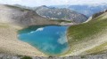
 Col de la petite Cayolle - Petite Cayolle and Garrets lakes
 Visorando Member
 6.15 mi
 +1,686 ft
 -1,660 ft
 4h 20
 Moderate
 Departure from Uvernet-Fours (Alpes-de-Haute-Provence)
A beautiful day's hike. Varied landscapes, snowfields, scree, lakes, marmots, chamois, everything you need to have a good time.
Please note that you will be hiking in the heart of the Mercantour National Park. Be sure to comply with the regulations in force.
Vallon Julien and waterfalls
 5.56 mi
+2,329 ft
-2,329 ft
4h 35
Moderate
Departure from Uvernet-Fours (Alpes-de-Haute-Provence)
This beautiful alpine walk will take you through a beautiful, uncrowded valley, along a path that is sometimes steep. Cliffs, torrents, waterfalls, and perhaps the chance to see a mountain goat.
Mont Cimet via the southern ridge
 8.10 mi
+3,451 ft
-3,448 ft
6h 45
 Difficult
Departure from Uvernet-Fours (Alpes-de-Haute-Provence)
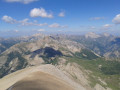
A superb hike in the Mercantour National Park, with a beautiful ridge leading to a summit over 3,000 metres high. Le Cimet, neighbouring Le Pelat and about thirty metres lower, offers a magnificent panorama on a clear day. The hike starts from the Vieux Brec bridge on the Col de la Cayolle road.
Mont Pelat from the Col de la Cayolle
 10.09 mi
+3,993 ft
-3,983 ft
8h 05
Difficult
Departure from Uvernet-Fours (Alpes-de-Haute-Provence)
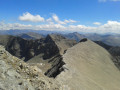
A very accessible 3,000-metre peak with magnificent views of Lac d'Allos and a 360° panorama. The hike is superb, with lakes, marmots and chamois along the route.
Circuit of the Pierre Éclatée ridge starting from Bayasse
 9.46 mi
+2,536 ft
-2,520 ft
6h 35
Difficult
Departure from Uvernet-Fours (Alpes-de-Haute-Provence)
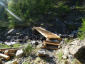
A lovely walk, best done when the larch trees turn yellow and ochre. It is very varied with a well-marked path and presents no major difficulty. The only slightly tricky section is the crossing of the Riou de la Saume, a small log bridge without a railing.
Allos Mountain Hut – Petit Col du Talon – Bayasse
 15.80 mi
+3,504 ft
-4,836 ft
10 hrs
 Very difficult
Departure from Uvernet-Fours (Alpes-de-Haute-Provence)
The third stage is very difficult due to its length of nearly 26 km, with a few technical sections – particularly when carrying a rucksack – which will put your body to the test. This is why I have classified this stage as ‘very difficult’. However, this stage is one of the most beautiful on this route: wild, technical, with stunning panoramic views.
You’ll cross pastures, wooded areas, mountain pastures and very rocky high-mountain sections between the two highest peaks of the Mercantour: Mont Pelat (3,051 m) and Le Cimet (3,020 m).
You’ll be crossing the northern part of the Mercantour National Park.
Allow between 8 and 10 hours for this challenging stage.
Mont Pelat via the Pas de la Grande Barre
 10.26 mi
+4,423 ft
-4,416 ft
8 hrs
Very difficult
Departure from Uvernet-Fours (Alpes-de-Haute-Provence)
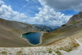
Whilst Mont Pelat is relatively accessible, with a vertical ascent of just 900 m from the Laus car park (Lac d’Allos) in the Verdon Valley, this unique route starting from the Pont du Vieux Brec on the road to the Col de la Cayolle, featuring a short, very tricky section with precarious grip, requires considerable skill to negotiate a steep slope with a gradient well over 50 per cent and no handholds.
You are in the Mercantour National Park; there are regulations to be observed, and failure to do so may result in a fine of up to €1,500 – see the practical information.
Read the reviews.
Three days in the Haut-Var starting from the Refuge de La Cantonnière
 25.18 mi
+7,812 ft
-7,802 ft
3 days
Difficult
Departure from Entraunes (Alpes-Maritimes)
This three-day route in the Haut-Var takes you past the Refuge de La Cantonnière every day, although it is not necessary to stay there overnight. It crosses several mountain passes: La Boucharde, La Petite Cayolle, Le Pas de Lausson, the Col de Gialorgues and the Col de La Roche Trouée. It passes close to a multitude of lakes.
From the Refuge de la Cantonnière to the Refuge de la Cayolle via the Col de la Boucharde
 6.90 mi
+2,874 ft
-1,503 ft
5h 40
Moderate
Departure from Entraunes (Alpes-Maritimes)
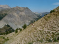
This route from the Refuge de la Cantonnière to the Refuge de la Cayolle via the Col de la Boucharde is the first day of a three-day route in the Haut-Var. After a shaded climb alongside the Ruisseau de Sanguinière, the route ascends the Ravin de la Boucharde before descending to the Bachelard after crossing the pass. You then need to follow the left bank of the Bachelard back up to the Refuge de la Cayolle, where you will spend the night.
Cime de la Plate and Lacs de la Braissette
 9.98 mi
+4,091 ft
-4,091 ft
8h 10
Difficult
Departure from Uvernet-Fours (Alpes-de-Haute-Provence)
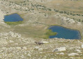
A beautiful hike in a wild environment, with no technical difficulties despite 50% of the route being off-trail. Orientation is not a problem either, despite the few cairns along the route; just follow the contours of the terrain and the streams at the edge of the meadows.The Visorando app may be useful.
La Cloche beneath the Chapeau de Gendarme at Villard d’Abas
 6.15 mi
+2,329 ft
-2,329 ft
4h 50
Moderate
Departure from Uvernet-Fours (Alpes-de-Haute-Provence)
This enigmatic title serves as a reminder that the Gorges du Bachelard’s notable features are given colourful names. This walk, where the ascent is tackled straight away (with a sometimes steep gradient and a path washed away in places), takes you to Baume Longe, then on to the Col de Cloche. After the Col de Cloche, there are beautiful views of the Cimet peaks opposite the valley as you cross through mountain pastures. The stretch near the Chapeau de Gendarme rocks remains truly stunning.
Col de Cloche and Baume Longe from Villard d’Abas
 5.78 mi
+2,516 ft
-2,523 ft
4h 50
Difficult
Departure from Uvernet-Fours (Alpes-de-Haute-Provence)
A lovely walk starting from Villard d’Abas, which begins in a light, open deciduous forest, leading to the old hamlet of Cloche, before changing sides of the mountain (once again through a beautiful larch forest) to reach Baume Longe. The descent is also through the forest, along the mountainside. It’s a bit more treacherous, so you’ll need sure-footedness!Please note => check the route description on WP (7) before starting the descent.
From the Refuge de La Cayolle to Les Louiqs via the Col de la Petite Cayolle
 8.50 mi
+1,496 ft
-3,389 ft
5h 15
Moderate
Departure from Uvernet-Fours (Alpes-de-Haute-Provence)
This second stage will take you from the La Cayolle refuge to the Ferran lodge at the Louiqs farm via the Col de La Petite Cayolle and the Pas de Lausson. It offers views of numerous mountain lakes and the Var waterfalls beneath the Pont du Diable. You can stop at the La Cantonnière refuge to shorten the route or have a snack.