Country:

 City:
City:


Start from the car park situated 100 m before the hamlet of Les Portes (please note: there are only about 15 parking spaces).
(S/E) Head towards the village of Les Portes and walk through it. As soon as you leave the village, you’ll hear the roar of the Torrent des Oules on your left.
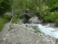
(1) At the sign for “Pont des Oules 100 m”, take the path leading down to the left. When you reach the Pont des Oules, you can take the walkway above the torrent to admire the ‘Marmites des Oules du Diable’.
(2) Then cross the bridge and follow the path to the right towards “Fouronnière 0h30”.
(3) Join the track by turning left towards the hamlet of Navette.
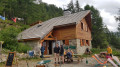
(4) At the hamlet, at the sign for “Waterfall la Buffe 0h45”, leave the track and take the path. Take a break in front of the chapel and use this opportunity to get your walking poles out, as the going gets steep from here. Follow the path without straying from it until you reach the Waterfall la Buffe.
(5) At the signpost marking the fork towards Le Chapeau, carry on straight on to the Waterfall de la Buffe.
(6) Turn back towards the hamlet of Navette.
(4) The return journey follows the same route as the outward leg. The more adventurous can make a round trip via the track to the Waterfall de Buchardet (approx. 1 hour round trip)
(3) Stay on the track as you cross the Pont de Fouronnière, until you reach the Portes car park (S/E).

 Visorando Member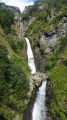

 Easy
Easy 
 Difficult

 Very difficult