Furfande Mountain Hut – Eygliers

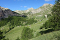
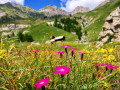
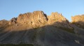
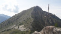
Return from the refuge via a very different route, with the option of adding a round trip along the ridge above the Col de Furfande to the Pic du Gazon (2,744 m). Stunning views.

This walk is part of a multi-day hike: A round trip to the Furfande Refuge from Eygliers

Details

n°2713672
Creation:
Last update:
Last review:
  • Walking
    Activity: Walking
  • ↔
    Distance: 10.85 mi
  • ◔
    Average duration: 6h 50 
  • ▲
    Difficulty: Difficult

  • ⚐
    Back to start: No
  • ↗
    Ascent: + 2,139 ft
  • ↘
    Descent: - 5,551 ft

  • ▲
    Highest point: 8,196 ft
  • ▼
    Lowest point: 4,085 ft

Description of the walk

(S) Head north along theGR®58, marked in red and white, above the refuge to reach the Col de Furfande.

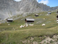
(1) Descend to the Granges de Furfande chalets via theGR®541, pass through them and head uphill to the right. Walk alongside Lac de la Vallette. Continue until you reach the junction of theGR®541and its alternative route.

(2) Take this variant to the right and begin the ascent, which ends at the Col Saint-Antoine.

(3) Descend towards the Col du Lauzet.

(4) Carry on towards Lac du Lauzet and reach the lake.

(5) Stay on theGR® and follow its red and white markings to reach the Col de Moussière via a short climb.

(6) Continue along theGR® on a long descent that crosses several streams before reaching the Cabane du Bois Durat.

(7) Here, theGR® follows a good forest track. Continue the descent along the Route Forestière du Bois Durat. Cross the Torrent de Sainte-Catherine and shortly afterwards you’ll reach the GR® junction.

(8) Ignore theGR® branching off to the right and continue along the track until you reach the car park on the Route de Gros (E).

Waypoints

  1. S : mi 0 - alt. 7,520 ft - Refuge de Furfande
  2. 1 : mi 0.68 - alt. 8,176 ft - Col de Furfande (2456m)
  3. 2 : mi 2.67 - alt. 7,208 ft - GR541 junction and its alternative route
  4. 3 : mi 3.48 - alt. 8,035 ft - Col St Antoine (2458m)
  5. 4 : mi 4.23 - alt. 7,352 ft - Col du Lauzet (2223m)
  6. 5 : mi 4.43 - alt. 7,192 ft - Lac du Lauzet
  7. 6 : mi 5.22 - alt. 7,500 ft - Col de Moussière.
  8. 7 : mi 8.47 - alt. 5,144 ft - Cabane du Bois Durat
  9. 8 : mi 10.34 - alt. 4,259 ft - Trail-GR junction
  10. E : mi 10.85 - alt. 4,085 ft - Route de Gros

Notes

Water available at the chalets and from streams (is it safe to drink?).

Worth a visit

(1) You can follow the ridge above on a round trip to reach the Pic de Gazon; allow an extra 1 hour 1/4.

(5) Lac du Lauzet

Always be cautious and plan ahead when you're outdoors. Visorando and the author of this route cannot be held responsible for any accidents occurring on this route.

The GR® and PR® markings are the intellectual property of the Fédération Française de Randonnée Pédestre.

Reviews and comments

4.7 / 5
Based on 1 review

Reliability of the description
5 / 5
Ease of following the route
4 / 5
Route interest
5 / 5
jpbar31
jpbar31

Overall rating : 4.7 / 5

Date of your route : Jul 04, 2024
Reliability of the description : ★★★★★ Very good
Ease of following the route : ★★★★☆ Good
Route interest : ★★★★★ Very good
Very busy route : No

I only did the descent to Eygliers – a magnificent route. Make sure you wear shoes with good grip and take care in the Vieux Parc area: there’s small gravel and a recent rockfall with loose stones near a stream, and the path is blocked.

Machine-translated

Other walks in the area

For more walks, use our search engine .

The GPS track and description are the property of this route's author. Please do not copy them without permission.