Furfande – Souliers

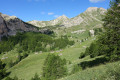
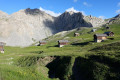
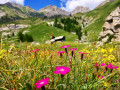
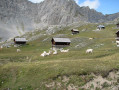
This walk, starting from the Furfande refuge, will take you past the magnificent barns and chalets of Furfande and lead you along a path running along a ridge above the Queyras valley, where the River Guil winds its way through, then on to Souliers via an ascent from the hamlet of Les Moullins in the Arvieux valley.

This walk is part of a multi-day hike: Chalets et bergeries d'estive autour d'Arvieux

Details

1266550
Creation:
Last update:
Last review:
  • Walking
    Activity: Walking
  • ↔
    Distance: 11.69 mi
  • ◔
    Average duration: 7h 25 
  • ▲
    Difficulty: Difficult

  • ⚐
    Back to start: No
  • ↗
    Ascent: + 2,339 ft
  • ↘
    Descent: - 3,858 ft

  • ▲
    Highest point: 7,523 ft
  • ▼
    Lowest point: 4,587 ft

Photos

Description of the walk

(S) From the Furfande refuge, take theGR®541alternative route heading west. At an oratory (altitude 2,286 m), rejoin theGR®541; turn left and cross the Granges de Furfande to reach the Vallette chalets.

(1) Continue to the left, heading due south. At the fork, turn left, leaving theGR®541. Continue downhill. Then head north-east to pass through the middle of the Furfande chalets.

(2) Begin a gentle climb heading east, then follow the balcony path to the Col de la Lauze, where you’ll join theGR®58coming from the Furfande refuge.

(3) Follow it for about 500 metres. Leave it at a place called Le Pervou and turn left towards Le Queyron via a second balcony path. Further on, rejoin theGRP® Tour de la Dent du Ratier, marked in red and yellow. Follow it to the left. On reaching Le Queyron, an orientation table offers a chance to take in the scenery.

(4) Continue to the crossroads just past the Queyron car park; the path leads to a lovely picnic area.

(5) Leave theGRP® leading to the village of Villargaudin and turn left, heading due north towards Les Moulins through a beautiful larch forest on a new balcony path. Cross the Torrent de la Combe and continue until you reach the Torrent de Pichal, ignoring the track and adjacent paths.

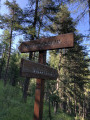
(6) Turn right onto the path, which is not very well marked but is indicated by a wooden signpost pointing towards Les Moulins. Head down towards the east, towards Les Moulins. You’ll soon come to a crossroads.

(7) Head straight ahead, following the signpost for Les Moulins. Ignore a path on the right. Reach this hamlet by crossing the Izoard. Follow the D702 road (Route des Trois Moulins) uphill, then turn left onto the RD902 (Route de l’Izoard) for 100 metres.

(8) Turn right onto a track signposted ‘Lac de Roue’. Join theGR®5via a winding climb, which is steep at first but becomes less so further on.

(9) Turn left and, after a few hundred metres, you’ll reach Lac de Roue.
Continue along a relatively flat path heading due north, with the lake on your left, until you reach Souliers (E).

Waypoints

  1. S : mi 0 - alt. 7,516 ft - Refuge de Furfande
  2. 1 : mi 1 - alt. 7,300 ft - La Valette
  3. 2 : mi 1.94 - alt. 6,640 ft - Furfande chalets
  4. 3 : mi 3.51 - alt. 6,847 ft - Col de la Lauze (1970m)
  5. 4 : mi 5.15 - alt. 6,424 ft - Le Queyron (1884m)
  6. 5 : mi 5.32 - alt. 6,470 ft - Queyron Picnic Area
  7. 6 : mi 7.19 - alt. 5,709 ft - Junction at the Pichal torrent
  8. 7 : mi 7.63 - alt. 5,180 ft - Crossroads of footpaths
  9. 8 : mi 8.3 - alt. 4,665 ft - Signpost for Lac de Roue
  10. 9 : mi 9.92 - alt. 5,899 ft - GR 5 junction
  11. E : mi 11.69 - alt. 5,997 ft - Souliers

Notes

(5) The Queyron picnic area is a lovely spot to rest and recharge your batteries.
There’s a lovely fountain in the hamlet of Les Moulins where you can top up your water supplies before the climb up to Souliers.

Always be cautious and plan ahead when you're outdoors. Visorando and the author of this route cannot be held responsible for any accidents occurring on this route.

The GR® and PR® markings are the intellectual property of the Fédération Française de Randonnée Pédestre.

Reviews and comments

5 / 5
Based on 2 reviews

Reliability of the description
5 / 5
Ease of following the route
5 / 5
Route interest
5 / 5
abrgrando2005
abrgrando2005

I’ve downloaded this walk, but I haven’t actually done it yet.

Machine-translated

patdestesso1972
patdestesso1972

Overall rating : 5 / 5

Date of your route : Jul 30, 2018
Reliability of the description : ★★★★★ Very good
Ease of following the route : ★★★★★ Very good
Route interest : ★★★★★ Very good

A lovely walk: you can set off from the Queyron car park, then head to the Furfande refuge, continue along La Valette with its chalets, then past the sheepfolds and the Furfande chalets, and return to the Queyron car park.
Hike completed on 27 July 2018

Machine-translated

papinou38
papinou38

Overall rating : 5 / 5

Date of your route : Jun 18, 2018
Reliability of the description : ★★★★★ Very good
Ease of following the route : ★★★★★ Very good
Route interest : ★★★★★ Very good

I did this lovely circular route last June: it took me round the Queyron chalets, the refuge and the Col de Furfande, then back via Les Granges and the Furfande chalets

Machine-translated

Other walks in the area

For more walks, use our search engine .

The GPS track and description are the property of this route's author. Please do not copy them without permission.