Laval Mountain Hut – Névache

After an interesting evening at the Refuge de Laval, take a slightly different route back to the village of Névache.

This walk is part of a multi-day hike: Around the Clarée

Details

n°489154
Creation:
Last update:
Last review:
–
  • Snowshoeing
    Activity: Snowshoeing
  • ↔
    Distance: 8.73 mi
  • ◔
    Duration according to the author: 8 hrs 
  • ▲
    Difficulty: Difficult

  • ⚐
    Back to start: No
  • ↗
    Ascent: + 1,273 ft
  • ↘
    Descent: - 2,657 ft

  • ▲
    Highest point: 7,041 ft
  • ▼
    Lowest point: 5,226 ft

Photos

Description of the walk

(S) To continue exploring this high valley, head north-west towards the summer car park, cross it to reach the Pont du Moutet.

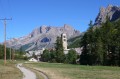
(1) Carry on along the right bank of the Clarée to reach a small hillock beneath the Dent de Crépin. Enjoy a remarkable view of the valley from here.

(2) Take a short circular loop to return to the Pont du Moutet.

(1) Cross the Clarée and, following its left bank, reach the footbridge you crossed the day before. Walk up the gentle slope to reach the Chalets de Roche Noire. Continue south to reach the junction with the Roche Noire stream.

(3) Leave the path leading to Le Jadis on your left and continue to the right. Follow a series of gentle ups and downs to reach the Chalets du Queyrellin.

(4) Begin a short descent to reach the Fontcouverte campsite.

(5) Turn right onto the wide track leading to the Refuge du Chardonnet. Begin a steep climb to reach the Chalets de Laraux. Climb up to the last one to reach another crossroads.

(6) Leave the path to the refuge on your right and turn left onto the wide track used to supply the refuge in winter. Follow this wide track to the Pont de la Souchère.

(7) Cross the Clarée via this bridge to join the road; follow it, passing the chapels. After the bend by the second chapel, take the shortcuts around the bends.

(8) Take these and continue on to the crossroads at the Chapelle Saint-Benoit.

(9) Follow the same route as the previous day to return to the Névache Tourist Office car park (E).

Waypoints

  1. S : mi 0 - alt. 6,611 ft - Refuge Laval
  2. 1 : mi 0.38 - alt. 6,631 ft - Moutet Bridge - Clarée (rivière)
  3. 2 : mi 1.39 - alt. 6,991 ft - Small hill
  4. 3 : mi 3.45 - alt. 6,450 ft - Roche Noire crossroads
  5. 4 : mi 4.34 - alt. 6,539 ft - Queyrellin Chalets
  6. 5 : mi 4.95 - alt. 6,125 ft - Fontcouverte Campsite
  7. 6 : mi 5.34 - alt. 6,506 ft - Laraux Chalets junction
  8. 7 : mi 6.4 - alt. 5,932 ft - Souchère Bridge
  9. 8 : mi 7.75 - alt. 5,692 ft - Shortcuts
  10. 9 : mi 8.26 - alt. 5,374 ft - Saint-Benoit Chapel
  11. E : mi 8.73 - alt. 5,226 ft - Névache Tourist Office car park

Notes

Fontcouverte campsite for a rest before the climb to Laraux

Worth a visit

On the way back, the view over the valley is stunning.
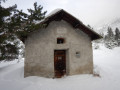
Make the most of the beauty of the alpine chalets dotted around here, which are veritable little paradises, particularly those at Roche Noire in their exceptional setting.

Other walks in the area

For more walks, use our search engine .

The GPS track and description are the property of this route's author. Please do not copy them without permission.