


 Country:

 City:


There are numerous mountain lodges and guesthouses dotted throughout this valley, making it easy to go on a multi-day hike without a care in the world.
Around the Clarée


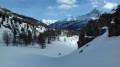
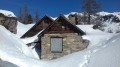
A two-day snowshoe hike in the upper Clarée Valley. A chance to rediscover this valley without having to put up with the smell of car exhaust fumes. A real treat.
Details
Creation:
Last update:
Last review:
-
 Activity: Snowshoeing
-
 Distance: 14.56 mi
-
 Duration according to the author: 2 days
-
 Difficulty: Difficult
-
-
 Back to start: Yes
-
 Ascent: + 2,713 ft
-
 Descent: - 2,713 ft
-
-
 Highest point: 7,041 ft
-
 Lowest point: 5,226 ft
Photos
Stages of the route
This route needs several days, find the details below:
Notes
Worth a visit
Névache and its history.
All the resorts in the north of the department, and here in particular the Serre-Chevalier and Montgenèvre areas.
Reviews and comments
5 / 5
Based on 1 review
Reliability of the description
Not used
Not used
Ease of following the route
Non utilisé
Non utilisé
Route interest
5 / 5
5 / 5

bernardino

Hello
Yes, I agree with Christophe’s comment. I’d also add that any snowshoe hikes undertaken at this time of year need to be planned very carefully. Not only the snow, but also the cold and damp must be carefully taken into account. And on trips covering a good dozen kilometres and involving a few metres of elevation gain, the effort required is still intense, and these long trips should only be undertaken by people well-accustomed to this type of activity.
It should be noted that, despite the minimal elevation gain, I have rated this two-day circular loop as ‘Difficult’.
Machine-translated

christophe13930
Overall rating : 5 / 5
Date of your route : Feb 04, 2017
Reliability of the description : Not used / Not applicable
Ease of following the route : Not used / Not applicable
Route interest : ★★★★★ Very good
A stunning valley and a hike in breathtaking surroundings.
The welcome at the Laval refuge is very warm, and the rooms are cosy. At the far end of this valley, you can carry on to the Drayères refuge.
However,
this is high-altitude mountain terrain, and snow conditions must be checked carefully. Check the avalanche risk forecast.
When the refuge is unstaffed, there is no stove or toilet facilities.
Truly a superb spot!!
Machine-translated
Other walks in the area
Névache – Refuge de Laval
 Visorando Member
5.83 mi
+1,460 ft
-95 ft
6 hrs
Difficult
 Departure from Névache (Hautes-Alpes)
Following the famous River Clarée, head to the new Laval refuge in the large cirque of the Champ des Rochilles for a very pleasant evening and night’s stay.
Buffère Mountain Hut
2.98 mi
+1,627 ft
-98 ft
3 hrs
 Moderate
Departure from Névache (Hautes-Alpes)
You’ll gradually discover the Clarée valley. As you gain altitude, your view will widen. It’ll soon become truly extraordinary!
In the Clarée Valley, Fontcouverte
 7.33 mi
+974 ft
-961 ft
6 hrs
Moderate
Departure from Névache (Hautes-Alpes)
Route along the right and left banks of the Clarée, to discover the hamlet of Fontcouverte, in the heart of the Cerces Massif.
The Col de l'Échelle tunnel
 6.19 mi
+820 ft
-820 ft
4 hrs
Moderate
Departure from Névache (Hautes-Alpes)
A very peaceful walk along the road and through the forest to reach this small tunnel before the long descent to Bardonneche.
Col de Buffère
4.35 mi
+1,214 ft
-1,211 ft
4 hrs
Moderate
Departure from Névache (Hautes-Alpes)
A must-see, the Col de Buffère offers superb views of both the Cerces and the Écrins massif.
This short route, with little elevation gain, is very pleasant and offers a wide range of possibilities.
Laval Mountain Hut – Névache
8.73 mi
+1,273 ft
-2,657 ft
8 hrs
Difficult
Departure from Névache (Hautes-Alpes)
After an interesting evening at the Refuge de Laval, take a slightly different route back to the village of Névache.
From Monêtier-les-Bains to La Salle-les-Alpes
 Association / Club / Walk leader
 7.89 mi
+420 ft
-413 ft
6h 28
 Easy
Departure from Le Monêtier-les-Bains (Hautes-Alpes)
A round trip hike to be done during the snowy season (no snowshoes required as there are sections on tarmac), accessible to all ages. The route is flat and only starts to climb from Chemin des Crozes, in La Salle-les-Alpes (three-quarters of the way along the route).There is a single trail along the entire route, which runs alongside the cross-country ski trail. This is groomed and regularly maintained by the resort, making for a pleasant walk.
For more walks, use our search engine .
The GPS track and description are the property of this route's author. Please do not copy them without permission.

