Col de Buffère

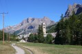
A must-see, the Col de Buffère offers superb views of both the Cerces and the Écrins massif.
This short route, with little elevation gain, is very pleasant and offers a wide range of possibilities.

This walk is part of a multi-day hike: Col et Refuge de Buffère

Details

n°2969572
Creation:
Last update:
Last review:
  • Snowshoeing
    Activity: Snowshoeing
  • ↔
    Distance: 4.35 mi
  • ◔
    Duration according to the author: 4 hrs 
  • ▲
    Difficulty: Moderate

  • ⚐
    Back to start: Yes
  • ↗
    Ascent: + 1,214 ft
  • ↘
    Descent: - 1,211 ft

  • ▲
    Highest point: 7,969 ft
  • ▼
    Lowest point: 6,755 ft

Description of the walk

(S/E) Head south, following the various tracks.

There are several routes; some are marked if an event has just taken place. You can choose your own route, but avoid steep slopes and exposed areas below steep slopes.

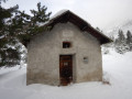
Just below the pass, you’ll see some ruins; this is a good landmark to help you find your way.
Reach the pass.

(1) For the return journey, follow the route in the opposite direction. At around 2,200 m, you can turn right to walk along the right bank of the Torrent de Buffère and rejoin the tracks just above the Chalets de Buffère.
Head to the refuge (S/E).

Waypoints

  1. S/E : mi 0 - alt. 6,755 ft - Refuge de Buffère
  2. 1 : mi 2.16 - alt. 7,966 ft - Col de Buffère (2427m)
  3. S/E : mi 4.35 - alt. 6,759 ft - Refuge de Buffère

Notes

Of course, make sure you check the conditions at the refuge. You are in high mountains and must take precautions regarding the snow. It is essential to read the full BERA (Avalanche Risk Assessment Bulletin), which is displayed at the refuge. The risk is rated out of 5, but a rating of 3 is not ‘moderate’ but ‘marked’.
Have a chat with the warden!

In preparation for the weekend, read:
Snow and avalanche bulletins
and, in this case, select Hautes-Alpes then Thabor.

The route can be done in the morning, with a picnic at the pass or below, or you can have a meal at the mountain hut so you can travel light.

Worth a visit

There are plenty of photo opportunities, with a particularly good spot at the pass.

Reviews and comments

5 / 5
Based on 1 review

Reliability of the description
5 / 5
Ease of following the route
5 / 5
Route interest
5 / 5
annickdaniel
annickdaniel

Overall rating : 5 / 5

Date of your route : Jun 19, 2024
Reliability of the description : ★★★★★ Very good
Ease of following the route : ★★★★★ Very good
Route interest : ★★★★★ Very good
Very busy route : No

A lovely walk to round off our two-week stay in Clarée. The climb up to the mountain hut was a bit steep in places, but short. Beyond the hut, the setting was beautiful: a large plateau in a very peaceful and idyllic valley teeming with marmots. Almost 2 km of flat terrain, which was very pleasant. The climb to the pass was relatively easy, in two stages, with a stunning view at the top. We returned to the refuge via the same route and, following the advice of the refuge owners – who were lovely people – headed towards the Pont de la Souchere, then on to Rately, which was very pretty.

Machine-translated

Other walks in the area

For more walks, use our search engine .

The GPS track and description are the property of this route's author. Please do not copy them without permission.