Country:

 City:


Park at the Névache Tourist Office car park, which is the end of the road in winter.
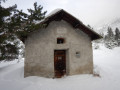
(S/E) Take the main street through Névache Ville Haute. Walk through the village and rejoin the snow-covered road leading into the Upper Valley. Head towards the crossroads where the path meets the road at the Chapelle Saint-Benoit.
(1) Turn left onto the path and head towards the Débaret power station. Turn right to begin a short climb, then reach a flat section. Continue straight on to the Pont du Rately.
(2) Cross the Clarée and follow its right bank; leave the path leading up to the Chalets de Buffère on your left and continue some distance from the river to reach the Chalets de la Basse Sausse, then the Pont de la Souchère.
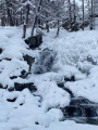
(3) Stay on the right bank of the river, leaving the wide path on your left which is used in winter to supply the Refuge du Chardonnet. Reach the Chalets de la Meuille. Begin a short climb to look out over the Waterfall de Fontcouverte.
(4) Then, at the Chalet de la Fruitière, join the road leading to the upper valley.
(5) Turn left onto this road and, before reaching Le Jadis, take a path on the left.
(6) Follow this path; you’ll soon enter the forest and, after a fairly steep climb, reach the Roche Noire stream, followed shortly afterwards by the chalets of the same name.
(7) Begin a short descent and cross the Clarée via the footbridge. Climb very slightly to rejoin the road, then continue to the Chalet Refuge de Laval (E).


 Hello, thank you for all the walks you’ve made available to us.
 Visorando Member

 Moderate
 Association / Club / Walk leader
 Easy