Refine your search for walks in Refuge Cézanne
Refuge Cézanne walks
 La Sainte-Victoire: Croix de Provence via the Pas des Moines and the Escalette

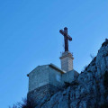
A hike that takes you up to the Sainte-Victoire priory and the Croix de Provence from the Plan d'En Chois car park.
 Sainte-Victoire mountain through the Clapier gap

A loop hike on the south side of Sainte-Victoire Montagne allowing access to the ridge via the Marbrière and the Brèche du Clapier (gap). The walk along the ridge towards the Croix de Provence offers splendid views. Descent via the Priory, the Pas du Berger and the Cézanne Shelter.
 The Sainte-Victoire

A beautiful hike up one of the highest mountains in the Provence: the magnificent Sainte-Victoire. Enjoy 360° views as far as the Alps and the Ventoux. The Priory alone is well worth the effort.
 Les Harmelins and the ruins of Le Trou

Hike through a landscape of rocks and vegetation dotted with ochre and red earth. The first part of the route follows a very wide path in the footsteps of Cézanne, offering extraordinary views of the Sainte-Victoire mountain (south-west side, the most painted by the artist), the Refuge Cézanne and the ruins of the hamlet of Le Trou. The second part is shaded, on a small path, shorter and wilder.
 La Sainte-Victoire via Garagaï

Spectacular route on the southern slope of Sainte-Victoire, arriving on the ridge path via the Grotte des Hirondelles and descending via the Pas de l'Escalette and the Refuge de Cézanne.
 Sainte-Victoire from the Aurigon car park near Le Tholonet
A magnificent hike following the closure of the Bimont dam for over a year during the week. Superb views, to be enjoyed clockwise as you climb towards the Bimont dam.
11/09/2024: Closure of the Imoucha trail for 3 months, from 1 October to 31 December (2024 and 2025). Hike not possible during these periods. See practical information.
 Large circular on the south side and ridges of Sainte-Victoire

This large circular starting from Saint-Antonin-sur-Bayon takes you through several characteristic places: the old marble quarry, the Barthélémy Baudino Refuge, the Hermitage of Saint-Ser and the pass of the same name, then the ridges on the way back to the Priory, the descent to the Pas de l'Escalette and the Cézanne Refuge and, finally, the Oppidum Untinos.
 Sainte-Victoire : Bau Cezanne - Garagai - Deux Aiguilles de l'Anchois

A physical loop hike along Sainte-Victoire, a climb to Prieuré Sainte-Victoire / Croix de Provence through Bau Cézanne and going back through "le Gouffre de Garagaï" and "les deux Aiguilles".
 Refuge Cézanne from the Bouquet car park

A pleasant walk with views of La Croix de Sainte-Victoire.
The Bouquet car park can be busy during peak periods. It is therefore advisable to choose your timing carefully and not hesitate to set off early.
Stop off at the Cézanne refuge before setting off along a wide path through groves of young oak trees and well-maintained olive groves.
07/11/2024: Hikes temporarily inaccessible: the black and green trails on Sainte-Victoire are closed by municipal decree due to rockfalls. See practical information.
 From the Refuge Cézanne to the Deux Aiguilles car park via the Trou

This trail is an alternative known to local hikers for reaching the Saint-Antonin car parks when they have just completed a circular in Sainte-Victoire: it avoids following the brown-marked route, passing through the Col de l'Oppidum (alt. 580 m), then descending a very steep and rugged path. There is a 40-metre less elevation gain, and when you are in a hurry to get to the car park or tired, taking this Trou trail is a good option, especially in bad weather.
