


 Country:

 City:




Start from the 2 Aiguilles car park, 500 metres east of the Maison de la Sainte-Victoire, in the commune of Saint-Antonin-sur-Bayon.
(S/E) From the car park, facing Sainte-Victoire, cross the road; the signposts are on a rock.
Follow the signs for Refuge Baudino – Chapelle Saint-Ser along the black route (a fairly difficult Garagaï), which heads off to the right. Ignore the next three paths branching off to the left; the markings then take a bend and head north-east straight towards the cliff. 150 metres further on, continue the ascent along a path coming from the right.
(1) At a junction, ignore the path on the left and the one opposite, and turn right, following the brown signposting. The path descends into a small valley before climbing up the opposite side. On the ascent, a cairn marks a small path to the right leading to a cave and back. Continue along the path, which alternates between flat and uphill sections, until you reach a junction.
Follow the path as it turns left, still following the brown markings. After a few metres heading due north, the path turns left (west) and then bends right towards La Marbrière. Just before the cave, a cairn indicates a left-hand turn to go round it from above. Once you reach a flat section, the path continues, then crosses a small north-facing rocky outcrop (Pas du Clapier) and leads to a large cairn on another flat stretch.
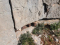
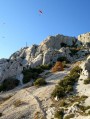
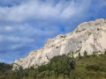
(2) Take the path on the left, following green markings which climb steeply towards the rock face. There are numerous sections where you’ll need to use your hands, but these are never particularly dangerous or overly exposed. A final sloping fissure leads you onto the ridges.
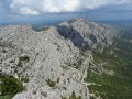
(3) Take in the view and continue to the left on theGR®®9(red-white). TheGR®® markings veer slightly away from the ridges at times; do not hesitate to step away from them and take a few steps to the left to fully enjoy the view, but do take great care. Pass the Signal (969m) and carry on. Take a dotted Red-White marked track which leads you up to the left towards the Croix de Provence.
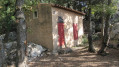
(4) Head back down, passing to the right of the hut, and rejoin theGR®® which turns left to pass above the Prieuré de la Sainte-Victoire, then follow it.
(5) Take a quick look around, then continue the descent to the left along the GR®®. About 200m further down, at a junction, let theGR®® branch off to the right and continue the descent straight ahead following the blue markings (Bimont). The path runs along a stony track and approaches the ridge line. After crossing a wall, let the path branch off to the right and head for a large cairn.
(6) Continue left onto the red-marked path which descends. Cross a short section requiring scrambling (Pas du Berger), then carry on until you reach a rock marking the junction with the dotted red route coming from the right.
Continue the descent to the left to reach a junction 600 metres further down, very close to the Refuge de Cézanne.
(7) Turn left towards the Oppidum Untinos and the Maison de la Sainte-Victoire. A few metres further on, take the opportunity to visit the Refuge Cézanne.
(8) Continue along the path, which is marked in brown with theGR®®653A, to the Oppidum. 300m after the refuge, turn left following the markings.
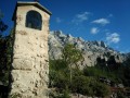
After walking for about 500m, let the green-marked Forcioli trail branch off to the left; then, at the top of a short, steep slope, the Oratoire de l’Amitié is well worth a brief stop.
Carry on for a further 300m until you reach a junction.
(9) Turn right towards the Oppidum and the Deux Aiguilles car park, leaving the brown signposting to rejoin the yellow signposting.
At a junction, let the path branch off to the left and continue straight ahead on the yellow route heading towards the Oppidum. After going round the ruins, the path runs along the edge of the cliff and turns left to pass under a rocky outcrop. When the path rejoins the yellow markings left further up, continue to the right to complete the descent to the car park (S/E).



 Visorando Member
 Very difficult

 Moderate
 Extremely difficult
 Easy

