


- Vallées de la Restonica et du Tavignanu
La boucle des deux vallées de la Restonica au Tavignanu

La Boucle des Deux Vallées est un itinéraire d’exception reliant la vallée de la Restonica à la vallée du Tavignanu. Elle peut être réalisée en une seule journée pour les plus sportifs (21 km au total), ou en deux étapes, avec une nuit au refuge de A Sega.
Details
Creation:
Last update:
Last review:
-
 Activity: Walking
 -
 Distance: 13.27 mi
 -
 Average duration: 2 days
 -
 Difficulty: Difficult
 -
-
 Back to start: No
 -
 Ascent: + 3,583 ft
 -
 Descent: - 5,102 ft
 -
-
 Highest point: 5,394 ft
 -
 Lowest point: 1,480 ft
-
 Country:
France
Country:
France
-
 Area: Vallée de la Restonica
 -
 City:
Corte (20250)
City:
Corte (20250) -
 Start: N 42.261635° / E 9.072519°
 -
 End: N 42.308584° / E 9.146608°
 -


 Hour-by-hour weather
Stages of the route
This route needs several days, find the details below:
Worth a visit

Other walks in the area
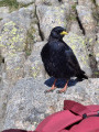
Lakes Mélo and Capitello in Restonica
 Visorando Member
 11.46 mi
+3,783 ft
-3,783 ft
8h 35
11.46 mi
+3,783 ft
-3,783 ft
8h 35
 Very difficult
Departure from Corte (Haute-Corse)
Very difficult
Departure from Corte (Haute-Corse)
A magnificent and unmissable hike.
Caution: the passage of ladders and cables before Lac Melo and the descent of this section may prove difficult for those not accustomed to using this equipment and also to stony paths.
20/05/2024: Hike modified. The Restonica valley is no longer accessible by car! The start is now at the last stop served by the shuttle bus(Pont de Frasseta). See practical information.
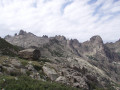
The Cirque des Waterfalls in the Restonica
 12.65 mi
+4,446 ft
-4,449 ft
8 hrs
Very difficult
Departure from Corte (Haute-Corse)
12.65 mi
+4,446 ft
-4,449 ft
8 hrs
Very difficult
Departure from Corte (Haute-Corse)
A more challenging hike than the one to Lac de Melo, as it takes you through the steep-sided valley of the Ruisseau de Rinoso and up to over 2,100 m on theGR® 20, before descending via Lac de Melo.
Only attempt this in good weather as, if it rains on the large slabs at around 2,000 m, it can be slippery.
20/05/2024: The Restonica Valley is no longer accessible by car! The start point is now at the final stop served by the shuttle bus (Pont de Frasseta).
From Frasseta to the Melu and Capitellu lakes via Grotelle
 Tourist office
 11.32 mi
+3,678 ft
-3,678 ft
8h 25
Very difficult
Departure from Corte (Haute-Corse)
11.32 mi
+3,678 ft
-3,678 ft
8h 25
Very difficult
Departure from Corte (Haute-Corse)
U chjassu di i lavi
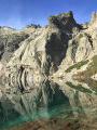
The beautiful lakes of Melu and Capitellu are still accessible. It is now a challenging hike. Take on the challenge and your efforts will be rewarded!
The former starting point for this hike, from the Grotelle sheepfolds, is no longer accessible by vehicle due to the significant damage caused by storms Ciaran and Domingos. The starting point is now at the Frasseta bridge.
From Frasseta to the sheepfolds at E Grotelle
7.61 mi
+1,985 ft
-1,985 ft
5h 15
 Moderate
Departure from Corte (Haute-Corse)
Moderate
Departure from Corte (Haute-Corse)
The E Grotelle Path
The only access route to the upper Restonica valley, this walk takes you to the famous sheepfolds of E Grotelle.
Following the storms last November, extensive damage has made the upper Restonica valley inaccessible by car from the Tagone Bridge (which was swept away by the flood).
Access to the E Grotelle sheepfolds is now via this walking route from La Frasseta (this is the same starting point as for the route leading to the Cappellaccia sheepfolds).
This trail can be taken either for a moderate-difficulty hike leading to the Grotelle sheepfolds, or to reach the start of the hike to the Melu and Capitellu lakes (which is now considered a challenging route). This trail runs along the upper Restonica valley and leads to the Grotelle sheepfolds.
From Lake Melo to the Brèche de Capitello
 12.47 mi
+4,265 ft
-4,239 ft
9h 25
Very difficult
Departure from Corte (Haute-Corse)
12.47 mi
+4,265 ft
-4,239 ft
9h 25
Very difficult
Departure from Corte (Haute-Corse)
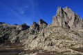
This is a very beautiful hike that allows you to discover the two lakes of Melo and Capitello with a view of the Brèche de Capitello. The view from the breach allows you to discover both sides of the massif.
20/05/2024: The Restonica Valley is no longer accessible by car! The starting point is now at the last stop served by the shuttle bus( Pont de Frasseta) . See practical information.
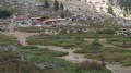
The Cappelaccia and Alzo sheepfolds as seen from the Frasseta Bridge
 6.61 mi
+2,641 ft
-2,644 ft
5h 20
Moderate
Departure from Corte (Haute-Corse)
6.61 mi
+2,641 ft
-2,644 ft
5h 20
Moderate
Departure from Corte (Haute-Corse)
You’ll be delighted by the unique view of the Cappelaccia sheepfolds. We are now at the highest point of the vast Alzo plateau and can enjoy a magnificent panoramic view stretching from Rotondo to Cinto, via Punta Artica and Paglia Orba. A large sign and red markings show us the way forward.
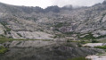
Lake Oriente and the Timozzu sheepfolds
 5.88 mi
+3,527 ft
-3,501 ft
5h 45
Difficult
Departure from Corte (Haute-Corse)
5.88 mi
+3,527 ft
-3,501 ft
5h 45
Difficult
Departure from Corte (Haute-Corse)
A challenging hike to one of Corsica’s most beautiful lakes, at an altitude of over 2,000 metres.
Please note: read the latest review dated August 2024.
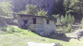
The Riviseccu Sheepfolds (Rivisecco)
 5.58 mi
+1,814 ft
-1,798 ft
4h 10
Moderate
Departure from Corte (Haute-Corse)
5.58 mi
+1,814 ft
-1,798 ft
4h 10
Moderate
Departure from Corte (Haute-Corse)
These sheepfolds, which are in very good condition, mark the end of a forest area. The group of sheepfolds forms a small hamlet of several well-restored huts. The surroundings are magnificent, with large rock formations and the Riviseccu stream.
Shaded throughout, the route follows an old forest track that climbs gradually through a forest where beech trees are omnipresent, in contrast to the Laricio pine trees along the stream.
For more walks, use our search engine .
The GPS track and description are the property of this route's author. Please do not copy them without permission.

