Country:
 City:
City:


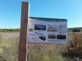
Introduction: On this 19 km route, there is a suggested starting point in the centre of each village.
The direction of the route, as originally conceived and described below, begins in Saint-Martin-de-Pallières. The Notre Dame du Revest Chapel in Esparron, at the centre of the route, forms the junction between the Esparron–Artigues and Esparron–Saint Martin circular routes. The route is marked in blue and features a number of directional signposts, three start signs and 10 information boards, two of which are interactive. It follows roads, sections ofthe GR® 99 andGR® 99a, and the EuroVelo 8.
(S/E) The starting sign in Saint-Martin is located in the car park beneath the Bistrot de Pays on the D470.
Take the small flight of steps at the far end of the car park and head down onto the D470. Walk along the side of the road to the right towards the hairpin bend and the signpost indicating Chapelle Saint Étienne. Take the steps leading up the dirt track and follow the marked path through the woods. Please note that the vegetation can be quite overgrown in places; you’ll also cross a seasonal stream where you’ll need to climb a little. You’ll arrive at the heart of the La Ferrage housing estate. Turn right and walk up the cul-de-sac. A narrow passage between the houses, marked by a small flight of steps, leads you to the D561.
(1) Cross the road via the raised footbridge and turn left, then immediately right. Road signs point you towards the Chapelle Saint-Étienne. You are now back on the D 470 and on a section ofthe GR® 99. You’ll pass the Ferme du Logis, mentioned on signpost 1.
A signpost directs you to take a small path up to the left to see the Chapelle Saint-Étienne. You’ll cross a grassy area. From the oratory, you’ll have a magnificent view of the village and Saint Martin Castle. The first information board is in front of the chapel. Continue along the path through the trees and, a few metres further on, you’ll rejoin the D 470. Turn left and walk along the side of the road until you reach the directional sign on the right-hand side of the road, which indicates that you should leave the road.
(2) Turn right, then a few metres further on, turn left, following the signposts. On this path through the woods, the sounds of nature can be heard in every season (birdsong, leaves crunching underfoot, running water); these are the subject of the fun information panel 2, which is located just after you cross the Le Grand Vallat stream.
At signpost 2, you’ll find yourself facing a field. The path continues straight ahead, but do not cross the crops; instead, walk along the left-hand side of the field, towards the old Saint-Martin railway station.
(3) On the other side, you’ll reach the old Nice–Meyrargues railway line, which runs through Provence-Verdon from Rians to Fox-Amphoux. It is now owned by the Var Department and has been developed as EuroVelo 8, the Mediterranean cycle route. So turn left onto the cycle route, passing in front of the station. You’ll come out onto the D 470 again.
Leave theGR® 99 at the road, cross it and continue along the cycle route, which runs slightly further along on the opposite side. The stretch along the cycle route is quite long; you’ll pass three information boards, cross the D 65 and the D 70, ride past the old Esparron railway station, cross a small bridge, before turning left at the signpost indicating the Notre-Dame du Revest Chapel.
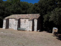
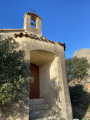
(4) The tarmac path leads to the chapel. At the oratory and the ruins, sign 6 provides an interpretation of the landscape. Continue straight on until you rejoin the D 561.
(5) Cross the road again. Please take care: visibility is better in this direction than the other way round, but there is a fair amount of traffic.
You are now in the car park opposite the chapel. It forms part of the ‘Laissez-vous conter Esparron de Pallières’ heritage route. You are also at the centre of the ‘8’. There are several options available to you
- towards Esparron village and Saint-Martin,
- or towards Artigues via the ridge or theGR® 99a.
The rest of the route, as planned, takes us on towards Artigues via the ridge.
Walk past the chapel and the cemetery. Further on, follow the signpost indicating Artigues via the ridges. At the bend, turn right (still following the blue markings).
Look out for the second directional sign on the left-hand side of the path. It marks a narrow, steep passage through the vegetation. It’s a bit tricky to climb up there, and the ascent to the Esparron reservoir and the ridge is quite steep. However, an alternative route is available should you find this section particularly difficult. At thesecond marker, continue along the path and stay on it – it is well signposted and is the access path to the reservoir. When you reach the reservoir, walk round it to get to the other side and rejoin the rest of the signposted route.
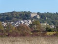
Climb a little further up until you reach the ridge. Head west (to the left). The view is magnificent over the plains, plateaus and the northern and southern peaks when the landscape opens up. From another vantage point, you’ll catch sight of the village of Esparron, then, in the distance, the Château de Saint-Martin. The scents of the hills are very pronounced, and the wind sweeps over you on days when the Mistral blows. The route along the ridge is marked by a series of ascents and descents, and the vegetation can sometimes be overgrown. You’ll pass signpost 2, then the ruined Oratory of Saint-Jean d’Esparron. You’ll also pass under the high-voltage power line. Finally, you’ll reach the Croix d’Artigues, where signpost 8 awaits you, and below that, the Artigues reservoir.
At the reservoir’s fence, go round it to the right, head down the small access path, and you’ll come out onto a tarmac road.
(6) Turn right and follow the road down to the entrance to the village of Artigues.
(7) Head slightly to the right to cross through the village. From here until almost the end of the route, you’ll be on theGR® 99a. In Artigues, walk past the castle and the church. The sign marking the start of the route is at the far end of the car park, on the wall by the steps leading to the community hall. Be sure to take a stroll round the village; a small garden with picnic tables is the perfect spot for a well-deserved break. The route continues past the town hall, the low-rise (blue) house and a cross. As you leave the village, the path soon turns into a forest track.
(8) At the fork in the road, take the path on the right. Walk past the interactive sign no. 9 dedicated to trees. The path ends in front of a vineyard. Go round it on the right. Turn left at the letterbox and head back down the path to the Notre-Dame du Revest Chapel.
(5) Walk along the edge of the D 561 on the right-hand side of the road until you reach the village of Esparron.
(9) In the village, follow the red and whiteGR® markings and the blue markings for the route. Take the Chemin de Fontaine Neuve, the Rue de l’Oratoire and the Grand Rue Les Aires. Walk past the post office, the town hall and the church; opposite them, you’ll find the information board for the Esparron route. It’s mounted on the wall of the former village school, now the Bistrot de Pays, next to the board detailing the heritage trail ‘Laissez-vous conter Esparron de Pallières’. Be sure to visit the village.
(10) On leaving the village, at the Fork in the road by the mission cross, take the path leading uphill to the right. Walk past the cross and follow the painted markings. You’ll come to signpost 10 (the last on the route) at the low point of the valley.
(11) The path joins the D470. Turn left, then right at the Fork in the road towards the village of Saint Martin. Walk past the cemetery and continue along the tarmac road towards the castle.
(12) Turn left to enter the village centre. Walk past the cistern, go up Rue de l’Église, walk alongside the castle and go down the steps. Cross the Place du Bancaou and head for the Bistrot de Pays car park. Be sure to explore the village by following the heritage route “Laissez-vous conter Saint Martin de Pallières” (S/E).



 Visorando Member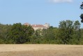
 Moderate

 Easy
Easy