Country:
 City:
City:


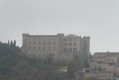
Start at the old Saint-Martin-de-Pallières railway station, at the entrance to the village. To get there, turn right towards the Chapelle Saint-Etienne, continue along the D470 and, at a bend, you’ll reach the old station with a car park.
(S/E) Walk past the station and turn right. Walk past a signpost and cross the field.
(1) Find a small path between two large oak trees and cross a stream. At the junction, turn right to rejoin the D470.
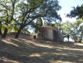
(2) Turn left. Continue along the road, take a short detour to visit the chapel on the right, then continue towards the village.
(3) At the crossroads, go straight on towards the village and take a small shortcut on the left. Continue along the road towards the village. At the entrance, turn right up the wooden steps, pass in front of the oratory and the cross, then follow the road to the right towards the village.
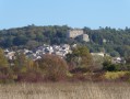
(4) On the left, heading towards "the village", take the "Carriera dou Four", cross a square, then turn into the alleyway on the left. Then turn right up the steps, go under the porch and past the church, turn left, pass the castle and the underground cathedral. Turn left into Rue de l'Église.
(5) At the junction, turn right towards Esparron, then left towards the cemetery. Walk past it.
(6) Cross the D470, turn right 50 metres further on. At the next junction, go straight on and round a bend; at a junction with another track, turn left to rejoin the D470.
(7) Do not follow the road but go straight on along a small path. At the junction with a signpost, turn right onto a rocky track leading downhill.
(8) At the junction, take the small path on the left, crossing a small stream. At the next crossroads, turn right then continue left, passing a fire hydrant.
(9) Pass a signpost, follow the signs for Esparron (1 km), Paris (785 km) and Warsaw (2036 km) (that’s a bit far!). About fifty metres further on, turn left, pass a small marker and then head straight along the lovely track to the village of Esparron.
(10) At the entrance to the village, by the playground, turn right, pass the church and take the “Grand’ Rue”. Turn right onto Rue de l’Oratoire, then left onto Chemin de la Fontaine Neuve. Cross a road and go straight on to join the D561.
(11) At the oratory, turn left and continue on the D561.
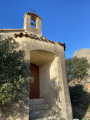
(12) At the chapel, leave the road, turn left, walk past the chapel and continue straight ahead.
(13) Take the second path on the right, before the postbox. At the next junction, take the track on the left which turns into a small path through the forest, then back into a track as you reach Artigues.
(14) At the entrance to Artigues, walk past the town hall, then turn left. Take the second right, then left.
(15) At the signpost, turn right onto the D65.
(16) About 1 km from the village, take a small path on the left where the power line crosses the road. At the junction of two paths, take the sharp right-hand bend.
(17) At the fork, continue straight ahead; do the same at the next junction and you will come out onto a track (signpost).
(18) Turn left, then enter the village of Ubac via the small road.
(19) At fire hydrant 43, turn right, then left and straight on.
(20) At the end of the large field, turn right, then continue along the small road on the left to descend into the valley.
(21) On the small road, after an electrical box, turn right and take the old railway line. Go straight on, cross the D561, continue along the railway line for 7km to return to the car park (S/E).



 Visorando Member
 Moderate
 Tourist office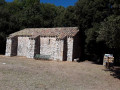

 Easy
Easy