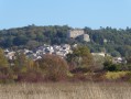
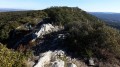
On the outskirts of Rians

A circular walk between La Grande Bastide and the village of L'Ubac, on the outskirts of the town of Rians, passing by its church.
Moderator's warning on 08/02/2021: Changes to the starting point of the hike; see notices.

Details

787176
Creation:
Last update:
Last review:
  • Walking
    Activity: Walking
  • ↔
    Distance: 8.63 mi
  • ◔
    Average duration: 4h 50 
  • ▲
    Difficulty: Moderate

  • ⚐
    Back to start: Yes
  • ↗
    Ascent: + 974 ft
  • ↘
    Descent: - 948 ft

  • ▲
    Highest point: 1,526 ft
  • ▼
    Lowest point: 1,047 ft
  • ⚐ Country: France
  • ⚐ City: Rians (Var) (83560)
  • ⚑
    Start/End: N 43.633918° / E 5.790787°
  • ❏
    IGN map(s): Ref. 3343OT
  • Hour-by-hour weather

Photos

Description of the walk

To get to La Grande Bastide, take the D23 between Rians and Ginasservis. Between the two 70km/h zones, take a very small road at the sign for "Grande Bastide" and park on the side of the road before the building.

(S/E) Follow the small road to the Plan de Valavès housing estate and reach the D23.

(1) Turn left for a few metres, then turn left onto Chemin de Carnaille. At the next junction, leave the road and turn right, then immediately left. At a small junction, go straight ahead, passing several low walls. At several junctions (not shown on the IGN map), go straight ahead.

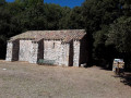
(2) At the ruined wooden hut, turn right and, at the next junction, turn right again. At the end of a low wall, go straight ahead on the downhill path, join a small road and go downhill to the right. Continue straight ahead on the road and, at the bridge, turn right.

(3) Between a large oak tree and a bus shelter, 10 metres before the D23, turn left. In the middle of the field, turn left, take the small path and climb a small embankment. At the next small embankment, turn right and continue straight ahead to reach a small road.

(4) Turn right, arrive on the D23 and turn left towards Rians. At the roundabout, turn right towards the motorway.

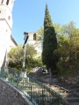
(5) Take the first left and go up Avenue de la Gare. At the fountain, go up the stairs and pass in front of the Municipal Police station.

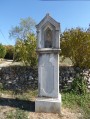
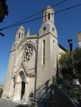
(6) Turn left onto the large staircase and, when you reach the church, follow the path on the left to go around it. At the bottom, turn right and then left. At the crossroads, turn right and continue straight ahead down Avenue du 19 Août 1944. Pass the plane trees, continue straight ahead and, at the oratory, turn right onto the small road going uphill.

(7) At the crossroads where the road turns into a track, turn left, then right about 450 metres further on. Pass a first path on the right, then a second on the left. At an old electric fence, turn left (east) and continue straight ahead. In a clearing, the track turns into a small path. At the cairn, turn left.

(8) At the X-shaped junction of small paths, go down to the left and follow the red and whiteGR®99Amarkings. When you reach a track, at the "Ubac" signpost, turn left towards the village. At fire hydrant 43, turn left and then immediately right to walk along a field. At the end, turn right and then left to continue down the road towards the valley.

(9) Cross the D561 and make a zigzag to take a small road. Cross the bridge.

(10) At the end of the road, turn right along a building. At the three-way junction, take the small path on the left and continue straight ahead. At the junction with a track, turn left and continue straight ahead (north).

(11) At the crossroads, continue straight ahead. At the junction with a track, turn left and continue towards the car park (S/E).

Waypoints

  1. S/E : mi 0 - alt. 1,109 ft - La Grande Bastide
  2. 1 : mi 1.08 - alt. 1,053 ft - D23
  3. 2 : mi 1.62 - alt. 1,201 ft - Wooden hut, on the right
  4. 3 : mi 2.04 - alt. 1,079 ft - On the left between an oak tree and a bus shelter
  5. 4 : mi 2.28 - alt. 1,129 ft - Small road, on the right
  6. 5 : mi 2.93 - alt. 1,184 ft - Ascent to the town
  7. 6 : mi 3.25 - alt. 1,276 ft - Turn left onto the large staircase.
  8. 7 : mi 4.24 - alt. 1,401 ft - End of the road, on the left
  9. 8 : mi 5.45 - alt. 1,417 ft - GR junction, on the left
  10. 9 : mi 6.24 - alt. 1,158 ft - D561
  11. 10 : mi 6.93 - alt. 1,250 ft - End of the road, on the right
  12. 11 : mi 8.1 - alt. 1,253 ft - At the roundabout, go straight ahead.
  13. S/E : mi 8.63 - alt. 1,109 ft - La Grande Bastide

Worth a visit

An easy walk.
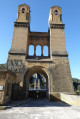
In Rians, don't miss the fountain, the church and the tower.

Always be cautious and plan ahead when you're outdoors. Visorando and the author of this route cannot be held responsible for any accidents occurring on this route.

The GR® and PR® markings are the intellectual property of the Fédération Française de Randonnée Pédestre.

Reviews and comments

4.1 / 5
Based on 8 reviews

Reliability of the description
4.3 / 5
Ease of following the route
4 / 5
Route interest
4.1 / 5
marcheur97400
marcheur97400

Overall rating : 4.7 / 5

Date of your route : Jan 08, 2025
Reliability of the description : ★★★★★ Very good
Ease of following the route : ★★★★★ Very good
Route interest : ★★★★☆ Good
Very busy route : No

I did this route again with a group of 24 people who loved the walk. I would like to add a small detail: since my hike on 27 December 2024, a passage has been cleared to reach the Arenas path while avoiding the electric fence, and a small tree has even been cut down. This makes the route much easier to follow.

Machine-translated

marcheur97400
marcheur97400
• Edited:

Overall rating : 4.7 / 5

Date of your route : Dec 27, 2024
Reliability of the description : ★★★★★ Very good
Ease of following the route : ★★★★★ Very good
Route interest : ★★★★☆ Good
Very busy route : No

A pleasant route through the countryside, easy to follow with GPS. No particular difficulties. It's true that walking (10-15 minutes) along the D 23 to reach Rians isn't ideal (mainly because of the noise from heavy traffic). But you can follow the cycle path and even use the grassy verge at regular intervals.
I preferred to start from Rue de la Gare in Rians, where it's fairly easy to park, and leave the D 23 for the end. Please note: before reaching Chemin de l'Arenas, you will come across some electric wires that appear to be protecting a recent tree planting. However, you can easily get around them by going to the left through the bushes (this is just a few metres before you reach the path in question).
My pedometer read 14 km when I arrived.
Thank you again for this route.

Machine-translated

Géryf
Géryf

Overall rating : 3.7 / 5

Date of your route : Apr 08, 2024
Reliability of the description : ★★★★☆ Good
Ease of following the route : ★★★★☆ Good
Route interest : ★★★☆☆ Average
Very busy route : No

Far too much tarmac, especially when you follow the VERY busy D3 to enter Rians. On the other hand, the section through the town centre is pleasant and the second half of the route after Rians finally returns to nature.

Machine-translated

dasebinca13
dasebinca13

Overall rating : 4 / 5

Date of your route : Jan 16, 2022
Reliability of the description : ★★★★☆ Good
Ease of following the route : ★★★★☆ Good
Route interest : ★★★★☆ Good
Very busy route : No

We did the hike starting from Rians.
We did the route in reverse, with the road section at the beginning as it is less pleasant. We looked for the path between points 4 and 2. The whole section on the GR9A is very good. Rians is a pleasant place to visit.

Machine-translated

henri57
henri57 ★

Hello,

Thank you for taking the time to give your opinion.

Some small paths are not easy to distinguish on the map and are not marked.

By "marked on the map", we do not mean evaluating the markings, but rather the accuracy of the route as it appears on the map in relation to the actual terrain.

Happy hiking!

Machine-translated

JRMILLET
JRMILLET

Overall rating : 3.7 / 5

Date of your route : Apr 28, 2019
Reliability of the description : ★★★★☆ Good
Ease of following the route : ★★★☆☆ Average
Route interest : ★★★★☆ Good

A pleasant hike with varied views and no difficulties. We set off from Rians in the opposite direction to the original route. This allows you to start with the less pleasant section of the route and then stay away from traffic. A GPS is almost essential as some of the small paths are not easy to see on the map and are not marked.

Machine-translated

SAINT MARTIN 83
SAINT MARTIN 83

Overall rating : 4.3 / 5

Date of your route : Feb 28, 2019
Reliability of the description : ★★★★☆ Good
Ease of following the route : ★★★★☆ Good
Route interest : ★★★★★ Very good

The description and signposting after the Carnailles path is average or even non-existent. I got lost and followed another route that took me to Rians, where I was able to rejoin the suggested route and complete the circular route as planned.

Machine-translated

totoetzoe
totoetzoe

Overall rating : 4.7 / 5

Date of your route : Apr 08, 2018
Reliability of the description : ★★★★★ Very good
Ease of following the route : ★★★★☆ Good
Route interest : ★★★★★ Very good

A magnificent route, despite winds of 120 km/h, varied landscapes, pleasant paths without difficulty, a pretty village and a very beautiful church. GPS is necessary as there are so many paths; this route deserves to be signposted.

Machine-translated

Other walks in the area

For more walks, use our search engine .

The GPS track and description are the property of this route's author. Please do not copy them without permission.