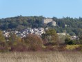
In the shade of the woods at the start of Seillons-Source-d'Argens

Follow the animal tracks, learn to recognise a few plant species and, above all, make sure you leave only a minimal footprint on this forest ecosystem.

Developed by the Provence Verdon Community of Municipalities, the Randonner Autrement project aims to introduce families to the natural heritage, outlying built heritage, landscapes and their evolution over time, as well as views of the villages, in an educational and fun way.

Details

1177686
Creation:
Last update:
Last review:
  • Walking
    Activity: Walking
  • ↔
    Distance: 1.85 mi
  • ◔
    Average duration: 1h 10 
  • ▲
    Difficulty: Easy

  • ⚐
    Back to start: Yes
  • ↗
    Ascent: + 328 ft
  • ↘
    Descent: - 328 ft

  • ▲
    Highest point: 1,322 ft
  • ▼
    Lowest point: 994 ft

Photos

Description of the walk

The route starts at the car park of the waste collection centre and shooting range, at the intersection of Chemin du Devançon, Chemin du Vallat and Chemin des Carmes in Seillons, north of Saint-Maximin-la-Sainte-Baume.

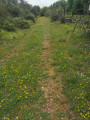
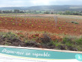
(S/E) The start sign is located at the edge of the car park at the entrance to the trail. A few metres further on, heading east, a path on the right leads down to the edge of the road. Do not take this path; continue straight ahead. At a fork (elevation 315), turn right, following the signpost for "Suei Rouvelong," and climb straight up into the woods. Ignore the paths crossing at the sides. Instead, take a few moments to observe the landscape (educational sign 1) and the three botanical markers that punctuate the climb.

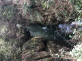
Reach Suei Rouvelong, a cemented waterhole fed by rain and hunters, in the middle of the oak trees. Information panel 2 awaits you there.

(1) Turn left (north-west) following the directional marker to reach the Stèle de la Résistance. Pass information board 3.

(2) At the next intersection, a new signpost marked "Stèle de la Résistance" will indicate that you should turn left again to reach the stele (educational panel 4).

(3) Turn left (south) towards the shooting range. Walk along thePR® Provence Verte et Verdon "Le Puits Dagnié" and follow the yellow markings. Pass five botanical markers and educational panel 5.

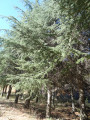
At the next intersection (elevation 324), continue straight ahead following the yellow markings (do not take the path on the right). You will pass information board 6 in the middle of a cedar plantation.

Pass the shooting range (on your left), then you will reach the entrance to the waste collection centre and the car park at the start (S/E).


Waypoints

  1. S/E : mi 0 - alt. 994 ft - Waste collection centre car park - trail start sign
  2. 1 : mi 0.63 - alt. 1,316 ft - Suei Rouvelong - educational panel 2
  3. 2 : mi 0.94 - alt. 1,171 ft - Intersection
  4. 3 : mi 1.03 - alt. 1,152 ft - Resistance memorial - educational panel 4
  5. S/E : mi 1.85 - alt. 994 ft - Waste collection centre car park - shooting range

Notes

Please respect other people's property and nature.
Remember to check the fire risk alert map on the Var Prefecture website and find out about hunting seasons, hunting days and battues.
Emergencies: 112
Seillons Town Hall: 04 98 05 20 40

If you want to combine business with pleasure by doing your bit for the environment and picking up litter, bring bags and gloves to protect yourself. You can sort your waste in the bins in the car park or at the waste collection centre (subject to opening hours) at the end of the route.

Worth a visit

During the hike:

Departure: Signpost for the "À l'ombre des bois" route (S)

Botanical marker: "Two Mediterranean herbaceous plants"

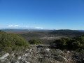
Station 1: device for focusing the gaze - landscape opening "Viewpoint over the village"

Botanical markers: "Wild asparagus", "Alaterne buckthorn"

Station 2: educational and fun information panel "Enquête sur la faune de la forêt" (Investigation into forest wildlife), at the Rouvelong stream (1)

Follow the instructions of your little travelling companion. Find the footprints of some of the forest's inhabitants and check your answers by lifting the flaps.

As you continue your walk, notice the rounded areas on the ground until you reach the next station. These are the sites of former charcoal kilns.

Station 3: educational panel "Hunting, a tradition"
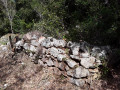
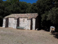
A few metres further on, on the right-hand side of the path, you will see the remains of a charcoal burner's hut.

Station 4: educational panel "The Resistance in Seillons", at the Resistance memorial (3)

Botanical markers: "The baguenaudier", "The maples", "The wild service tree", "The Christ's thorn", "The wig tree"

Station 5: educational panel "The gardeners of nature"

Station 6: educational panel "From leaves to needles"

Near the hike:

The Provence Verdon Community of Communes belongs to the Provence Verte Verdon Land of Art and History. Discover the heritage routes of the villages: "Let us tell you about the Provence Verte Verdon Land of Art and History", "Let us tell you about Seillons Source d'Argens".

Also worth seeing in Seillons: the source of the Argens, the watering bridge.
PR® Le Puits Dagnié,PR® Le Gascon in thePR® guide "La Provence Verte... à pied" (Green Provence... on foot).

Nearby: Randonner Autrement route "From vineyard to vineyard" in Brue-Auriac, Randonner Autrement route "The senses of the landscape" in Saint-Martin-de-Pallières - Esparron de Pallières - Artigues

Always be cautious and plan ahead when you're outdoors. Visorando and the author of this route cannot be held responsible for any accidents occurring on this route.

The GR® and PR® markings are the intellectual property of the Fédération Française de Randonnée Pédestre.

Reviews and comments

4.6 / 5
Based on 9 reviews

Reliability of the description
4.7 / 5
Ease of following the route
4.7 / 5
Route interest
4.3 / 5
User 27477074

Overall rating : 4.7 / 5

Date of your route : Aug 28, 2025
Reliability of the description : ★★★★★ Very good
Ease of following the route : ★★★★★ Very good
Route interest : ★★★★☆ Good
Very busy route : No

Good signage, easy route and reliable itinerary.
Ideal for a first hike with children!

Machine-translated

User 26109848

Overall rating : 4.3 / 5

Date of your route : Jun 09, 2025
Reliability of the description : ★★★★☆ Good
Ease of following the route : ★★★★★ Very good
Route interest : ★★★★☆ Good
Very busy route : No

Perfect for a digestive stroll with the family

Machine-translated

Evaro
Evaro

Overall rating : 5 / 5

Date of your route : May 19, 2024
Reliability of the description : ★★★★★ Very good
Ease of following the route : ★★★★★ Very good
Route interest : ★★★★★ Very good
Very busy route : No

A very pleasant, short walk with plenty of shade.

Machine-translated

223190GUY
223190GUY

Overall rating : 5 / 5

Date of your route : Dec 27, 2020
Reliability of the description : ★★★★★ Very good
Ease of following the route : ★★★★★ Very good
Route interest : ★★★★★ Very good
Very busy route : No

A very pleasant, easy and relaxing trail. Ideal for after a meal.

Machine-translated

Kacet nadine
Kacet nadine

Overall rating : 5 / 5

Date of your route : Oct 09, 2020
Reliability of the description : ★★★★★ Very good
Ease of following the route : ★★★★★ Very good
Route interest : ★★★★★ Very good
Very busy route : No

Perfectly matches the description

Machine-translated

Randonner Autrement CCPV

Thank you for your comment. Indeed, the woods of Seillons allow you to extend your walk/hike well beyond the route.

Machine-translated

ganalexbis@live.fr
ganalexbis@live.fr

Overall rating : 4.7 / 5

Date of your route : Jul 17, 2020
Reliability of the description : ★★★★★ Very good
Ease of following the route : ★★★★★ Very good
Route interest : ★★★★☆ Good
Very busy route : No

A pleasant walk, especially in the shade during summer. Option to extend the circular by 4 or 5 km.

Machine-translated

Randonner Autrement CCPV

Great. Thank you for your feedback.

Machine-translated

COPAT BONNEL
COPAT BONNEL

Actually, I posted this comment on the wrong hike, but I couldn't delete it...

I did the "A l'ombre des bois" hike previously... a well-marked and fun trail with educational signs, very nice... (except for the shooting range at the beginning, I'm not a fan of firearms . But as you are informed at the start, no worries).

Machine-translated

Randonner Autrement CCPV

Hello

I am sorry you got lost. However, I think you took the wrong route.

The trail starts at the sign marked "A l'ombre des bois" (In the shade of the woods) located in the dirt car park opposite the waste collection centre. You then enter a wooded area. There are no vineyards to walk alongside on this route. You stay in the wooded area throughout the route and return to the car park where you started after passing six educational signs, eight botanical markers, the Resistance memorial and the shooting range.

I hope you will have the opportunity to do it again.
Have a nice day.

Machine-translated

COPAT BONNEL
COPAT BONNEL

Overall rating : 2.7 / 5

Date of your route : Feb 02, 2020
Reliability of the description : ★★★☆☆ Average
Ease of following the route : ★★☆☆☆ Disappointing
Route interest : ★★★☆☆ Average

Well then... at first, no worries... except that the hike starts on a tarmac road, then we follow some very nice vineyards...then we found ourselves on a road, not very busy but a road nonetheless... and after 50 minutes of walking... well, I think we must have missed a turn, we ended up in Bras and a nice lady showed us the way back... along the banks of the Argens; rather pleasant.

In short, we got lost (40 minutes longer than planned!) Pay attention to the signposts and explanations, which personally didn't help us... we're still looking for the "Fromage" sign... a walk with too much road but still pleasant.

Machine-translated

Touriste59
Touriste59

Overall rating : 5 / 5

Date of your route : Sep 07, 2018
Reliability of the description : ★★★★★ Very good
Ease of following the route : ★★★★★ Very good
Route interest : ★★★★★ Very good

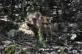
A pleasant hike with an unexpected encounter: a wild boar cub around a bend in the path...

Machine-translated

bandolrobert
bandolrobert

Overall rating : 4.7 / 5

Date of your route : Jul 25, 2018
Reliability of the description : ★★★★★ Very good
Ease of following the route : ★★★★★ Very good
Route interest : ★★★★☆ Good

A pleasant, seasonal hike.

Machine-translated

Other walks in the area

For more walks, use our search engine .

The GPS track and description are the property of this route's author. Please do not copy them without permission.