Jovinal Circular Route

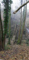
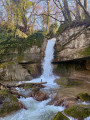
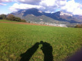
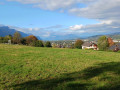
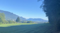
Set amongst the foothills of the Épine range between Cognin and Vimines, this short walk takes you through landscapes oforchards, pastures and chestnut forests. It offers views of the Chambéry Gorge and iconic peaks, with a view to the north over the southern tip of Lake Bourget.

Details

n°110700953
Creation:
Last update:
Last review:
–
  • Walking
    Activity: Walking
  • ↔
    Distance: 3.27 mi
  • ◔
    Average duration: 2h 10 
  • ▲
    Difficulty: Easy

  • ⚐
    Back to start: Yes
  • ↗
    Ascent: + 735 ft
  • ↘
    Descent: - 735 ft

  • ▲
    Highest point: 1,690 ft
  • ▼
    Lowest point: 991 ft
  • ⚐ Country: France
  • ⚐
    Area: Alps
  • ⚐ City: Cognin (73160)
  • ⚑
    Start/End: N 45.557559° / E 5.889453°
  • ❏
    IGN map(s): Ref. 3332OT, 3333OT, 3333OTR
  • Hour-by-hour weather

Description of the walk

Park at the leisure centre.

(S/E) Head south-west along the Nant du Forézan until you reach a crossroads.

(1) Follow the small road uphill for 150 m.

(2) Take the Chemin des Bœufs on the right, then head up the Route de la Forêt d’Albert.

(3) Turn right onto the Route de Rougier and follow it to its end.

(4) At Rougier, turn south, follow the Chemin de la Plantaz and you’ll reach the Route de Jovinal.

(5) Head north-east and, at the bend, turn left down towards the signposts.

(6) Head down the Sentier de Montmirel and you’ll reach the junction of the Route de la Sallaz and the Route de Rougier.

(3) Head due south along the Route de la Sallaz.

(7) Turn left twice and head down the Route des Bisettes.

(8) Continue along the path to the left of a house and join the Chemin des Gabet.

(2) Turn right onto this path and, after the barrier, head down the Chemin du Forézan to return to the leisure centre car park (S/E).

Waypoints

  1. S/E : mi 0 - alt. 991 ft
  2. 1 : mi 0.17 - alt. 1,014 ft - Crossroads
  3. 2 : mi 0.2 - alt. 1,030 ft - Junction of the circular loop
  4. 3 : mi 0.74 - alt. 1,460 ft - Junction of Route de la Sallaz and Route de Rougier
  5. 4 : mi 1.3 - alt. 1,493 ft - Rougier, Chemin de la Plantaz
  6. 5 : mi 1.67 - alt. 1,686 ft - Junction of the Montmirel and Jovinal roads
  7. 6 : mi 1.84 - alt. 1,660 ft - Towards the Montmirel footpath
  8. 7 : mi 2.36 - alt. 1,522 ft - Junction with the Route de Montpas
  9. 8 : mi 2.65 - alt. 1,404 ft - Path towards the heights of Forézan / Les Cadoux
  10. S/E : mi 3.27 - alt. 991 ft - Leisure Centre

Notes

Fountain and pond at Le Rougier,

Worth a visit

Views of the Épine, Bauges, Chartreuse and Belledonnes mountain ranges, Lake Bourget and the Chambéry gorge; the fortified house at La Sallaz (private), the Forézan park and its farm.

Other walks in the area

For more walks, use our search engine .

The GPS track and description are the property of this route's author. Please do not copy them without permission.