The Two Bridges Walk in Tournefeuille

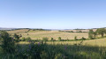
Pleasant circular loop along the Touch. On the left bank, the path is well-maintained and shared with cyclists. On the right bank, the walk is more unspoilt, with the path winding through meadows, woods and clearings. You may spot roe deer, foxes, coypu, common cranes, ducks and other birds, as well as rare and protected plant species. A lovely immersion in nature, just a stone’s throw from the town.

Details

464534
Creation:
Last update:
Last review:
  • Walking
    Activity: Walking
  • ↔
    Distance: 1.82 mi
  • ◔
    Average duration: 0h 50 
  • ▲
    Difficulty: Easy

  • ⚐
    Back to start: Yes
  • ↗
    Ascent: + 10 ft
  • ↘
    Descent: - 10 ft

  • ▲
    Highest point: 515 ft
  • ▼
    Lowest point: 499 ft

Description of the walk

You can park your car in the car park on the other side of the bridge, on Avenue du Général Leclerc. To get there, enter the neighbourhood by taking the first left after the bridge if coming from the south, or the first right before the bridge if coming from the north.

(S/E) Head towards the far end of the car park, then take the small wooden footbridge and join theGR®86(marked in red and white) to the left, under the bridge.

(1) Continue straight on along theGR®, following the left bank of the Touch to the next bridge: you can either follow the path at the foot of the hill or the small, winding track along the crest of the embankment.

(2) Turn right to cross the footbridge and reach a junction. Leave theGR® on your left and, on your right, follow the Touch along the pavement or across the grass.

(3) At the end of the small meadow bordering the river, cross a ditch (passable all year round, except in the event of heavy rainfall).
Alternatively, you can go round the ditch by continuing along the trees until you reach the first house. Just before this, there is a small path that winds its way through the woods. This leads you back to the Touch path a few dozen metres further on, on the left.
At the end of the path, walk up the embankment towards the bridge and cross it on the pavement.

(1) Then return to the starting car park, which is on the left (S/E).

Waypoints

  1. S/E : mi 0 - alt. 509 ft - Car park
  2. 1 : mi 0.08 - alt. 509 ft - Road bridge
  3. 2 : mi 0.89 - alt. 502 ft - Pedestrian footbridge
  4. 3 : mi 1.2 - alt. 505 ft - Ditch or detour
  5. S/E : mi 1.82 - alt. 509 ft - Car park

Notes

Alternatives:

You can park at the other end of the walkway by the quay (youth centre) or at the Tournefeuille tennis club, not far from the (2), or join the walk from the town centre.

You can also extend the walk along either bank, as far as the next bridge on Rue du Touch. To do this, on the left bank, you can cut across behind the tennis courts (or cross the small branch of the Touch to walk alongside the sports grounds, using two footbridges), past the Utopia cinema, the media library and Square Bernard Audigé (enjoying its orchard in season as you go), and on the right bank you’ll pass between the Touch and the fishermen’s lake.

And you can, of course, incorporate this circular route into the lovely walk along the banks of the Touch, which stretches from Lac de Plaisance to Saint-Martin du Touch.

Worth a visit

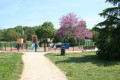
There is a children’s playground on the route in a meadow on the right bank, as well as another one at the far end (2) just before the tennis courts.
In season, you can pick many different varieties of wild plums and other berries all along the walk.

Always be cautious and plan ahead when you're outdoors. Visorando and the author of this route cannot be held responsible for any accidents occurring on this route.

The GR® and PR® markings are the intellectual property of the Fédération Française de Randonnée Pédestre.

Reviews and comments

3.9 / 5
Based on 5 reviews

Reliability of the description
4.2 / 5
Ease of following the route
4.2 / 5
Route interest
3.4 / 5
Sometimes
Sometimes
• Edited:

Overall rating : 4.3 / 5

Date of your route : Jul 19, 2026
Reliability of the description : ★★★★★ Very good
Ease of following the route : ★★★★★ Very good
Route interest : ★★★☆☆ Average
Very busy route : No

The walk isn’t anything out of the ordinary, but it does offer the chance to explore a preserved natural area near Toulouse. It’s a short walk, which we did just to get out of the house during a heatwave, around 5–6 pm. It’s mostly shaded (less so in the first third), and the ground is very dry throughout. We were practically on our own.

Machine-translated

MichelPaul
MichelPaul

Overall rating : 3.7 / 5

Date of your route : Jun 08, 2026
Reliability of the description : ★★★★☆ Good
Ease of following the route : ★★★★☆ Good
Route interest : ★★★☆☆ Average
Very busy route : Yes

The track quickly becomes muddy as soon as it starts to drizzle.

Machine-translated

Peteuge
Peteuge

Overall rating : 4.7 / 5

Date of your route : Feb 20, 2023
Reliability of the description : ★★★★★ Very good
Ease of following the route : ★★★★★ Very good
Route interest : ★★★★☆ Good
Very busy route : Yes

A really lovely walk, with absolutely brilliant weather. But it was a Sunday and there were loads of people on the way there. The walk back, on the other hand, was very quiet.

Machine-translated

grandin
grandin ★

Thank you, fadudu, for your feedback and these clarifications. Could you include them in the description, at least under ‘Practical Information’?

Thank you

Machine-translated

fadudu
fadudu

It is true that the return path, which follows the right bank, is currently difficult to find. After crossing the footbridge and walking alongside a small meadow below a road, you come to a ditch that you need to cross. However, the entrance to it has been obscured for several months by a large fallen tree trunk. What’s more, you then cross a succession of meadows and small woods, and as the grass in the meadows has recently been mown, it is difficult to make out the old path that had formed there. However, you can make it out by staying fairly close to the Touch, following the vegetation that lines it, except for the first stretch of meadow, which you cross in a straight line to the passage at the back of the water treatment plant.

Machine-translated

grandin
grandin ★

Perhaps the author could provide some further details about this path (3), if I have understood correctly. Is it actually a path, or just a makeshift route across the fields? On the satellite image, you can clearly see a track beneath the route...

Machine-translated

Brindacier
Brindacier

Overall rating : 2.7 / 5

Date of your route : Jul 09, 2018
Reliability of the description : ★★☆☆☆ Disappointing
Ease of following the route : ★★☆☆☆ Disappointing
Route interest : ★★★★☆ Good

On the way there, taking the left-hand path, there are no problems until you reach a small landslide on the banks of the Touch; there are barriers and the path is cordoned off with tape, but you can easily get underneath them without much danger, as you’d really have to try very hard to fall into the water. So you reach the bridge, near the tennis court. And that’s when things get a bit unclear, as there’s no return path along the riverbank as described – at any rate, we never found one. After the bridge, there’s no way to walk along the Touch. Has the area been redeveloped? Inaccurate description? Is it much further on? We walked to the end of the strip of land, opposite the last street in the nearby housing estate, and ended up in fields but not along the Touch… We retraced our steps for the return journey and, looking across, couldn’t see any path on the right-hand side of the Touch. It would be good to be much more precise about the start of this right-bank path.

Machine-translated

Roroboubou
Roroboubou

Overall rating : 4.3 / 5

Date of your route : Feb 23, 2017
Reliability of the description : ★★★★★ Very good
Ease of following the route : ★★★★★ Very good
Route interest : ★★★☆☆ Average

A very short walk, so I combined it with ‘Les Hauts de Tournefeuille’, the starting point for which is 2 km away. These 2 km are easily covered on pavements or cycle paths. So around 11 km in total, on flat ground with no difficulty whatsoever.
Downsides: short, dreary surroundings and, above all, very, very, very busy.
Positives: the length can be adjusted on both sides of the route, towards Plaisance-du-Touch or towards Lac des Pêcheurs and the Coulée Verte. But the real highlight of this walk is being able to do it on your own – on the one hand, there’s no risk, and on the other, there are plenty of people along the route.

Machine-translated

Other walks in the area

For more walks, use our search engine .

The GPS track and description are the property of this route's author. Please do not copy them without permission.