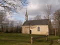
Walk in the Bois du Moustoir in Saint-Evazec

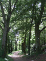
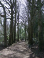
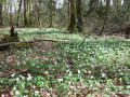
The Moustoir Wood is one of the largest woods in the Pays Fouesnantais. Comprising avenues of beech and oak trees and a wetland area, it offers a peaceful walk. The wood has been developed to accommodate an orienteering course.

Details

32629868
Creation:
Last update:
Last review:
  • Walking
    Activity: Walking
  • ↔
    Distance: 1.63 mi
  • ◔
    Average duration: 0h 50 
  • ▲
    Difficulty: Easy

  • ⚐
    Back to start: Yes
  • ↗
    Ascent: + 75 ft
  • ↘
    Descent: - 72 ft

  • ▲
    Highest point: 230 ft
  • ▼
    Lowest point: 121 ft

Photos

Description of the walk

Park in the car park at the entrance to the woodland.
Sign with a map of the paths.

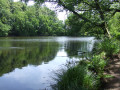
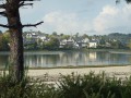
(S/E) Go through the gate and continue along the wide path at the edge of the woodland until you come out facing the lake. Walk alongside it for its entire length.

(1) Turn left onto the spillway and walk partly around it until you reach a developed area. Retrace your steps.

(1) Turn left onto a lovely avenue and follow it until you reach an inconspicuous path on the left just before a crossroads. Ignore all the paths branching off to the right.

(2) Turn left onto this inconspicuous path which leads into the woods and always keep to the path that goes to the left (not all paths are shown on the maps). Follow this path as it winds through the woods, forming a circular loop as it approaches the edge of the woodland.
Continue along a lovely beech-lined avenue, staying close to the edge of the woodland at all times. You’ll come to a sign indicating an authorised path leading to the village of Saint-Evarzec.

(3) After the sign, turn right heading due east and follow this path, ignoring all side tracks. You’ll emerge facing the path that descends to the far end of the lake.

(4) Do not go down, but turn left onto a small path that winds its way uphill amongst the moss-covered trees and leads to a T-junction.
Turn left onto this wider path and follow it to the edge of the woodland.

(5) Turn right and, after about a hundred metres, turn right again to re-enter the woods and continue straight on until you reach a Fork in the road. Turn left onto the wide path that descends and leads to the car park on the left (S/E).

Waypoints

  1. S/E : mi 0 - alt. 184 ft - Car park at Kroaz an Itron (D783)
  2. 1 : mi 0.18 - alt. 167 ft - End of the pond
  3. 2 : mi 0.67 - alt. 167 ft - Junction
  4. 3 : mi 1.13 - alt. 200 ft - Junction after the sign
  5. 4 : mi 1.31 - alt. 171 ft - Junction opposite the pond
  6. 5 : mi 1.47 - alt. 226 ft - Edge of the woodland
  7. S/E : mi 1.63 - alt. 184 ft - Car park at a place called Kroaz an Itron (D783)

Notes

The route is unmarked.
A photo of the map of the woodland at the car park might be useful.

Worth a visit

A lovely deciduous woodland.
Beautiful beech trees near the pond.

Reviews and comments

4.5 / 5
Based on 2 reviews

Reliability of the description
5 / 5
Ease of following the route
4 / 5
Route interest
4.5 / 5
pierrelo
pierrelo

Overall rating : 4.7 / 5

Date of your route : Jun 02, 2025
Reliability of the description : ★★★★★ Very good
Ease of following the route : ★★★★★ Very good
Route interest : ★★★★☆ Good
Very busy route : No

An easy walk

Machine-translated

jguich
jguich

Overall rating : 4.3 / 5

Date of your route : Jun 02, 2023
Reliability of the description : ★★★★★ Very good
Ease of following the route : ★★★☆☆ Average
Route interest : ★★★★★ Very good
Very busy route : No

A pleasant walk through the woodland. Sunny weather

Machine-translated

Other walks in the area

For more walks, use our search engine .

The GPS track and description are the property of this route's author. Please do not copy them without permission.