Condruz walk on the Évelette side

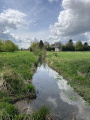
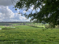
A walk, presenting no particular difficulty, leading from one Condroz ridge to another in the commune of Évelette, and offering some fine views, both of the countryside and of the large surrounding farms. It passes through the villages of Tahier and Libois before reaching Évelette.

Details

73205321
Creation:
Last update:
Last review:
  • Walking
    Activity: Walking
  • ↔
    Distance: 7.52 mi
  • ◔
    Average duration: 3h 45 
  • ▲
    Difficulty: Moderate

  • ⚐
    Back to start: Yes
  • ↗
    Ascent: + 367 ft
  • ↘
    Descent: - 364 ft

  • ▲
    Highest point: 955 ft
  • ▼
    Lowest point: 702 ft

Photos

Description of the walk

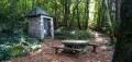
Car park at the end of Rue des Comognes in Évelette, at the picnic site.

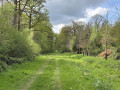
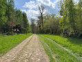
(S/E) Take the stony path that continues from Rue des Comognes and runs alongside the woodland. When you reach the tarmac road, cross it and carry on straight ahead along the forest path, known as the Sentier d’art Flumel, following it for a good kilometre.

(1) At the end of the woodland, at a place called Chêne à l’Image (signposted), take the path on the right, which slopes gently downwards and passes under a power line. At the end of the path, at the tarmac road, turn right downhill, cross the junction and continue straight on for about a hundred metres.

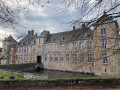
(2) Turn left onto the track (Chemin de Saint-Fontaine) running between the little church and the castle farm. It leads into a woodland, climbing gently. At the top of the track, turn right into the wide, grassy clearing and come out onto the tarmac road. Cross it straight ahead and continue along the path running alongside the woodland and a field.

(3) At the end of the field, at a place called Clavia Grimont (signposted), continue straight on along the forest track. This track curves sharply to the left (90°) and, 500 metres further on, joins another forest track. Take this track to the left and follow it to the end. 

(4) Head down to the right along the tarmac road (Rue le Long du Château) and walk past the small church.

(5) Shortly afterwards, turn right onto Rue de Libois. Follow it, keeping to the left, until you reach Rue de la Ferme. Turn onto this street and follow it to the end, where you’ll come back onto Rue de Libois; turn right here and continue for 70 metres.

(6) Turn left onto Chemin du Dessous. After the last houses, the road continues as a farm track and heads straight on towards the village of Évelette. In Évelette (school buildings), turn right onto Rue du Baty. At the junction, head straight up Rue du Tige. This road curves to the left and joins a main road. Turn right onto it and continue uphill for 200 metres.

(7) Turn right onto Rue des Comognes and follow it to the end to reach the picnic area (S/E).

Waypoints

  1. S/E : mi 0 - alt. 906 ft - End of Rue des Comognes (picnic spot)
  2. 1 : mi 1.28 - alt. 846 ft - Au Chêne à l’Image
  3. 2 : mi 2.11 - alt. 702 ft - Chemin de St-Fontaine (Tahier farm and château)
  4. 3 : mi 3.82 - alt. 909 ft - Clavia Grimont hamlet
  5. 4 : mi 4.56 - alt. 915 ft - Rue Le Long du Château (head down to the right)
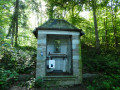
  6. 5 : mi 4.93 - alt. 751 ft - St Hubert’s Chapel, Libois
  7. 6 : mi 5.36 - alt. 768 ft - Chemin du Dessous, Libois
  8. 7 : mi 6.69 - alt. 909 ft - Rue des Comognes (on the right)
  9. S/E : mi 7.52 - alt. 906 ft - End of Rue des Comognes (picnic spot)

Notes

Covered picnic area (S/E) at the end of Rue des Comognes in Evelette

Picnic spot (uncovered) in Libois, Rue Le Long du Château, opposite the chapel (5).

Alternative starting point: Libois, opposite No. 157 Rue de Libois or at the entrance to Rue Le Long du Château.

Reviews and comments

5 / 5
Based on 2 reviews

Reliability of the description
5 / 5
Ease of following the route
5 / 5
Route interest
5 / 5
Marraine caucau
Marraine caucau

Overall rating : 5 / 5

Date of your route : Sep 07, 2026
Reliability of the description : ★★★★★ Very good
Ease of following the route : ★★★★★ Very good
Route interest : ★★★★★ Very good
Very busy route : No

A very pleasant walk in an area I know very well. Well done to the person who posted this walk for choosing such a wooded, countryside route. It’s always a joy to go for a walk without encountering anyone other than animals (red kites, buzzards, common toads, etc.)

Machine-translated

jamy quintens
jamy quintens

Overall rating : 5 / 5

Date of your route : May 12, 2025
Reliability of the description : Not used / Not applicable
Ease of following the route : ★★★★★ Very good
Route interest : ★★★★★ Very good
Very busy route : No

A lovely walk, practically surrounded by nature throughout the entire route.
Thank you for suggesting this, and well done on all the explanations

Machine-translated

Other walks in the area

For more walks, use our search engine .

The GPS track and description are the property of this route's author. Please do not copy them without permission.