


From Haillot-Verlée to Bouillon


A lovely walk through the woods and countryside of the Condroz, passing through pretty villages and the Vivaqua water catchment area and the Val de Tibiémont. Walkers can also follow the Hoyoux and the Ravel L126 cycle path, which runs from Ciney to Huy.
Details
Creation:
Last update:
Last review:
–
–
-
 Activity: Walking
 -
 Distance: 14.89 mi
 -
 Average duration: 7h 55
 -
 Difficulty: Difficult
 -
-
 Back to start: No
 -
 Ascent: + 991 ft
 -
 Descent: - 1,027 ft
 -
-
 Highest point: 951 ft
 -
 Lowest point: 620 ft
 Country:

 City:
City:


Waypoints
- S : mi 0 - alt. 886 ft
- E : mi 14.89 - alt. 843 ft
Other walks in the area
Circular around Goesnes starting from Jallet
 Visorando Member
 10.98 mi
+781 ft
-778 ft
5h 45
10.98 mi
+781 ft
-778 ft
5h 45
 Moderate
 Departure from Ohey (Province de Namur)
This circular starting from Jallet first passes by the work of art entitled 'Renversement' (Overturning), which has been overturned and lying on the side of the path for quite some time, a simple reminder that all human action has certain limits.Then, turning towards Goesnes and taking the Tige du Sart aux Roches, the route crosses the countryside towards Jamagne in the direction of the Triffoy Nature Reserve before climbing and then descending towards Vyle, its church and its castle, which has been converted into a residence.After Vyle Castle, the walk takes a long detour along the memory trail, that of the Secret Army and the Bagatelle parachute drop zone, between Pailhe and Goesnes, during the Second World War.On the way back, the route passes in front of the Château-Ferme de Tahier before returning to the Chêne à l'Image, the forest and its Trivouac and finally the magnificent Château d'Hodoumont.
Condruz walk on the Évelette side
 7.52 mi
+367 ft
-364 ft
3h 45
Moderate
Departure from Ohey (Province de Namur)
7.52 mi
+367 ft
-364 ft
3h 45
Moderate
Departure from Ohey (Province de Namur)
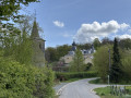
A walk, presenting no particular difficulty, leading from one Condroz ridge to another in the commune of Évelette, and offering some fine views, both of the countryside and of the large surrounding farms. It passes through the villages of Tahier and Libois before reaching Évelette.
From Bois d'Ohey towards Strud and Haltinne
 7.81 mi
+623 ft
-627 ft
4h 10
Moderate
Departure from Ohey (Province de Namur)
7.81 mi
+623 ft
-627 ft
4h 10
Moderate
Departure from Ohey (Province de Namur)
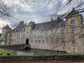
Starting from Bois d'Ohey, the route leads to the Struvaux stream and its many "little bridges", then through the woods to the hamlet of Strud and back via Haltinne, on a more open route. The trails are embellished with a few works of art; moreover, (re)discovering Haltinne Castle is always a pleasure!
In the vicinity of Comognes-le-Libois, Saint-Fontaine and Ossogne
6.07 mi
+479 ft
-479 ft
3h 10
 Easy
Departure from Ohey (Province de Namur)
Easy
Departure from Ohey (Province de Namur)
A lovely, easy 10 km walk, with the first part through the woods to the pretty village of Saint-Fontaine with its ford, then back towards Libois via Ossogne.
Solières and its stream, starting from Bohisseaux
 7.38 mi
+860 ft
-873 ft
4h 10
Moderate
Departure from Andenne (Province de Namur)
7.38 mi
+860 ft
-873 ft
4h 10
Moderate
Departure from Andenne (Province de Namur)
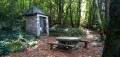
A Condroz walk through the valley of the Ruisseau de Solières, starting from the hamlet of Bohisseaux, leading through woods, meadows and across fields towards the village of the same name, with the return route taking you through the valley of the Ruisseau de Chessin, further south.
Streams, forests and fields in the Solières area
8.15 mi
+1,040 ft
-1,050 ft
4h 40
Moderate
Departure from Province de Liège
This varied and undulating route allows you to explore the beautiful region of Solières and Ben-Ahin with its vast woodlands and picturesque streams (the Solières and Ben streams).
From Solières to La Sarte in Ben
 9.47 mi
+807 ft
-817 ft
5h 05
Moderate
Departure from Province de Liège
9.47 mi
+807 ft
-817 ft
5h 05
Moderate
Departure from Province de Liège
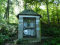
Whilst the local authorities offer a few signposted walks, there are clearly not many walkers in the area… and yet the region is well worth the effort!Lovely rolling countryside alternates with woodland sections (mainly deciduous) of all kinds: stony paths, wide tracks and winding trails, sometimes as muddy as you could wish for.
Circular Route of Royal Arches
 Tourist office6.68 mi
+810 ft
-810 ft
3h 45
Moderate
Departure from Andenne (Province de Namur)
Tourist office6.68 mi
+810 ft
-810 ft
3h 45
Moderate
Departure from Andenne (Province de Namur)
Marked walking route no. 3
It is marked with a green rectangle.
This 10 km hike starts right next to the picturesque Moulin de Kevret and takes you on a journey of discovery through the countryside and woods around the village of Coutisse.
For more walks, use our search engine .
The GPS track and description are the property of this route's author. Please do not copy them without permission.

