From Solières to La Sarte in Ben

Whilst the local authorities offer a few signposted walks, there are clearly not many walkers in the area… and yet the region is well worth the effort!
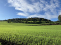
Lovely rolling countryside alternates with woodland sections (mainly deciduous) of all kinds: stony paths, wide tracks and winding trails, sometimes as muddy as you could wish for.

Details

53304496
Creation:
Last update:
Last review:
  • Walking
    Activity: Walking
  • ↔
    Distance: 9.47 mi
  • ◔
    Average duration: 5h 05 
  • ▲
    Difficulty: Moderate

  • ⚐
    Back to start: Yes
  • ↗
    Ascent: + 807 ft
  • ↘
    Descent: - 817 ft

  • ▲
    Highest point: 869 ft
  • ▼
    Lowest point: 397 ft

Photos

Description of the walk

A few details, just in case:

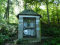
(1) The waters of the Saint-Eutrope Fountain (at the foot of the chapel of the same name) are, it seems, beneficial for the ears (ear infections or other ailments…).
Further on, if crossing the Solières stream proves difficult, turn left across the meadow towards the old Moulin de Solières (nightclub).

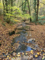
(5) Ford and path beyond which can sometimes be tricky (water and mud).

(6) For a shortcut: turn right.

(8) End of the shortcut: take the cycle path that descends opposite towards the bottom of the valley.

.

Waypoints

  1. S/E : mi 0 - alt. 791 ft - Solières Cemetery
  2. 1 : mi 0.49 - alt. 794 ft - Saint-Eutrope Chapel and Fountain
  3. 2 : mi 0.56 - alt. 784 ft - Solières Abbey
  4. 3 : mi 2.37 - alt. 778 ft - Power line
  5. 4 : mi 3.11 - alt. 741 ft - Bohisseaux
  6. 5 : mi 3.78 - alt. 515 ft - Ford across the Ruisseau de Bousalle
  7. 6 : mi 5.97 - alt. 499 ft - Shortcut
  8. 7 : mi 7.25 - alt. 581 ft - The Sarte at Ben
  9. 8 : mi 8.7 - alt. 761 ft - End of the shortcut
  10. 9 : mi 8.89 - alt. 709 ft - Solières (cours d'eau) - Belgique - Affluent de la Meuse
  11. S/E : mi 9.47 - alt. 791 ft - Solières Cemetery

Notes

(2) Solières Abbey, Château Vert (visitor centre) and the Royal Union Hutoise are private properties through which public paths or tracks once ran; these appear to have been closed off by signs erected here and there. As the legal situation is unclear, it is safer to turn left and then take the Chemin de Perwez rather than risk a confrontation...

Other walks in the area

For more walks, use our search engine .

The GPS track and description are the property of this route's author. Please do not copy them without permission.