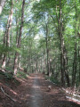
Solières and its stream, starting from Bohisseaux

A Condroz walk through the valley of the Ruisseau de Solières, starting from the hamlet of Bohisseaux, leading through woods, meadows and across fields towards the village of the same name, with the return route taking you through the valley of the Ruisseau de Chessin, further south. 

Details

70730486
Creation:
Last update:
Last review:
  • Walking
    Activity: Walking
  • ↔
    Distance: 7.38 mi
  • ◔
    Average duration: 4h 10 
  • ▲
    Difficulty: Moderate

  • ⚐
    Back to start: Yes
  • ↗
    Ascent: + 860 ft
  • ↘
    Descent: - 873 ft

  • ▲
    Highest point: 863 ft
  • ▼
    Lowest point: 492 ft

Photos

Description of the walk

Car park: Notre-Dame du Sacré-Coeur Church, Rue de l’Étang des Arches, 171, Bohisseaux, 5300 Andenne.

(S/E) From the church, follow Rue de l’Étang des Arches all the way to the end and begin the descent towards the bottom of the valley. At the bottom, continue straight ahead along the forest track for about 150 m.

(1) Just before the top of the track, turn right onto the straight path. This soon leaves the woods and runs alongside fields and meadows.

(2) At the end of the path, which has become a farm track, cross the road and take the tarmac road opposite. This continues as a farm track past a house and winds its way through fields and meadows to join a road just under a kilometre further on.

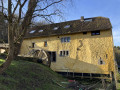
(3) Turn left towards the large farm buildings (Chemin de Morogne). Walk past the farm, ignore the road on the right and continue past the houses (the street is now called Chemin de Perwez). Shortly after number 5a, turn right onto Rue du Vieux Moulin and follow it for about 200 metres.

(4) Before the house (signposted ‘Chapelle’), head down to the left onto the path lined with coppice, which leads to the stream. Cross the stream and continue straight on to the Chapelle Saint-Eutrope.

(5) At the chapel, turn left onto the path running above the stream. When you reach the tarmac road, head right towards Solières Church. After the church, at the end of the street, turn left into Rue du Crucifix, then right into Rue de Wawehaye, and continue to No. 9.

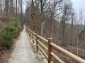
(6) Take the path on the left. This path descends to the Ruisseau de Solières, crosses it (via a wooden footbridge) and then climbs up the other side (ignore the path branching off to the right after the stream). The path is tarmac-surfaced and protected by a wooden railing. At the top, at the junction, carry on straight ahead. The path passes through a wood of conifers and then deciduous trees before leading downhill onto a tarmac road.

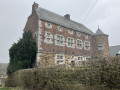
(7) First turn right then left to continue the descent along the grassy path. This leads out onto a bend in the road. Continue straight down this road for 200 metres. Shortly after the house, turn left onto the forest track, which soon crosses a small stream, then passes in front of a stone house before taking a right-hand bend.

(8) About fifty metres after the bend, turn left onto the path which climbs slightly alongside a woodland and a meadow. After 300 m, this path joins a street (Rue Thiénogrives); follow it to the end and then turn right onto the road. Follow this road for 400 m.

(9) Just as the road begins to curve to the right (you’ll see plastic tunnel greenhouses), turn left onto the farm track heading towards the woodland. Enter the woodland and, after passing the two houses, at the Fork in the road, keep to the forest track on the left. After 250 m, the track becomes less defined and begins to wind its way through a birch copse, then turns into a footpath and starts to descend, emerging opposite a meadow.

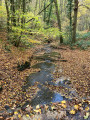
(10) Walk along the edge of the meadow. At the far end of the meadow, the path enters the woods again, then crosses a coppice and two streams (use the logs) before coming out onto a road, Rue Fond de Boussale.

(11) Follow it to the left. At the next junction, turn right onto Rue Eugène Malherbe and follow it to the end. At the end (town boundary sign), take the road on the left and follow it for 150 m, then turn left towards the church and the car park (S/E).


Waypoints

  1. S/E : mi 0 - alt. 758 ft - Bohisseaux Church
  2. 1 : mi 0.5 - alt. 656 ft - Junction
  3. 2 : mi 0.87 - alt. 774 ft - “Aux Arches” crossroads
  4. 3 : mi 1.46 - alt. 846 ft - Morogne Path
  5. 4 : mi 2.67 - alt. 784 ft - Rue du Vieux Moulin - Solières (cours d'eau) - Belgique - Affluent de la Meuse
  6. 5 : mi 2.75 - alt. 794 ft - Saint-Eutrope Chapel - Chapelle St-Eutrope
  7. 6 : mi 3.56 - alt. 741 ft - No. 9 Rue Wawehaye
  8. 7 : mi 4.11 - alt. 679 ft - Henimont Path
  9. 8 : mi 4.72 - alt. 492 ft - Path on the left 50 m after the bend
  10. 9 : mi 5.49 - alt. 646 ft - Plastic tunnel greenhouses
  11. 10 : mi 6.01 - alt. 659 ft - Meadow
  12. 11 : mi 6.61 - alt. 509 ft - Road junction
  13. S/E : mi 7.38 - alt. 758 ft - Bohisseaux Church

Notes

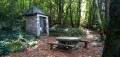
Stone picnic table at Saint-Eutrope Chapel (5

Fond de Boussale: the section through the scrub before point (11) may be muddy: wear suitable footwear!

NB: Alternative start point to avoid a hill at the finish: Solières Church, Rue Chefaïd.

Reviews and comments

5 / 5
Based on 2 reviews

Reliability of the description
5 / 5
Ease of following the route
5 / 5
Route interest
5 / 5
jacques.nys
jacques.nys

Overall rating : 5 / 5

Date of your route : Apr 29, 2025
Reliability of the description : ★★★★★ Very good
Ease of following the route : ★★★★★ Very good
Route interest : ★★★★★ Very good
Very busy route : No

Although the local authorities have marked out a few walking routes, there clearly aren’t many walkers here… and yet the region is well worth a visit!
We didn’t see a SINGLE SOUL on this route today, despite the glorious weather and the school holidays.
Lovely rolling countryside alternates with forest sections (mainly deciduous) of all kinds: stony paths, wide tracks and winding trails, some of which are quite muddy.
I can confirm that, following a spell of continuous rain, the path mentioned just before the waypoint (11) is VERY difficult due to the amount of mud.
NB: we had already covered part of this walking route during a slightly longer walk starting from Solières church… but in the opposite direction. Walking this route in the opposite direction offers a different perspective and a different experience. We weren’t disappointed at all.
Please note that the stream between points (4) and (5) can sometimes be impassable without getting your feet wet. In that case, it’s best to continue along the road to the Moulin de Solières, turn left into the large car park and head left across the meadow/pasture (which is also very wet at that point) to the Chapel of St Eutrope.

Machine-translated

jamy quintens
jamy quintens

Overall rating : 5 / 5

Date of your route : Mar 24, 2025
Reliability of the description : ★★★★★ Very good
Ease of following the route : ★★★★★ Very good
Route interest : ★★★★★ Very good
Very busy route : Yes

A lovely route through lush green countryside with beautiful views of the surrounding landscape.
This route combines the countryside, woodland and the charms of these scattered little hamlets.

Jamy

Machine-translated

Other walks in the area

For more walks, use our search engine .

The GPS track and description are the property of this route's author. Please do not copy them without permission.