Country:
 City:
City:



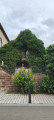
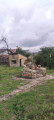
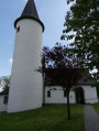
The route starts between the town hall and Saint-Rémi Church (car park).
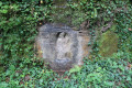
(S/E) Follow Rue de la Mairie (D237) northwards, keeping the town hall on your right. After about a hundred metres, take a path on the left. On the right you’ll find a small grotto.
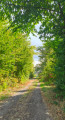
(1) A little further on, at the bench, turn left, then right, then left again. Stay on this tarmac footpath. On the slight descent, stay on the pavement, walking alongside the houses on your right. You’ll start to go uphill. Head towards the stadium and carry on straight ahead to join a tarmac forest track.
(2) At the edge of the woodland, on your right, you’ll find a table and a bench… Do not take the road on the right here, but carry on straight ahead along this track. At the next junction, turn right and then carry on straight ahead until you reach the edge of the woodland.
(3) Take the dirt track immediately on your right. You’ll start heading downhill, first on a concrete section and then on a tarmac section, crossing two roads in the housing estate.
(4) At thethird road, Rue des Lilas, turn right, then carry on straight ahead. Take the first footpath on your left, which has large concrete steps leading downwards. At the bottom of the concrete steps, follow the tarmac path straight ahead and, after turning left, you’ll come back to the original fork in the path.
(1) Carry on straight ahead until you reach the D919.
(5) Follow it to the right, staying on the pavement, and carry on until you reach the junction. Go round the roundabout, then carry on straight ahead, crossing the bridge over the Eichel. At the next junction, take the street on the right, staying on the pavement. Cross Rue de la Laiterie and carry on straight ahead, going uphill to the postbox. Turn left and you’ll arrive back at the starting point (S/E).
 Visorando Member

 Moderate