Route nature in Oermingen

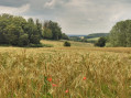
An easy walk, surrounded by nature. Ideal for visitors to our region and for anyone who simply wants to go for a stroll. Pets are welcome; you can let them run free on the grassy areas in the open fields.

Details

105842879
Creation:
Last update:
Last review:
  • Walking
    Activity: Walking
  • ↔
    Distance: 1.72 mi
  • ◔
    Average duration: 0h 50 
  • ▲
    Difficulty: Easy

  • ⚐
    Back to start: Yes
  • ↗
    Ascent: + 66 ft
  • ↘
    Descent: - 82 ft

  • ▲
    Highest point: 902 ft
  • ▼
    Lowest point: 843 ft
  • ⚐ Country: France
  • ⚐ City: Oermingen (67970)
  • ⚑
    Start/End: N 48.9985° / E 7.128381°
  • ❏
    IGN map(s): Ref. 3613ET
  • Hour-by-hour weather

Description of the walk

Park in the library car park.

(S/E) With your back to the car park, follow Rue de la Mairie to the left, continue straight ahead on the pavement towards the restaurant until you reach Rue de la Fontaine. Cross the road using the pedestrian crossing and continue straight ahead along Rue du Moulin until you reach the start of a path on the left.

(1) Take the path, then cross the footbridge over the Eichel. Carry on straight ahead and, at the bush, turn left until you reach the D919. Follow this road to the next junction. Cross Rue de la Gare and then the departmental road on your right, using the pedestrian crossing. Follow the railway line and go straight on along the road closed to vehicles (indicated by a ‘No Entry’ sign) until you reach the next junction.

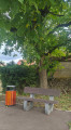
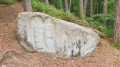
(2) Turn left towards the bridge, cross it and turn left. On your left, you’ll find a table and bench where you can rest, all by the stream. Carry straight on to the next junction. Turn right and take the middle path (to the left of the large rocks). Carry straight on, passing the houses on your right.

(3) Take the garden path on your left and carry on straight ahead until you reach the D919, which you should cross carefully at the pedestrian crossing, then continue straight ahead along the footpath.

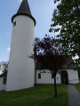
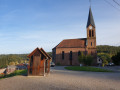
(4) Then take the path on the left by the bench and follow this path to Rue de la Mairie. Keep to the right on the pavement and continue straight on to the church. Cross the road using the pedestrian crossing in front of the church and turn right to the finish point in front of the library (S/E).

Waypoints

  1. S/E : mi 0 - alt. 902 ft - Library car park - Église Saint-Rémi (Oermingen)
  2. 1 : mi 0.14 - alt. 869 ft - Junction - Eichel (rivière)
  3. 2 : mi 0.96 - alt. 879 ft - Junction of footpath and cycle path - Gare d'Oermingen
  4. 3 : mi 1.24 - alt. 886 ft - Garden Trail
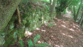
  5. 4 : mi 1.58 - alt. 886 ft - Bench by the cave
  6. S/E : mi 1.72 - alt. 889 ft - Library car park - Église Saint-Rémi (Oermingen)

Notes

Along this walk, you’ll find benches for your use, as well as a table and bench by the stream. This route can be combined with others in Oermingen and the surrounding area.

Worth a visit

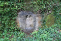
You may spot various animals, such as sheep, cows, swans and ducks. Admire our beautiful town hall, the grotto along the walking trail, and then the grotto to the right of the church. You’ll cross the Eichel Stream several times via the footbridge and the bridge. The route also takes you past some private gardens.

Other walks in the area

For more walks, use our search engine .

The GPS track and description are the property of this route's author. Please do not copy them without permission.