Route through the countryside of Berg and Mackwiller in Alsace-Bossue

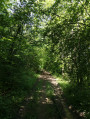
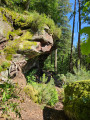
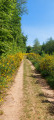
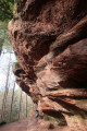
A lovely walk exploring the countryside of Alsace-Bossue, with a few stretches through oak forests where the birdsong accompanies us!

Details

13456666
Creation:
Last update:
Last review:
  • Walking
    Activity: Walking
  • ↔
    Distance: 10.55 mi
  • ◔
    Average duration: 5h 20 
  • ▲
    Difficulty: Moderate

  • ⚐
    Back to start: Yes
  • ↗
    Ascent: + 525 ft
  • ↘
    Descent: - 528 ft

  • ▲
    Highest point: 1,145 ft
  • ▼
    Lowest point: 771 ft
  • ⚐ Country: France
  • ⚐ City: Bas-Rhin (67)
  • ⚑
    Start/End: N 48.898246° / E 7.139655°
  • ❏
    IGN map(s): Ref. 3613ET, 3614ET
  • Hour-by-hour weather

Photos

Description of the walk

Car park at Kirchberg accessible via the D96 towards “Site de Kirchberg”.

(S/E) From the car park, follow the Blue Ring marked path towards the Kirchberg nature trail, heading towards the church. After about 200 m, turn left, then left again until you reach the D96.

(1) Follow it to the right, taking care. At the bend, leave the road and follow the path marked with the Yellow Triangle to the left until you reach a road.

(2) Follow it to the right, taking care for a few metres, then cross it to take the path on the left, still signposted with a Yellow Triangle, and arrive at the D92.

(3) Cross with care, then follow it to the left for a few metres, before turning right onto the path marked with a Red Ring towards Faessboesch and Fuerstenwald, and reach an inverted Y-junction as you emerge from the forest.

(4) Turn sharply right onto the path marked with the Blue Ring, first along the edge of the forest and then across open countryside heading south-south-east until you reach the D92.

(5) Follow it to the left, following the Red Ring signpost, to reach the entrance to Mackwiller via Rue Principale. You’ll come to a Fork in the road.

(6) Continue straight on, slightly uphill along Rue des Menuisiers, past the fire station, until you reach Rue de l’Église. At the end, after the right-hand bend, you’ll rejoin Rue Principale.

(7) Turn left onto Rue Principale and continue to the next junction.

(8) Turn right onto Route de Thal. Cross a stream and continue to a fork in the road, ignoring the path on the right.

(9) Turn left onto the Voie Romaine, signposted with a Blue Triangle.
Please note: this path has been altered further on by the Club Vosgien and no longer corresponds to the IGN base map. Carry on straight ahead, pass under a railway line and reach a bend.

(10) Continue to the right across the fields until you reach a T-junction. Turn right, ignoring a path on the left and another on the right, and head towards the entrance to the Froeschmuehle at a fork in the path.

(11) Turn left and follow the path (still marked with a Blue Triangle) until you reach the entrance to Berg at a bend in the road (Rue Principale).

(12) Follow it downhill to the right and, after the bridge, turn left into Rue du Presbytère until you reach the fountain on your left.

(13) Turn right until you reach the next junction. Turn slightly left, then immediately right (ignore Rue des Saules on the left), and continue to the last house.

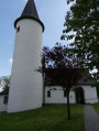
(14) Follow the path straight ahead (marked with a blue triangle, Yellow Ring and Red Triangle) to the Kirchberg Chapel.

(15) Carry on straight ahead to reach the car park at Kirchberg (S/E).

Waypoints

  1. S/E : mi 0 - alt. 1,145 ft - Kirchberg car park
  2. 1 : mi 0.52 - alt. 1,125 ft - Junction – D96 road
  3. 2 : mi 1.44 - alt. 1,047 ft - Crossroads
  4. 3 : mi 2.85 - alt. 1,102 ft - Crossing the D92
  5. 4 : mi 5.03 - alt. 912 ft - Junction
  6. 5 : mi 6.12 - alt. 876 ft - D92 junction – Red Ring
  7. 6 : mi 6.5 - alt. 833 ft - Mackwiller - Fork in the road
  8. 7 : mi 6.74 - alt. 804 ft - Main Street
  9. 8 : mi 6.83 - alt. 794 ft - Junction – Route de Thal
  10. 9 : mi 7.01 - alt. 778 ft - D96 road x Roman Road
  11. 10 : mi 7.33 - alt. 771 ft - Tunel – Right-hand bend
  12. 11 : mi 8.68 - alt. 791 ft - Froeschmuehle – Blue Triangle
  13. 12 : mi 9.52 - alt. 843 ft - Berg – Crossroads
  14. 13 : mi 9.68 - alt. 850 ft - Crossroads – Fountain
  15. 14 : mi 9.98 - alt. 902 ft - Last house – Impasse du Kirchberg
  16. 15 : mi 10.23 - alt. 1,109 ft - La Chapelle du Kirchberg
  17. S/E : mi 10.55 - alt. 1,145 ft - Kirchberg car park

Notes

There is a picnic spot just after (3).
You can also enjoy a drink or a light meal next to the Kirchberg Chapel (15) on days when the Association des Amis du Kirchberg is open.
The only challenge of this walk is its length.

Names and meanings of the Club Vosgien signposts.

Worth a visit

- Archaeological site in Mackwiller near the fire station.

Reviews and comments

4.1 / 5
Based on 3 reviews

Reliability of the description
4.3 / 5
Ease of following the route
4.3 / 5
Route interest
3.7 / 5
biache.pascal@orange .fr

Overall rating : 3.7 / 5

Date of your route : Sep 28, 2025
Reliability of the description : ★★★★☆ Good
Ease of following the route : ★★★★☆ Good
Route interest : ★★★☆☆ Average
Very busy route : No

Lots of small roads and forest and farm tracks. Not enough footpaths. A shame.
No real points of interest...

Machine-translated

mach
mach

Overall rating : 4.7 / 5

Date of your route : Jul 15, 2025
Reliability of the description : ★★★★★ Very good
Ease of following the route : ★★★★★ Very good
Route interest : ★★★★☆ Good
Very busy route : No

A lovely, easy walk. Great for families.

Machine-translated

Ryck
Ryck

Overall rating : 4 / 5

Date of your route : Apr 16, 2024
Reliability of the description : ★★★★☆ Good
Ease of following the route : ★★★★☆ Good
Route interest : ★★★★☆ Good
Very busy route : No

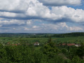
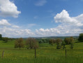
It was a really lovely walk, with beautiful countryside and lovely views of the ‘Humpbacked Alsace’ countryside.

Machine-translated

Other walks in the area

For more walks, use our search engine .

The GPS track and description are the property of this route's author. Please do not copy them without permission.