Country:
 City:


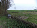
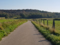
Start from the city-stade car park, Rue de la République.
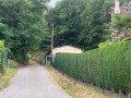
(S/E) Once parked, cross the RD13 and turn left onto Rue de la République. After about 130 m, turn right onto Rue Sainte-Périne. Walk up the street for about 150 m, then take the small path on your left. Stay on this path until you reach the first small path on your left, which leads downhill.
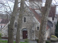
(1) Follow this small path downwards, walking alongside the Source Saint-Pierre for a short while until you reach the back of the church. Then take the path on your right that runs behind the school. Continue to the bottom of the Ru des Raseaux at Rue du Rhuy.
(2) Take the path on your right: a small barrier has been put up to block the way for motorised vehicles. Walk uphill alongside the stream, cross the footbridge and continue uphill. As you emerge from the woods, turn right after the gabions and wattle fences, follow the edge of the woods and then turn left twice. On the ridge, follow the wattle fences until you reach Rue des Ruelles in the hamlet of Dizocourt. Carry on straight ahead.
(3) Turn left onto Rue Cahène, then walk down Rue des Racques on the pavement as you’ll encounter vehicles. After the second speed bump, situated about 100 metres before the traffic lights, turn left into Impasse des Poussins. At the top of the cul-de-sac, turn left.
(4) Turn right towards the small copse and continue until you reach Rue de Rhuy: take care on the slight descent just before Rue de Rhuy, which you’ll turn right into. Cross the RD13 at the pedestrian crossing and turn left onto Ruelle des Alleux, which will take you onto the Voie Verte.
(5) Turn left and walk alongside the railway line. At the end of the path, leave the pedestrian tunnel on your right, turn left to reach the village hall and cross the car park. Walk round the village hall to reach Rue de la République, which you should follow to the right for about 200 m. Caution: stay on the pavement whilst walking along this section of road.
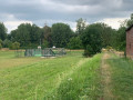
(6) Take the small path on your right opposite the church. Follow this path for about 400 m and look out for the multi-sports ground on your left. Then turn left and head back to the starting car park (S/E).

 Visorando Member


 Moderate