Armancourt Valley and Plain

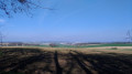
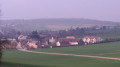
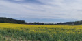
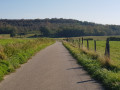
Armancourt is a small village nestled on the hillside of the Oise valley. This route will allow you to appreciate the charm of the towpath along the riverbank and, as you climb the hillside, to enjoy beautiful views of the valley to the south and the plain to the north.

Details

n°5270706
Creation:
Last update:
Last review:
  • Walking
    Activity: Walking
  • ↔
    Distance: 4.13 mi
  • ◔
    Average duration: 2h 05 
  • ▲
    Difficulty: Easy

  • ⚐
    Back to start: Yes
  • ↗
    Ascent: + 180 ft
  • ↘
    Descent: - 180 ft

  • ▲
    Highest point: 292 ft
  • ▼
    Lowest point: 102 ft
  • ⚐ Country: France
  • ⚐ City: Armancourt (60880)
  • ⚑
    Start/End: N 49.371837° / E 2.763885°
  • ❏
    IGN map(s): Ref. 2511OT
  • Hour-by-hour weather

Photos

Description of the walk

The walk starts at Place des Treilles (car park nearby).
Meet in front of the community hall.

(S/E) Walk past the school and cross the road, turn left and, after about 50 m, take the small path on the right. At the end of the path, turn right to cross the road using the pedestrian crossing and take the greenway to the left to reach the level crossing, passing behind the war memorial.
Cross the railway line and take the path on the right. Follow the railway line for about 50 m. The path turns left then right to go round the copse. After about 250 m, turn left and follow the path towards the River Oise.

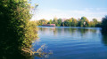
(1) When you reach the riverbank, turn left and take the towpath. Continue straight on, leaving the Chemin Vaillant on your left.

(2) At the Île du Grand Peuple, keep to the path on the right to follow the river for 500 m. Turn left onto the path that takes you back towards the railway line. Cross the railway line and, at the junction, turn left.

(3) Cross the D13 and take the small street on the right. At the end of the street, take the path on the right. When you reach a Y-junction, take the path on the right. Continue along the Chemin de la Grande Cavée until you reach Rue de la Plaine. Follow this street to the right.

(4) At the junction with the Grande Cavée, take the road on the left and follow it down for about 300 m. Turn onto the path on the left, go through the small copse and follow the path alongside the field.

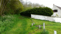
(5) At the entrance to Bois Godon, follow the small path on the left, pass by the old cemetery and walk up the slope to reach the car park of the new cemetery.
Walk down Ruelle du Moulin and turn right into Rue des Vignes Blanches.

(6) Walk past the church and head down Rue des Vignes Blanches. After about 100 metres, at the first bend, take the small path on the right until you reach Rue des Durboises.

(7) Walk down this street to Rue de la Basse Côte, cross at the pedestrian crossing and turn left onto the cycle path. Continue to Place des Treilles. Cross the road at the pedestrian crossing and take the path to the left of the sports ground to walk back up to the square to the information board for the walking trails in the ‘Quatre Coteaux’ municipalities (S/E).

Waypoints

  1. S/E : mi 0 - alt. 112 ft - Place des Treilles
  2. 1 : mi 1.01 - alt. 105 ft - Towpath - Oise (l')
  3. 2 : mi 1.54 - alt. 102 ft - The Île du Grand Peuple
  4. 3 : mi 2.2 - alt. 118 ft - La Maladrerie (D13)
  5. 4 : mi 2.86 - alt. 285 ft - La Grande Cavée (Y-junction)
  6. 5 : mi 3.33 - alt. 249 ft - Chemin du Bois Godon
  7. 6 : mi 3.53 - alt. 243 ft - Notre-Dame d’Armancourt Church
  8. 7 : mi 3.75 - alt. 125 ft - Rue des Durboises
  9. S/E : mi 4.13 - alt. 112 ft - Place des Treilles

Worth a visit

(2) The Île du Grand Peuple: its name comes from the poplars, which were once called ‘Peuples’. The island, offering natural shelter, was inhabited for a long time. Discoveries along the banks of the Oise show that human presence in our region dates back more than three thousand years.

The Armancourt helmet ==> https://armancourt.fr/fr/rb/470303/le-ca...]
Spears and swords ==> https://armancourt.fr/fr/rb/470407/lance...]
The Armancourt vase ==> https://armancourt.fr/fr/rb/470420/le-va...]

(3) The Leprosarium: During epidemics, towns would build leprosariums on the outskirts to isolate the sick. The one in Armancourt still stands (a house on the corner of Rue des Matinnoix and Rue des Clos Pasiens).

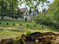
(6) The Church of Notre Dame d’Armancourt, built around 1400, overlooks the village at an altitude of 117 m. Near the church there used to be a spring reputed to have miraculous properties, as well as a windmill.
More information about the church ==> [https://...].

Reviews and comments

3.8 / 5
Based on 2 reviews

Reliability of the description
4 / 5
Ease of following the route
4 / 5
Route interest
3.5 / 5
ovil
ovil
• Edited:

Overall rating : 3.7 / 5

Date of your route : Aug 01, 2023
Reliability of the description : ★★★★☆ Good
Ease of following the route : ★★★★☆ Good
Route interest : ★★★☆☆ Average
Very busy route : No

I combined this walk with those entitled ‘Around Jaux and Les Hauts de Le Meux via the Bois Godon’ to create a route of around twenty kilometres.
Grey and windy weather, but just a few drops of rain in the morning.
Tall grass along the towpath.
There is a picnic table on the banks of the Oise near the Île du Grand Peuple.

Machine-translated

estaimbourg
estaimbourg

Overall rating : 4 / 5

Date of your route : Jun 04, 2023
Reliability of the description : ★★★★☆ Good
Ease of following the route : ★★★★☆ Good
Route interest : ★★★★☆ Good
Very busy route : No

A peaceful and beautiful village

Machine-translated

Other walks in the area

For more walks, use our search engine .

The GPS track and description are the property of this route's author. Please do not copy them without permission.