Tour du Meux via Rivecourt

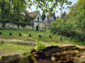
A walk that takes you over the hill overlooking Longueuil-Sainte-Marie, from where you can enjoy a magnificent view.

Details

n°16617472
Creation:
Last update:
Last review:
  • Walking
    Activity: Walking
  • ↔
    Distance: 4.52 mi
  • ◔
    Average duration: 2h 25 
  • ▲
    Difficulty: Easy

  • ⚐
    Back to start: Yes
  • ↗
    Ascent: + 436 ft
  • ↘
    Descent: - 427 ft

  • ▲
    Highest point: 420 ft
  • ▼
    Lowest point: 131 ft
  • ⚐ Country: France
  • ⚐ City: Le Meux (60880)
  • ⚑
    Start/End: N 49.366495° / E 2.743952°
  • ❏
    IGN map(s): Ref. 2411O, 2511OT
  • Hour-by-hour weather

Description of the walk

Park in the post office car park.

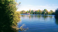
(S/E) From the car park, follow Rue de la République towards Jonquières, then turn left to head up the path towards Le Meux-en-Mont at the large weeping willow.

(1) Turn left onto Chemin du Butel towards the Mont farm and continue to the junction with the road linking Le Meux, Longueil and Sainte-Marie. Follow the road towards Longueil for about a hundred metres.

(2): Take the path on the left leading to the Bois de la Fontaine du Biat. In the woods, at the junction with another path, follow this one to the right for about a hundred metres, then turn left (the ‘no entry’ signs are for motorbikes) to reach the small wayside shrine dedicated to the Blessed Virgin, which overlooks the mountain.

(3) With your back to the wayside shrine, take the path that descends directly towards Rivecourt. Please note there are sections where the path has been eroded. Take care. At the bottom of the slope, follow the path on the right to reach Rivecourt via Rue des Fontaines.

(4) At the junction of Rue des Fontaines and Rue du Grand Ferré, turn left, then head back up towards the woods along the Cavée du Moulin, passing by the cemetery and the church.

(5) Be sure to take the path on the left, which takes you through the Bois de la Motte du Moulin.
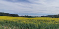
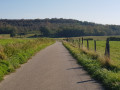
As you leave the woods, there is a magnificent view from the path on the hillside looking down towards the Oise valley.
Continue on to Rue de la République.

(6) At the end of the path, which leads to the medical centres, turn left onto Rue de la République, which will take you back to the starting point at the post office (S/E).


Waypoints

  1. S/E : mi 0 - alt. 167 ft - Post Office car park
  2. 1 : mi 0.57 - alt. 279 ft - Junction of the Chemins de Butel and the Chemins de la Ferme du Mont
  3. 2 : mi 1.24 - alt. 262 ft - Junction on the path
  4. 3 : mi 2.22 - alt. 413 ft - Oratoire de la Montagne
  5. 4 : mi 2.84 - alt. 131 ft - Junction of Rue des Fontaines and Rue du Grand Ferré
  6. 5 : mi 3.08 - alt. 217 ft - Junction of the Pressoir Leroy paths
  7. 6 : mi 4.09 - alt. 131 ft - medical centres, Rue de la République
  8. S/E : mi 4.52 - alt. 167 ft - Post Office car park

Reviews and comments

4 / 5
Based on 2 reviews

Reliability of the description
4.5 / 5
Ease of following the route
4 / 5
Route interest
3.5 / 5
erictual
erictual

Overall rating : 4.7 / 5

Date of your route : Sep 24, 2023
Reliability of the description : ★★★★★ Very good
Ease of following the route : ★★★★★ Very good
Route interest : ★★★★☆ Good
Very busy route : No

A lovely walk combining woodland and meadows, with two beautiful churches to discover. There are no real difficulties apart from a very steep descent just before Rivecourt, which should be tackled with caution, especially in wet weather.
All in all, a nature walk just the way we like them.

Machine-translated

ovil
ovil

Overall rating : 3.3 / 5

Date of your route : Aug 08, 2023
Reliability of the description : ★★★★☆ Good
Ease of following the route : ★★★☆☆ Average
Route interest : ★★★☆☆ Average
Very busy route : No

Take care at the start – the large weeping willow has lost most of its leaves. Will it still be there in a few months’ time?
I encountered difficulties at point 2 trying to enter the woods. At the first path, there were ‘no entry’ signs painted on four trees, plus a ‘private property – no trespassing’ sign on another. So I took the next path and ended up in Longueuil-Sainte-Marie, from where I reached Rivecourt via the cycle path and the D 13.
So I didn’t get to see the oratory.
A beautiful carved gate at the church in Rivecourt, which was closed, as is all too often the case.

Machine-translated

Other walks in the area

For more walks, use our search engine .

The GPS track and description are the property of this route's author. Please do not copy them without permission.