Country:
 City:


Meeting point at Place des Treilles (car park nearby).
Meet in front of the community hall.
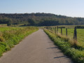
(S/E) Walk past the school and cross the road, turn left and, after about 50 metres, take the small path on your right. At the end of the path, turn left onto the pavement and walk to the Town Hall. Head north-west along the road starting in front of the Town Hall and leading up into the village of Armancourt. When the road bends to the left, take the path on the right. Climb a steep slope, then follow the path north-east, running alongside the fields, from where the Oise valley comes into view.
At the end of the path, turn right and head down the Chemin de la Grande Cavée until you reach the Fork in the road. Then turn left onto the Impasse des Larris Martin. Head downhill, come out onto the D13 and follow it to the left for about fifty metres.
(1) At the junction, turn right onto Rue des Clos Pasiens. Cross the railway line and continue straight on towards the river.
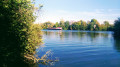
(2) Turn right and walk alongside the River Oise on your left. Pass a picnic area, then walk past the Île du Grand Peuple, which was inhabited during the Neolithic period.
(3) You’ll come to a tarmac path; follow it to the right. Cross the railway line again and take the greenway immediately on your left, passing behind the war memorial. Cross the road at the pedestrian crossing and walk straight up Rue des Écoles; turn left onto the square and walk alongside the school to return to the starting point (S/E).

 Visorando Member



 Moderate