Circular loop starting from Jonquières

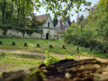
A walk offering a variety of landscapes in our beautiful countryside. A circular route combining fields, woods, hills, footpaths and greenery.

Details

21186318
Creation:
Last update:
Last review:
  • Walking
    Activity: Walking
  • ↔
    Distance: 9.37 mi
  • ◔
    Average duration: 5h 00 
  • ▲
    Difficulty: Moderate

  • ⚐
    Back to start: Yes
  • ↗
    Ascent: + 751 ft
  • ↘
    Descent: - 745 ft

  • ▲
    Highest point: 499 ft
  • ▼
    Lowest point: 190 ft

Photos

Description of the walk

Start at 13 Rue de Varanval (car park nearby).

(S/E) Opposite the school, turn right towards the junction of Rue de Varanval, Rue de l’Archerie, Rue du Château and Rue des Jonquilles. Take Rue de l’Archerie and continue to the town hall.
Take Rue du Mont Clergé, which runs alongside the town hall on the right. Continue to the end of Chemin du Mont Clergé until you reach the vegetable gardens.

(1) Turn left to climb up to the heights of Jonquières (magnificent view over the village).
At the corner by the cemetery, follow the path downhill to reach Rue du Clos Moise. Follow it to the right; 100 metres further on, turn right onto Chemin des Prés Roy and head downhill between the fields and the forest.

(2) At the edge of the woodland, turn left at the junction and continue straight ahead along the clearly marked path until you reach Rue des Fontaines.

(3) Once you reach Canly, turn left straight away onto this street and head uphill until you reach the tarmac path on your right.

(4) Take this road, then cross the D10 with care and immediately join the path signposted just after the transformer.

(5) Turn left onto this track, head into the forest, cross the whole of Mont Hart and arrive at a small pass.

(6) Follow the path on the right, skirting the forest, and take the second path on your left. Make your way through the fields until you reach the D98.

(7) Once you have crossed this departmental road with care due to the traffic, carry on straight ahead, staying on the marked path.
Before the small copse, veer to the right and then, 500 metres further on, turn left towards Caulmont (alternative route in the practical information section).

(8) Head straight ahead but do not enter the forest; go round the houses and join the woods via the Chemin de l’Orée du Bocquet. In the woods, the path is clearly marked.

(9) As you emerge from the woods, you’ll come to a tarmac road. Turn left and continue until you reach the village of Varanval. Walk 150 m through the village.

(10) Take the Chemin des Sources, which runs between two houses on your right. At the end of the path, leave the village on your left and turn right onto Rue du Champ du Mont.

(11) At the signposts, head into the woods on your left. Follow the marked route – which is a bit winding but easy to follow – as it climbs up to Mont d’Huette. Walk right through the woods until you come out the other side.

(12) Do not join the D98; instead, take Chemin du Lainemont on your left until you reach Le Carmel.

(13) At the road, turn right onto Rue de Varanval to return to your starting point (S/E).

Waypoints

  1. S/E : mi 0 - alt. 318 ft - 13 Rue de Varanval (car park nearby)
  2. 1 : mi 0.46 - alt. 381 ft - Turn left after the Chemin du Mont Clergé
  3. 2 : mi 1.24 - alt. 266 ft - Junction
  4. 3 : mi 2.04 - alt. 230 ft - Rue des Fontaines
  5. 4 : mi 2.45 - alt. 341 ft - Junction on a tarmac road
  6. 5 : mi 2.78 - alt. 308 ft - Path to the forest
  7. 6 : mi 3.68 - alt. 338 ft - Junction in the forest
  8. 7 : mi 4.9 - alt. 217 ft - D98
  9. 8 : mi 5.64 - alt. 190 ft - Caulmont
  10. 9 : mi 6.59 - alt. 331 ft - Turn left onto the road towards Varanval
  11. 10 : mi 7.07 - alt. 305 ft - Path between the houses
  12. 11 : mi 7.65 - alt. 322 ft - Entrance to the woods
  13. 12 : mi 8.7 - alt. 374 ft - Turn left onto Chemin du Lainemont
  14. 13 : mi 9.11 - alt. 325 ft - Turn right onto Rue de Varanval
  15. S/E : mi 9.37 - alt. 318 ft - 13 Rue de Varanval (car park nearby)

Notes

Suitable footwear is essential for walking through fields and woodland.

Reminder: please do not pick wildflowers anywhere along the route.

If you’re going for a walk with a picnic, please make sure you take your rubbish away with you.

Alternative route:
(8) At the junction with the cycle path, you may wish to head left towards Jonquières to cut the route short and return to your starting point via (13).

Reviews and comments

4.3 / 5
Based on 3 reviews

Reliability of the description
4.7 / 5
Ease of following the route
4 / 5
Route interest
4.3 / 5
Brno02
Brno02

Overall rating : 4.7 / 5

Date of your route : Oct 22, 2023
Reliability of the description : ★★★★★ Very good
Ease of following the route : ★★★★☆ Good
Route interest : ★★★★★ Very good
Very busy route : No

We were looking for a cycle route of about fifteen kilometres; the Jonquières loop is a really lovely one. Those little valleys bathed in autumn sunshine. Highly recommended!

Machine-translated

ovil
ovil

Overall rating : 3.3 / 5

Date of your route : Aug 08, 2023
Reliability of the description : ★★★★☆ Good
Ease of following the route : ★★★☆☆ Average
Route interest : ★★★☆☆ Average
Very busy route : No

Getting to Mont Hart is no easy task. Branches and even trees blocking the paths, along with several junctions not shown on the map, mean you have to navigate using a compass.
Similarly, in Varanval, I had to ask for directions twice from some very helpful locals, as there were no street signs.
A doe, startled by a tractor, crossed the path shortly after point 7.

Machine-translated

PhilEga
PhilEga

Overall rating : 5 / 5

Date of your route : Jan 16, 2023
Reliability of the description : ★★★★★ Very good
Ease of following the route : ★★★★★ Very good
Route interest : ★★★★★ Very good
Very busy route : No

Very good

Machine-translated

Other walks in the area

For more walks, use our search engine .

The GPS track and description are the property of this route's author. Please do not copy them without permission.