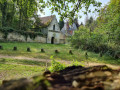
The upper reaches of Le Meux via Bois Godon and Caulmont

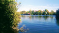
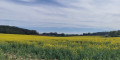
A short family walk, partly through shaded areas and fields, offering views of the beautiful rolling countryside towards the hamlet of Caulmont.

Details

n°17150212
Creation:
Last update:
Last review:
  • Walking
    Activity: Walking
  • ↔
    Distance: 3.31 mi
  • ◔
    Average duration: 1h 40 
  • ▲
    Difficulty: Easy

  • ⚐
    Back to start: Yes
  • ↗
    Ascent: + 144 ft
  • ↘
    Descent: - 118 ft

  • ▲
    Highest point: 279 ft
  • ▼
    Lowest point: 138 ft
  • ⚐ Country: France
  • ⚐ City: Le Meux (60880)
  • ⚑
    Start/End: N 49.366509° / E 2.743801°
  • ❏
    IGN map(s): Ref. 2511OT
  • Hour-by-hour weather

Description of the walk

Park in the Post Office car park.

(S/E) Turn onto Rue de la République, heading towards Jonquières, then immediately turn right onto Rue du Général Leclerc in front of the town hall.

(1) Turn right onto Rue Pierre Carluy and walk alongside the castle wall.

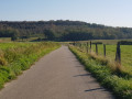
(2) Roughly where the wall ends, take the path on the left towards Bois Godon. This path forms an S-shape after entering the woods and then becomes straight. On leaving the woods, you’ll join a section ofthe GR® 124A, from where there’s a lovely view of the Caulmont hillsides. Continue straight on along theGR® until you reach Rue de Caulmont.

(3) Turn left, then right into Rue des Fontaines.

(4) At the top of the street, keep as far to the left as possible to follow the path along the hillside.

(5) Just after entering the Bois du Bocquet, turn left heading due south. From there, follow the path which crosses the cycle path corresponding tothe GR® 124A, then winds its way through the fields. Cross the RD98, taking care due to the traffic, and continue straight on up the gentle slope until you reach the junction with the Chemin du Butel on the left.

(6) Follow the Chemin du Butel downhill until it joins the Rue de la République. Continue straight on until you reach the post office car park on the right (S/E).

Waypoints

  1. S/E : mi 0 - alt. 167 ft - Post Office car park
  2. 1 : mi 0.27 - alt. 171 ft - Junction of Rue Général Leclerc and Rue Pierre Carluy
  3. 2 : mi 0.5 - alt. 138 ft - Start of the Bois Godon footpath
  4. 3 : mi 1.56 - alt. 233 ft - Rue de Caulmont
  5. 4 : mi 1.78 - alt. 253 ft - Junction with Rue des Fontaines
  6. 5 : mi 1.92 - alt. 266 ft - Bois du Bocquet, on the left
  7. 6 : mi 2.74 - alt. 276 ft - Junction with Chemin du Butel, on the left
  8. S/E : mi 3.31 - alt. 167 ft - Post Office car park

Always be cautious and plan ahead when you're outdoors. Visorando and the author of this route cannot be held responsible for any accidents occurring on this route.

The GR® and PR® markings are the intellectual property of the Fédération Française de Randonnée Pédestre.

Reviews and comments

3.7 / 5
Based on 2 reviews

Reliability of the description
4.5 / 5
Ease of following the route
3.5 / 5
Route interest
3 / 5
Reitserof
Reitserof
• Edited:

Overall rating : 3.7 / 5

Date of your route : Jul 14, 2024
Reliability of the description : ★★★★★ Very good
Ease of following the route : ★★★☆☆ Average
Route interest : ★★★☆☆ Average
Very busy route : No

The walk is easy, but the path is very poorly maintained. On the climb up to Godon Wood (after 2), the path was overgrown with stinging nettles and impassable. To get past this, we had to go across the meadow just above it, which runs alongside the path. It had just been mown. We were thus able to get back onto the path just before entering the wood.

Machine-translated

ovil
ovil

Overall rating : 3.7 / 5

Date of your route : Aug 01, 2023
Reliability of the description : ★★★★☆ Good
Ease of following the route : ★★★★☆ Good
Route interest : ★★★☆☆ Average
Very busy route : No

I’ve combined this walk with those entitled “Armancourt Valley and Plain and around Jaux” to create a route of around twenty kilometres.
So we set off on this route from La Plaine.
It was grey and windy, with a few drops of rain in the morning.
The climb up to the Bois Godon is lined with stinging nettles.

Machine-translated

Other walks in the area

For more walks, use our search engine .

The GPS track and description are the property of this route's author. Please do not copy them without permission.