


Refine your search for walks in Pouldergat
Pouldergat walks


 Circuit des Moulins de Pouldergat partie Nord-Ouest
 Visorando Member
 6.58 mi
 +341 ft
 -328 ft
 3h 20
3h 20
 Moderate
 Departure from Pouldergat (Finistère)
The Mills Route circles the town for about 27 km. This section runs through the countryside along sunken paths and shaded valleys, and along small roads in the second part. In the past, there were several mills on the many streams.
Banks of the Goyen and countryside south-east of Pouldergat
 7.27 mi
+381 ft
-400 ft
3h 40
Moderate
Departure from Pouldergat (Finistère)
7.27 mi
+381 ft
-400 ft
3h 40
Moderate
Departure from Pouldergat (Finistère)
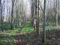
This hilly route covers part of the long route that goes around the commune of Pouldergat, taking its south-eastern section.
It follows a section of the River Goyen, which is still only a modest stream, and returns through the countryside.
Stang Vraz Circular (Grande Vallée)
 2.57 mi
+190 ft
-187 ft
1h 20
2.57 mi
+190 ft
-187 ft
1h 20
 Easy
Departure from Guiler-sur-Goyen (Finistère)
Easy
Departure from Guiler-sur-Goyen (Finistère)
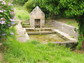
This route through the countryside and woods has been restored by the Haut Pays Bigouden Community of Communes.
It takes you into the very wild, wooded moorland on the left bank of the Goyen valley: peace and quiet are guaranteed on this little-used route.
Along the Goyen River
 5.87 mi
+331 ft
-341 ft
3h 00
Easy
Departure from Guiler-sur-Goyen (Finistère)
5.87 mi
+331 ft
-341 ft
3h 00
Easy
Departure from Guiler-sur-Goyen (Finistère)
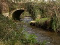
Discover the Goyen river and its valley via sunken paths and woodland.
Route of the old mills of Landudec
 6.47 mi
+322 ft
-305 ft
3h 15
Moderate
Departure from Landudec (Finistère)
6.47 mi
+322 ft
-305 ft
3h 15
Moderate
Departure from Landudec (Finistère)
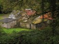
Follow the start of the Goyen valley, which joins the sea after about thirty kilometres, along a few small country roads and paths through the woods.
This river used to power several mills. The route will take you past three of them.
You can also enjoy the peace and quiet of the valley floor.
Circuit de la Fontaine Saint-Anne et campagne de Landudec
 6.59 mi
+285 ft
-305 ft
3h 15
Moderate
Departure from Landudec (Finistère)
6.59 mi
+285 ft
-305 ft
3h 15
Moderate
Departure from Landudec (Finistère)
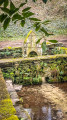
The route alternates between small country roads and numerous sunken paths in wooded areas.Passes by the Saint-Anne Fountain (1743) and part of the botanical trail near the water catchment protection area.The rest of the route follows various valleys where mills were once located.
Around Gourlizon via the Chapel of La Boissière and its fountain
 4.60 mi
+387 ft
-381 ft
2h 25
Easy
Departure from Gourlizon (Finistère)
4.60 mi
+387 ft
-381 ft
2h 25
Easy
Departure from Gourlizon (Finistère)
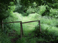
The first section is a signposted route through the countryside around the village of Gourlizon, passing through meadows and past the parish church of Saint-Cornély.
In the second part, the route descends into the valley of the stream that feeds into the River Goyen, leading to the monumental La Boissière fountain and its chapel.
Return via a narrow hedgerow path.
In the countryside around Gourlizon
 6.14 mi
+341 ft
-328 ft
3h 05
Easy
Departure from Gourlizon (Finistère)
6.14 mi
+341 ft
-328 ft
3h 05
Easy
Departure from Gourlizon (Finistère)
Starting from the small village of Gourlizon, this country route first takes us into a small valley along a little stream, then through a wood.
The second part follows small roads linking a few isolated farms, where you can enjoy the peaceful tranquillity.
Viewpoint overlooking Douarnenez Bay.
The Upper Goyen Valley or the Five-Village Route
10.89 mi
+817 ft
-810 ft
5h 45
Moderate
Departure from Gourlizon (Finistère)
This route, which passes through five local authorities, allows you to explore the upper Goyen valley, close to its source, and to admire magnificent panoramic views on both sides of the valley. The route takes in the site of theChapelle de la Boissière in Plonéis and its fountain,
Following the sardine route in Douarnenez
 4.59 mi
+210 ft
-217 ft
2h 20
Easy
Departure from Douarnenez (Finistère)
4.59 mi
+210 ft
-217 ft
2h 20
Easy
Departure from Douarnenez (Finistère)
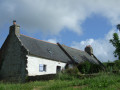
This route, adapted from the sardine route, is marked by 17 information panels explaining the history of sardine fishing in Douarnenez from Gallo-Roman times to the latest changes in the port.
Bronze nails bearing the image of a sardine guide you through the streets, alleys, ports and seaside (a fun treasure hunt).
Passing through Pouldavid, a district of Douarnenez
 5.49 mi
+374 ft
-374 ft
2h 50
Easy
Departure from Douarnenez (Finistère)
5.49 mi
+374 ft
-374 ft
2h 50
Easy
Departure from Douarnenez (Finistère)
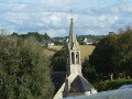
Pouldavid, which became part of Douarnenez in 1945, was primarily a port at the end of the ria.It was of considerable importance in the Middle Ages as a trading port.This ria is now occupied by Port-Rhu, half of which has become a museum of ancient boats afloat, the port museum of Douarnenez, and the other half a marina.This district of Douarnenez was previously part of the rural commune of Pouldergat.In 1919, it became an independent commune under the name of Pouldavid-sur-Mer.
Coastal path via the beaches of Trezmalaouen and Kervel
 6.75 mi
+666 ft
-650 ft
3h 40
Moderate
Departure from Kerlaz (Finistère)
6.75 mi
+666 ft
-650 ft
3h 40
Moderate
Departure from Kerlaz (Finistère)
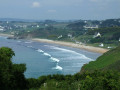
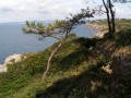
Framed by the cliffs of Cap-Sizun to the south and the Crozon Peninsula to the north, Douarnenez Bay is a sheltered spot, well known to ships when heavy weather is forecast.TheGR®® runs along the various beaches at the bottom of the bay and offers a beautiful view of Douarnenez and its fishing port.
NB: a new section was inaugurated in March 2024 to avoid the 20% incline at the start. The GR® markings do not currently take this into account, but it will soon become the official route.
Passing through Ploaré, a district of Douarnenez
 5.57 mi
+479 ft
-476 ft
3h 00
Easy
Departure from Kerlaz (Finistère)
5.57 mi
+479 ft
-476 ft
3h 00
Easy
Departure from Kerlaz (Finistère)
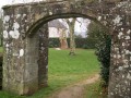
After passing through the Plomarc’h site, let’s set off to explore the former parish of Ploaré, which has been part of Douarnenez since 1945. It retains its strong connection to the land.
Wooded circular in Plogastel-Saint-Germain
 3.54 mi
+128 ft
-138 ft
1h 45
Easy
Departure from Plogastel-Saint-Germain (Finistère)
3.54 mi
+128 ft
-138 ft
1h 45
Easy
Departure from Plogastel-Saint-Germain (Finistère)
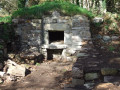
In the countryside around Plogastel-Saint-Germain, this short route mainly follows paths lined with wooded embankments and passes through small woods and wetlands, which can be crossed via a long wooden walkway.
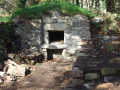
During the walk, you will discover an old bread oven saved at the last minute, an old farmhouse and a well-maintained wash house.
Countryside and woods around Plogastel-Saint-Germain
 6.68 mi
+394 ft
-394 ft
3h 25
Moderate
Departure from Plogastel-Saint-Germain (Finistère)
6.68 mi
+394 ft
-394 ft
3h 25
Moderate
Departure from Plogastel-Saint-Germain (Finistère)
This route, along small roads and wooded paths, largely combines two small routes around the village of Plogastel-Saint-Germain:
Wooded circular in Plogastel-Saint-Germain.
- Around the village of Plogastel-Saint-Germain via the Bois du Quilliou (in the opposite direction).
On the edge of the Bois du Névet
 6.88 mi
+781 ft
-761 ft
3h 50
Moderate
Departure from Kerlaz (Finistère)
6.88 mi
+781 ft
-761 ft
3h 50
Moderate
Departure from Kerlaz (Finistère)
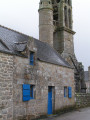
Starting from the small village of Kerlaz, descend into the Névet valley, a small river that flows into the sea at Plage du Ry (or Ris) in Douarnenez.Climb back up this valley to reach the edge of the Bois du Névet, which you will skirt around, then descend back to Kerlaz.A relatively hilly and wooded route.
More walks in Pouldergat
Select a point of interest below: