Country:
 City:
City:



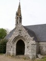
Access: From Quimper, take the D784 towards Audierne and, at the Kérandoaré roundabout, turn right onto the D57, which crosses the River Goyen and leads to Gourlizon. Park on the right in the car park near the school.
(S/E) As you leave the car park, turn right towards the village centre, turn left into the first street and carry on straight ahead.
Yellow signposting
You’ll come across the first signpost on a telephone pole shortly after a transformer; walk past the cemetery and its car park.
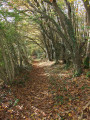
(1) Turn right onto the start of a tarmac path which continues as a wide, downhill lane. Follow this tree-lined lane until you reach the bottom of the valley.
No signposting
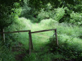
(2) Look out for an inconspicuous west-facing path on the left, near a rustic wooden gate and a few apple trees. If you carry on straight ahead along the wide path and reach a newly laid path marked by wooden posts bearing yellow markings, you’ve gone the wrong way. Turn back.
The relatively narrow path at the bottom of the valley runs alongside a stream. Cross a small wooden footbridge at the confluence with another stream, then cross a small ford. The path widens as it veers to the right into a woodland. You’ll come out onto a small road after passing a pasture on your right.
PR® “Route des 2 vallées” signposting: Yellow
(3) Turn right and follow this small road until it joins the D43, which you follow to the left along the path cut into the embankment for a few metres. Cross with care, as there is heavy traffic.
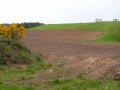
(4) After crossing the road, continue alongthe PR® route past the gable end of a shed: it runs alongside a field. This section is not shown on the IGN map (View of Douarnenez). Continue downhill towards the valley, then turn left to join a small road at the hamlet of Moustoulgoat.
(5) Turn right onto this small road, which descends. Leave it at a bend to follow a track suitable for vehicles opposite. The route marked ‘P’ on the map is no longer accurate. After passing a livestock farm and its silo, turn right into a woodland and follow the track that runs through it. At the junction with the road you left earlier, turn left to head back up towards Galvray and continue to the T-junction, where you leave thePR® trail, which continues to the left.
Unmarked
(6) Turn right and continue along this small road, which passes the farms of Kerzuillec, Kerloës and Keryaven (50 km/h speed limit).
(7) At Kerétar, veer right at an old shed, then head downhill to rejoin the D43 and follow it to the left for about 200 metres (Caution! Busy road).
(8) At a place called Le Fort, turn right onto the D57 (signposted Gourlizon). Follow this road southwards.
(9) At the sign for Mesquéon, Pen ar Stang, turn right and continue for about 100 metres.
Yellow markings
Take the wide, downhill track on the left, which is suitable for vehicles. It runs below a housing estate and leads to the hamlet of Kergagen. Turn left past some old buildings and continue until you reach Rue de la Mairie.
(10). Turn right onto this street, following the pavement; walk past the town hall, then veer right to pass close to the church.
Go round the church and you’ll come back to the school car park (S/E).


 Visorando Member
 Moderate