Country:
 City:
City:


Access: From Quimper, take the D784 towards Audierne and, at the Kérandoaré roundabout, turn right onto the D57, which crosses the River Goyen and leads to Gourlizon. Park on the right in the car park near the school.
(S/E) On leaving the car park, head right towards the centre of the village and, at the crossroads, continue to the left.
Yellow signposting
You’ll come across the first signpost on a telephone pole shortly after a transformer; walk past the cemetery and its car park.
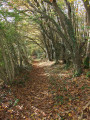
(1) Turn right onto the start of a tarmac path which continues as a wide, downhill lane. Follow this tree-lined lane until you reach the bottom of the valley.
No signposting
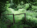
(2) Look out for an inconspicuous west-facing path on the left, near a rustic wooden gate and a few apple trees. If you carry on straight ahead along the wide path and reach a newly laid path marked by wooden posts bearing the yellow markings, you’ve gone the wrong way. Turn back.
The relatively narrow path at the bottom of the valley runs alongside a stream. Cross a small wooden footbridge at the confluence with another stream, then cross a small ford (you are now in the commune of Pouldergat). The path widens as it veers to the right into a wood. You’ll come out onto a small road after passing a pasture on your right.
PR®® “Route des 2 vallées” signposting: Yellow
(3) Turn left, enjoy the scenery as you head downhill, pass through the village of Kerlaouéret, join a road and head downhill to the left until you reach the bridge separating the villages of Pouldergat and Landudec.
(4) Walk back up the road past the waterfall, then head up to the right through the woodland to rejoin the road. Take this road to the left, passing two roads on your left.
(5) Turn onto the path leading uphill to the right (the junction path between thePR®® 18 and 17), pass two paths on the right and, at the third, turn left towards a tarmac road, which you cross. Carry on straight ahead and take the path on the right at the edge of the woods (you are now in the Plogastel-Saint-Germain area), which you follow until you reach the D784 departmental road.
(6) Before reaching this road, walk along the edge of the field (please note: private property – permission from the owner is required; please respect the crops). Then, turn left onto the track and follow it, then the road, until you reach a granite cross. Turn right onto the wide gravel road, reach the departmental road and follow it to the left until the next junction.
(7) Turn left onto the road, then keep left at the next junction. Follow the departmental road until you reach a right-angled left-hand bend.
(8) Take the steep path on the right which climbs up through the fields. At the top of this climb, take a moment to admire the Goyen valley.
(9) At the tarmac road, turn left and set off along a country lane. This turns right, skirts round the field, keeping it on your left as you take two left-hand bends, and comes out onto a road. Continue to the right, cross a road and follow the path opposite, on the edge of the woodland.
No signposting
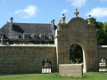
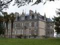
(10) Leave thePR®® and continue leftwards to reach the village of Guilly (you are now in Plonéis); then carry on straight ahead along a wide gravel road to the village of Ménébraz. Follow the tarmac road to the left towards the Manoir de Kerven.
(11) Head up the road to the left, then down to the right along the road leading to the Moulin de Kerven. At the entrance to the village, turn left to avoid going through the village square, and head up the path and then the road. Leave the village of Kerdanet on your left.
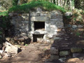
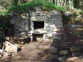
(12) Turn left towards La Boissière. After visiting the chapel site, go round the village and head north to the fountain; you may wish to go down to it (and back).
(13) Take the path on the left, cross the stream in the valley and head uphill, keeping the quarry on your right, towards the hamlet of Gourlizon. Walk past the sports ground and reach the crossroads. Turn left to reach the car park (S/E).






 Visorando Member
 Easy
Easy