


Refine your search for walks in Pontgouin
Pontgouin walks
 Walk around the Chuisnes ponds
 Visorando Member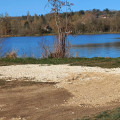
 3.34 mi
 +89 ft
 -89 ft
 1h 35
1h 35
 Easy
Easy
 Departure from Chuisnes (Eure-et-Loir)
An easy walk with pleasant sections, even with children. The start is at the church car park, where there is a public park
Circular Digny via the Château de la Hallière
 7.89 mi
+154 ft
-151 ft
3h 45
7.89 mi
+154 ft
-151 ft
3h 45
 Moderate
Departure from Digny (Eure-et-Loir)
Moderate
Departure from Digny (Eure-et-Loir)
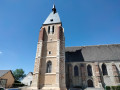
Digny is located on the border between Perche and Thimerais. This route through the fields starts at the foot of the bell tower of Saint-Germain Church, built in 1525 and recently beautifully restored. In 2025, a local association organised various events to celebrate the500th anniversary of its construction. The route takes you to the 16th-century Ferme du Romphaye farm and the Château de la Hallière castle, built in 1770. The return journey takes you through the hamlets of La Richardière and Bellandas, allowing you to return quickly to Digny or extend your walk to Mille Champs along paths offering beautiful views of the village.
Grand tour of the Château des Vaux
 9.24 mi
+312 ft
-325 ft
4h 30
Moderate
Departure from Saint-Maurice-Saint-Germain (Eure-et-Loir)
9.24 mi
+312 ft
-325 ft
4h 30
Moderate
Departure from Saint-Maurice-Saint-Germain (Eure-et-Loir)
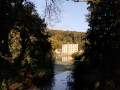
A route taking in the Boizard Locks and the Château des Vaux, passing through woods and fields around the Eure valley. The path first climbs to offer views of the Eure valley flowing between the forests of Senonches and Montécot towards Chartres. At the end of the17th century, Louis XIV and his engineers had hoped to channel the river’s waters as far as Versailles to supplement the insufficient water supply for the park’s fountains. The works could not be completed. A few remnants of this monumental project remain: the colossal embankment blocking the course of the Eure, a few traces of the canal, the gigantic embankment of the ‘terraces’ and the first storey of the aqueduct at the far end of the grounds of the Château de Maintenon. Charmed by this beautiful valley, the d’Alligre family, who had initially settled at the Château de la Rivière, expanded their estate by commissioning the splendid Château des Vaux, which today serves as a major vocational college run by the Fondation des Apprentis d’Auteuil.
No hills or mountains in Montécot
 6.55 mi
+105 ft
-105 ft
3h 05
Moderate
Departure from Le Favril (Eure-et-Loir) (Eure-et-Loir)
6.55 mi
+105 ft
-105 ft
3h 05
Moderate
Departure from Le Favril (Eure-et-Loir) (Eure-et-Loir)
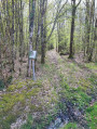
In fact, here you will only find a few undulations caused by the streams flowing towards the nearby Eure. This small 637-hectare national forest is surrounded by a bridle path and criss-crossed by straight paths. The D103 crosses it from east to west and is not very busy. A high-voltage power line divides the forest. Parallel to the D103, it overlooks a large clearing and is bordered by a well-maintained path. A long north-south lane, formerly part of the GR®35 hiking trail, marks the boundary of the private woods to the west. Finally, the Merise forest road connects the D920 to the D103: closed to cars from Rond de la Félicité to Rond de Diane.This network of paths allows you to combine numerous circular paths or take shortcuts. Just make sure you don't leave the state-owned forest, which is bordered by an embankment. Private woods are located all around. These woods are rich in game, and large animals are shot there, so it is wise not to venture in on hunting days!
Circular Digny starting from the hamlet of Saint-Fraise
 6.78 mi
+144 ft
-131 ft
3h 15
Moderate
Departure from Digny (Eure-et-Loir)
6.78 mi
+144 ft
-131 ft
3h 15
Moderate
Departure from Digny (Eure-et-Loir)
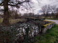
Starting from Saint-Fraise, a hamlet in the commune of Digny with an enigmatic name, this circular route first takes us across fields in the plain that stretches between the Senonches and Châteauneuf-en-Thymerais state forests. After crossing La Fizilière, it enters the forest, continues to Rond Fortin along a wide avenue and then crosses the somewhat wild Bois des Hauts Cornets forest before returning to the fields via Buisson-Elouis, La Frette and Les Mésangères.
Circular starting from Mare de l'Augerie
 5.31 mi
+98 ft
-115 ft
2h 30
Easy
Departure from Saint-Éliph (Eure-et-Loir)
5.31 mi
+98 ft
-115 ft
2h 30
Easy
Departure from Saint-Éliph (Eure-et-Loir)
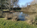
At the edge of the Montécot Forest, this circular route takes you past pretty little farms connected by winding roads. The bridle path on the western edge of the forest offers beautiful views of the countryside towards La Loupe.
Fontaine-Aubert lake in Belhomert
 3.90 mi
+233 ft
-203 ft
2h 00
Easy
Departure from Belhomert-Guéhouville (Eure-et-Loir)
3.90 mi
+233 ft
-203 ft
2h 00
Easy
Departure from Belhomert-Guéhouville (Eure-et-Loir)
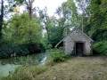
This short route starts in the village of Belhomert and takes you to the small lake at Fontaine-Aubert, a pleasant spot for fishing and picnics. The route through the fields offers beautiful views of the Eure valley.
In the footsteps of Saint-Laumer around Belhomert-Guéhouville
 5.02 mi
+1,280 ft
-1,391 ft
3h 25
Moderate
Departure from Belhomert-Guéhouville (Eure-et-Loir)
5.02 mi
+1,280 ft
-1,391 ft
3h 25
Moderate
Departure from Belhomert-Guéhouville (Eure-et-Loir)
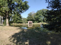
In the 6th century, Saint Laumer, or Lhomer, was a shepherd before becoming a canon and then bursar of Chartres Cathedral; he retired to the forests of the Perche where he founded two hermitages: he first settled in 558 in these places, later named Beatus Launomarus, then, 12 years later, moved to the banks of the Corbionne near Moutiers-au-Perche.This circular walk takes you around the Belhomert area in the footsteps of the holy man. Passing first by the entrance to the abbey that succeeded the original priory, the route follows the banks of the Eure. It reaches the edge of the Forest of Senonches, where trees were until recently the subject of strange rituals.After overlooking the valley at the edge of the forest, the route passes by the charming Étang de Fontaine-Aubert, a place name which, like Fontaine-Simon or Les Ressuintes, reminds us that many pagan places of worship were established near springs before being Christianised by devout hermits.
Castles and Calvary Sights starting from Le Thieulin
 Tourism professional6.34 mi
+98 ft
-98 ft
3h 00
Moderate
Departure from Le Thieulin (Eure-et-Loir)
Tourism professional6.34 mi
+98 ft
-98 ft
3h 00
Moderate
Departure from Le Thieulin (Eure-et-Loir)
The open space beyond the village offers views of the traditional buildings and the châteaux that dot the route: La Couture, Le Châtaignier and Lignerolles. The latter estate was vast in the 19th century; it stretched into the village and also included numerous woodlands. This route was developed in collaboration with the Eure-et-Loir Departmental Hiking Committee. Follow the yellow markings.
From the Senonches forest to the Boizard locks
 13.66 mi
+594 ft
-594 ft
6h 50
13.66 mi
+594 ft
-594 ft
6h 50
 Difficult
Departure from Senonches (Eure-et-Loir)
Difficult
Departure from Senonches (Eure-et-Loir)
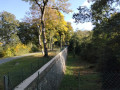
A beautiful hike, mostly in the woods around the Eure valley, starting from the Senonches State Forest and ending at the Boizard locks. Built in 1785 by Louis XIV's engineers, this structure was supposed to be the starting point of an unfinished aqueduct that would have carried water from the Eure to the fountains in the park of the Palace of Versailles. On the way back, discover the Château des Vaux and its gardens.
Views of the Eure Valley through the Senonches State Forest
 5.26 mi
+299 ft
-295 ft
2h 40
Easy
Departure from Senonches (Eure-et-Loir)
5.26 mi
+299 ft
-295 ft
2h 40
Easy
Departure from Senonches (Eure-et-Loir)
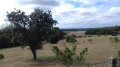
This beautiful woodland route includes a circular stretch halfway along the route, offering views of the Belhomert countryside. The village owes its name to Saint Laumer, who settled on the banks of the River Eure around 630. The hermit’s priory was attached to the important Abbey of Fontevrault around 1080.
Circular route from La Ville-aux-Nonains to Senonches
 9.62 mi
+85 ft
-85 ft
4h 30
Moderate
Departure from Senonches (Eure-et-Loir)
9.62 mi
+85 ft
-85 ft
4h 30
Moderate
Departure from Senonches (Eure-et-Loir)
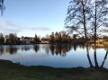
Don't be fooled by the name of this route: the "town" in question is just a small village attached to Senonches. The nuns and monks left it long ago! This circular route, starting from Ville-aux-Nonains, follows quiet paths and roads and leads to Senonches, a "Petite Cité de Caractère" (Small Town of Character) that is well worth a detailed visit. On the way back, it follows the edge of the national forest. This route also serves as a reminder, through its place names, of the activities that once took place in this other part of the Senonches area, better known for its forest, and evokes activities that have now disappeared: marl pits, tile works, lime kilns, forges and mechanical workshops, which played a major role in the economic development of the commune. These have now been replaced by intensive farming in vast fields reorganised after the consolidation of the old bocage. The hedges have disappeared, with only a few small woods remaining as refuges for game.
Jaudrais circular via the Grande Vallée
 7.32 mi
+203 ft
-220 ft
3h 35
Moderate
Departure from Jaudrais (Eure-et-Loir)
7.32 mi
+203 ft
-220 ft
3h 35
Moderate
Departure from Jaudrais (Eure-et-Loir)
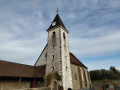
A walk half in the fields and half in the Châteauneuf-en-Thymerais State Forest, starting from the village of Jaudrais and passing through its hamlets. The circular route follows the Grande Vallée stream from a distance on both sides.
Bois Landry
7.71 mi
+171 ft
-174 ft
3h 40
Moderate
Departure from Champrond-en-Gâtine (Eure-et-Loir)
The route alternates between open countryside and woodland. The private Bois Landry forest is managed sustainably. It also serves as a venue for forest school and nature discovery trips. Along the way stands the fortified farm of Grand Bois Landry (17th century), still surrounded by moats.
More walks in Pontgouin
Select a point of interest below: