Grand tour of the Château des Vaux

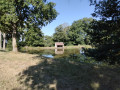
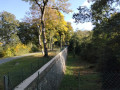
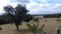
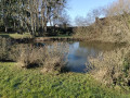
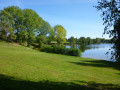
A route taking in the Boizard Locks and the Château des Vaux, passing through woods and fields around the Eure valley. The path first climbs to offer views of the Eure valley flowing between the forests of Senonches and Montécot towards Chartres.
At the end of the17th century, Louis XIV and his engineers had hoped to channel the river’s waters as far as Versailles to supplement the insufficient water supply for the park’s fountains. The works could not be completed. A few remnants of this monumental project remain: the colossal embankment blocking the course of the Eure, a few traces of the canal, the gigantic embankment of the ‘terraces’ and the first storey of the aqueduct at the far end of the grounds of the Château de Maintenon. Charmed by this beautiful valley, the d’Alligre family, who had initially settled at the Château de la Rivière, expanded their estate by commissioning the splendid Château des Vaux, which today serves as a major vocational college run by the Fondation des Apprentis d’Auteuil.

Details

83369543
Creation:
Last update:
Last review:
  • Walking
    Activity: Walking
  • ↔
    Distance: 9.24 mi
  • ◔
    Average duration: 4h 30 
  • ▲
    Difficulty: Moderate

  • ⚐
    Back to start: Yes
  • ↗
    Ascent: + 312 ft
  • ↘
    Descent: - 325 ft

  • ▲
    Highest point: 886 ft
  • ▼
    Lowest point: 597 ft

Description of the walk

Set off from Saint-Maurice - Saint-Germain Town Hall, 5 km north-east of La Loupe, via the D 928 then the D 34714 at the entrance to Belhomert – Parking available in front of the town hall.

Yellow and red markings of the GRP® Vallée de l’Eure

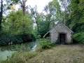
(S/E) From the town hall car park, head towards the church. At the crossroads, turn right (on the left is a large communal area: a wash house near the river – picnic table). Cross the Eure (old mill). After the bridge, take the path on the left which climbs up to the houses in Saint-Germain. Follow the Chemin de l’Épinay for 150 metres.

(1) Turn right onto Route de l’Épinay (D347.14) and immediately left onto Rue de Saint-Germain (D347). Turn right onto Rue de Bel-Air, which becomes a track. Walk uphill until you reach Route de la Garenne. Turn left and you will immediately arrive at the start of Route du Bois Guillaume. Leave the signposted route.

No signposting

(2) Follow the road to the right for about 1 km. After the last houses, follow the wide stony track. Walk alongside the Bois de Saint-Germain and reach a small road near Les Gâtines.

(3) Turn right and go round La Guinière. At the D155, turn right, cross Les Frétis to reach the junction with the D347 (stone cross). Turn right to reach the D347.13.

(4) Follow it to the right until you reach the crossroads before La Bondancière. Turn right onto the D347 and continue to the houses at La Bondancière.

(5) Take the path on the left, then, at the Fork in the road, keep left. Walk through the woods until you come to a track and follow it down to the right until it takes a sharp right-hand bend.

(6) At the bend, leave the track and continue downhill straight ahead through the woods. At the T-junction with a path, turn left to rejoin the D347.6 and follow this road to the right. Ignore the return path on the right. Continue straight on along the road and the GRP® to reach the Boizard locks.

Yellow and red markings

(7) From the locks, retrace your steps. Head back up the road to the path that leads into the woods on the left.

(8) Take the path on the left and follow it straight on until you reach a junction with a cross-path.

(9) Turn onto the path on the left, which cuts across a wide avenue blocked on both sides by cables. Continue straight ahead, passing close to the entrance to a gravel pit and crossing the Eure via a bridge. You’ll reach the D349.2.

(10) Follow it to the right. Pass in front of the Planche aux Chiens and reach a small bridge over a stream.

(11) Just after the small bridge, head up the stony track to the left and arrive at the lovely Petites Boussardières farm.

(12) Go round the farm and follow the path. At the next Fork in the road, head down to the right and arrive at Clos Moussu.

(13) Cross the D349.2 and immediately turn left onto the path blocked by a gate. Walk past the Intendance buildings. Follow the path along the banks of the Eure to the monumental staircase at the main entrance to the Château des Vaux.

(14) Continue straight ahead (pedestrian crossing). Take note of the sculpted trees. A few dozen metres further on, take the path on the right which overlooks the river, then, at the Fork in the road, leave it behind and head up the left-hand path to the village hall in Saint-Maurice-Saint-Germain. At the end of the path, return to the car park in front of the town hall (S/E).

Waypoints

  1. S/E : mi 0 - alt. 646 ft - Saint-Maurice - Saint Germain Town Hall - Eglise Saint-Germain (Saint-Maurice-Saint-Germain)
  2. 1 : mi 0.43 - alt. 663 ft - Chemin de l’Épinay - Eure (rivière)
  3. 2 : mi 1.13 - alt. 758 ft - Entrance off Route du Bois Guillaume
  4. 3 : mi 2.22 - alt. 853 ft - Les Gâtines
  5. 4 : mi 3.5 - alt. 830 ft - D347.13
  6. 5 : mi 3.94 - alt. 843 ft - La Bondancière
  7. 6 : mi 4.79 - alt. 823 ft - Sharp bend on the track
  8. 7 : mi 5.57 - alt. 620 ft - The Boizard locks
  9. 8 : mi 5.79 - alt. 659 ft - At the entrance to the Chemin du Retour.
  10. 9 : mi 6.34 - alt. 669 ft - Crossroads
  11. 10 : mi 6.8 - alt. 614 ft - D 349.2
  12. 11 : mi 7.36 - alt. 604 ft - Petit Pont
  13. 12 : mi 7.65 - alt. 653 ft - Les Petites Boussardières
  14. 13 : mi 7.86 - alt. 617 ft - Le Clos Moussu
  15. 14 : mi 8.37 - alt. 617 ft - Monumental staircase
  16. S/E : mi 9.24 - alt. 646 ft - Saint-Maurice - Saint Germain Town Hall - Eglise Saint-Germain (Saint-Maurice-Saint-Germain)

Notes

Sturdy, waterproof footwear is recommended. Please exercise extreme caution during the hunting season in the Pontgouin woods. Please follow the hunters’ instructions. You may wish to enquire at Pontgouin Town Hall about hunting days.

1, Rue Saint Jean
28190 Pontgouin
Tel: 02 37 37 40 19

Monday from 9.00 am to 12.00 pm

Tuesday and Thursday from 9.00 am to 12.00 pm and from 2.00 pm to 5.00 pm

Friday from 9.00 am to 12.00 pm and from 2.00 pm to 6.30 pm

Worth a visit

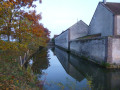
(7) Boizard Locks: Imposing remains of the dyke built by Louis XIV.
Bar at the Moulin de Boizard (open in season), fishing, fast food. Opportunity to stroll along the River Eure around the ponds in the gardens of the Château de la Rivière (admission fee applies),
Near (8) Seasonal tours of the Château de la Rivière.

(10) Château des Vaux: walk across the bridge to admire the façade. We recommend climbing the stairs to explore the magnificent dovecote, decorated with bricks and flint and topped with an elegant slate dome.

(11) Church of Saint-Maurice-Saint-Germain: at the crossroads after the church, take a look at the wash house at the bottom of the meadow; you can also make use of the picnic area.

Senonches: castle, museum, Huttopia holiday village, motorhome stopover area, fishing, riding centre.
La Loupe: castle, park, the ‘Caves de l’Histoire’
Fontaine Simon: Perche water park, swimming pool.
Perche campsite.
Water ski lift
Digny: treetop adventure course

Other walks in the area

For more walks, use our search engine .

The GPS track and description are the property of this route's author. Please do not copy them without permission.