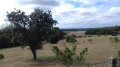
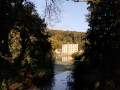
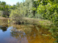
Views of the Eure Valley through the Senonches State Forest

This beautiful woodland route includes a circular stretch halfway along the route, offering views of the Belhomert countryside. The village owes its name to Saint Laumer, who settled on the banks of the River Eure around 630. The hermit’s priory was attached to the important Abbey of Fontevrault around 1080.

Details

24243810
Creation:
Last update:
Last review:
  • Walking
    Activity: Walking
  • ↔
    Distance: 5.26 mi
  • ◔
    Average duration: 2h 40 
  • ▲
    Difficulty: Easy

  • ⚐
    Back to start: Yes
  • ↗
    Ascent: + 299 ft
  • ↘
    Descent: - 295 ft

  • ▲
    Highest point: 909 ft
  • ▼
    Lowest point: 725 ft

Photos

Description of the walk

From La Loupe, take the D7928 towards Belhomert-Guehouville. Then take the D941 towards Senonches. Park at Rond Bergon.

(S/E) Cross the D941 with care and follow the Route Forestière de La Ferrière south-west. Turn left and walk for about 50 metres until you reach the crossroads.

(1) Turn left at a right angle onto theGR®® de Pays Vallée de l’Eure. Go straight ahead at the crossroads. Continue for a further 600 metres, then cross the D941 carefully once more to enter the forest until you reach the main stretch of the Route de la Mare Ronde.

(2) Turn left. After 400 metres, turn onto the track on the right (marker 239). Head towards the edge of the forest until you reach a junction.

(3) Turn left and, at the next track, turn right. Follow the path to the left for about 700 m until you reach the junction with the GRP®®.

(4) Follow the GRP®® to the right and head for the junction of the circular route

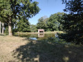
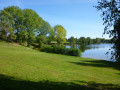
(5) Turn right and head down towards the pond, go round it and head back up the same way you came. After coming back up from the pond, take the path on the right as far as the last houses on the D928.

(6) Leave theGRP®® behind, turn left and take the path that heads to the right, going round a house. Cross the field between the fences and turn left until you reach a track.

(7) Follow the path to the crossroads.

(8) Turn right down the lane to reach another crossroads.

(9) Turn left and continue to the end of the lane. Turn right and head downhill to Rond Fortin.

(10) Follow the Route de la Ferrière to reach the Rond Bergon (S/E).

Waypoints

  1. S/E : mi 0 - alt. 837 ft - Rond Bergon
  2. 1 : mi 0.49 - alt. 791 ft - GRP trail
  3. 2 : mi 1.19 - alt. 748 ft - Route de la Mare
  4. 3 : mi 1.6 - alt. 725 ft - forest trail
  5. 4 : mi 2.2 - alt. 879 ft - GRP trail
  6. 5 : mi 2.57 - alt. 814 ft - pond
  7. 6 : mi 3.09 - alt. 840 ft - hamlet
  8. 7 : mi 3.28 - alt. 886 ft - path
  9. 8 : mi 3.62 - alt. 883 ft - junction
  10. 9 : mi 3.79 - alt. 906 ft - towards Rond Fortin
  11. 10 : mi 4.31 - alt. 863 ft - Route de la Ferrière - Rond Fortin
  12. S/E : mi 5.26 - alt. 837 ft - Rond Bergon

Notes

This route was created in collaboration with the Eure-et-Loir Departmental Hiking Committee. Follow the yellow markings.

Worth a visit

Always be cautious and plan ahead when you're outdoors. Visorando and the author of this route cannot be held responsible for any accidents occurring on this route.

The GR® and PR® markings are the intellectual property of the Fédération Française de Randonnée Pédestre.

Reviews and comments

3.3 / 5
Based on 4 reviews

Reliability of the description
2.8 / 5
Ease of following the route
2.8 / 5
Route interest
4.5 / 5
FARGAS Jean-Claude
FARGAS Jean-Claude

Following the disappearance of the path between the fields at Fontaine-Aubert, after the section between the buildings, the signposting has been removed from the small transformer at the entrance to the path leading to the pond right up to the point where the path rejoins the forest.
It now indicates that you should head to the pond, walk around it, enjoy the pleasant surroundings for a short break, and return along the same path to the first crossroads in the forest.

Alternatively, after returning only as far as the transformer, turn right and continue along the GRP marked in yellow and red, pass through the hamlet, cross the road carefully and continue for about 500 metres. Then, leave the GRP and take the first path on the left which goes round the houses, cross the road again and continue straight ahead past the riding school; head towards the forest where you rejoin the marked route.

Machine-translated

FARGAS Jean-Claude
FARGAS Jean-Claude

Thank you, Lyne 28, for your glowing praise of the signposting and the route description. As for its appeal, the short circular loop leading to Fontaine-Aubert and Belhomert Pond was designed precisely to get out of the forest for a bit and offer a view of the valley. It’s true, however, that the long, straight path between Rd Fortin and the finish is a bit monotonous, but it’s the only way to get back to the car quickly.
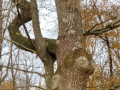
If you have the chance to do this route again, now that you know the route, you could walk it in the opposite direction to the signposting. You’d save the best for last and you’d also avoid the rather steep climb up to the junction where the circular loop begins, as, after the remarkable tree known as ‘The Ritual Oak’, the slope is gentler as you head back up onto the plateau.

Machine-translated

Lyne28
Lyne28

Overall rating : 4.3 / 5

Date of your route : Aug 14, 2023
Reliability of the description : ★★★★★ Very good
Ease of following the route : ★★★★★ Very good
Route interest : ★★★☆☆ Average
Very busy route : No

A very well-signposted route, but it’s all through the forest, so it’s a bit monotonous.

Machine-translated

FARGAS Jean-Claude
FARGAS Jean-Claude

The forest is a lovely place to go for a bit of fresh air at the moment. You were right not to leave it. There aren’t many people there now, so it’s peaceful…
A tip to make the most of it: pick up a map of the forest and its notable trees, published by ‘Les amis de la Forêt’, from the Senonches Tourist Office. With this, you can’t go wrong. The paths and clearings are marked. The plots are numbered, and you’ll find these numbers on the plaques nailed to the trees. This means there’s no limit to the number of walks you can take.
There are suggested routes to see the remarkable trees, but everyone can plan their own short or long walk. Enjoy your walks.
.

Machine-translated

patcross
patcross

Overall rating : 3.7 / 5

Date of your route : Aug 21, 2023
Reliability of the description : ★★★☆☆ Average
Ease of following the route : ★★★☆☆ Average
Route interest : ★★★★★ Very good
Very busy route : No

Hello,
My wife and I started this walk at the Rond de la Fontaine aux Liards, as getting to the Rond Bergon by car would have involved a detour.
We got a bit lost trying to reach the junction of the circular route, but we didn’t stray out of the forest. The compass and map came in very handy
Once we reached Rond Fortin, we took a path that passes through Rond Henri IV and Rond Barbereux, to get back to our starting point.
It’s a pleasant, shaded walk, but we only came across one person out for a jog – was that because of the heat and the fact it was August?

Machine-translated

FARGAS Jean-Claude
FARGAS Jean-Claude

Overall rating : 2.3 / 5

Date of your route : Apr 25, 2023
Reliability of the description : ★☆☆☆☆ Very disappointing
Ease of following the route : ★☆☆☆☆ Very disappointing
Route interest : ★★★★★ Very good
Very busy route : No

The GPS track appears to be incorrect. The signposts that have recently been put up need to be corrected. The route description is partly incorrect. It is recommended that you stick to the signposting, which is reviewed regularly.
Between points 3 and 4, the path is perfectly passable. It continues to follow the GRP as far as Fontaine-Aubert.
The route description should state:
Point 5 ‘Follow the GRP® signposting to the right and leave the forest, following the small road. At the first path leading down to the right (small electricity substation), it is recommended that you head down towards the Belhomert village pond (picnic area).
You can walk round it and then head back up to the transformer. Then follow the road to the right towards the hamlet.
At the first junction, turn left then right between the house and a hedge that is sometimes overgrown. At the end of this stretch, continue straight ahead along the village path, which is often overgrown with grass and difficult to see. Continue straight on for about 200 metres to reach the correct path running at right angles, which you take to the left and head back towards the forest.
You’ll come back to the junction of the circular path at point 5: turn right onto the winding path that follows the edge of the state-owned forest and soon joins a wider track. Turn left and continue to
Point 6: where you meet the Route forestière de la Mare ronde. Turn right and you will arrive at
Point 7: the Rond Fortin.
Take the first path on the left and follow it straight on until you reach Rd Bergon.
This route is very pleasant. It is a circular route offering lovely views over the Eure valley.
It takes about two hours to complete and presents no significant difficulties (a short climb towards Point 5)
If the section between the houses in Fontaine-Aubert and the perpendicular path is really too overgrown, you can continue along the GRP to the D 928. Follow it to the left and, taking the first path on the left, rejoin the route.

Machine-translated

loic.vatar@bbox.fr
loic.vatar@bbox.fr

Overall rating : 3 / 5

Date of your route : Nov 20, 2022
Reliability of the description : ★★☆☆☆ Disappointing
Ease of following the route : ★★☆☆☆ Disappointing
Route interest : ★★★★★ Very good
Very busy route : No

A very pleasant walk, enjoyed in lovely November sunshine amidst magnificent autumn colours.
A few issues encountered:
On two occasions, the GPS track I was following on my mobile turned out to be different from the planned route:

between point 3 and point 4, the route suggested by the GPS along the edge of the forest was impassable
between point 5 and point 6, where I had to improvise, turn back and follow the road to reach point 6 – contrary to the description and the GPS track – as the path shown was blocked by a private fence.

The signposting is sometimes very comprehensive, sometimes non-existent, and it is not always clear whether one should follow the yellow markings

Furthermore, the stated duration of 2 hours 30 minutes is very generous, as we took exactly 2 hours 30 minutes after taking several wrong turns and stopping frequently to take photos.
Loïc

Machine-translated

Other walks in the area

For more walks, use our search engine .

The GPS track and description are the property of this route's author. Please do not copy them without permission.