Country:

 City:
City:


The hike starts at the Montanges town hall (car park).
(S/E) Go down Rue des Fermes, then turn left at the first street, Rue du Château. Then cross Rue Paul de Vanssay and continue down Rue de la Chèvre. Turn right onto Chemin des Voites and continue to the end of the houses.
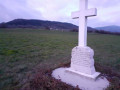
The street continues along a path which you follow until you see a cross in the middle of the field opposite you on the right. Leave the path and head towards the cross.
(1) This is the memorial to the place where Paul de Vanssay fell on 8 April 1944.
From the cross, head downhill towards the east, under the power line, until you reach a path below.
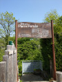
(2) Walk up this path to the D14a. Cross the road and turn right to find a path opposite, which you follow straight ahead along the hillside, keeping the road on your right. You will come to a sign for "Route du Tram Lacrans".
(3) Descend on the right-hand side until you reach the D14a. Turn left and walk carefully along the road for about 100 metres.
(4) Cross the road – take care as visibility is reduced due to the bend – towards the Pont des Pierres viewpoint on the left.
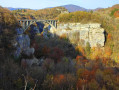
(5) This viewpoint offers a panoramic view of the wild and rugged Valserine valley and the bridge that crosses the gorge.
Retrace your steps for a few metres to take the marked mountain bike trail on the left. This is a path running along the edge of the Valserine, which continues until it reaches the Via Nantua.
(6) Head up to the right for about a hundred metres before you see a sign on the right for Montanges (20 mins), which you will follow along a small, very steep path that leads to a field, not far from the monument to Paul de Vanssay that you visited at the start of the hike, but which is not visible from this lower position.
(7) Simply head straight towards the power line, then turn left and follow it to return to the monument.
(1) Turn right to rejoin the path to the north and retrace your steps to return to the Town Hall car park (S/E).

 Visorando Member
 Difficult
 Tourist office
 Easy
Easy 
 Very difficult