La Namphée

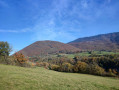
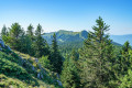
This route takes you down into the Valserine Valley, between the villages of Montanges and Champfromier. Woodland, meadows and fresh air await you!

Details

3167922
Creation:
Last update:
Last review:
  • Walking
    Activity: Walking
  • ↔
    Distance: 2.65 mi
  • ◔
    Average duration: 1h 45 
  • ▲
    Difficulty: Easy

  • ⚐
    Back to start: Yes
  • ↗
    Ascent: + 636 ft
  • ↘
    Descent: - 630 ft

  • ▲
    Highest point: 2,224 ft
  • ▼
    Lowest point: 1,736 ft

Photos

Description of the walk

Park in the car park at the Caserne roundabout.

(S/E) Join the Chemin des Géorennes, follow it to the left, then turn left towards the campsite. Take the path running alongside the campsite and follow it to the junction of two trails.

(1) Take the path on the left and, after a steep climb, you’ll come out at the old farms of La Namphée.

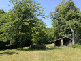
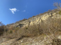
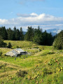
(2) It is a picturesque spot that exudes peace and tranquillity. Only the sound of water from the fountain fills the air. The cliff opposite La Namphée is home to numerous birds and birds of prey. There are also a few paths here that were once used by smugglers.

Turn right, then left onto the return path, which climbs towards Montanges to the south-west. After a fairly gentle climb, you’ll reach a large open space.

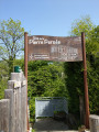
(3) At the junction with the Voie du Tram, a sign on the right points towards Champfromier. Turn right onto the path which winds its way through boxwood, coppice and fir woodland before joining the path to the campsite.

(1) Continue straight on, pass the campsite again, then turn right to reach the car park (S/E).

Waypoints

  1. S/E : mi 0 - alt. 2,152 ft - Fire station car park
  2. 1 : mi 0.38 - alt. 2,146 ft - Crossroads of the circular loop
  3. 2 : mi 0.96 - alt. 1,736 ft - La Namphée
  4. 3 : mi 1.47 - alt. 1,949 ft - The Voie du Tram
  5. S/E : mi 2.65 - alt. 2,152 ft - Salle des Fêtes car park

Notes

Take water with you. Wear walking shoes. Dogs must be kept on a lead.

Worth a visit

Discover other nearby walks: the Cirque des Avalanches, the Dragon Sous-Roche and the Voie du Tram...

More information at: https://www.terrevalserine.fr

Reviews and comments

4.4 / 5
Based on 3 reviews

Reliability of the description
4.7 / 5
Ease of following the route
4.3 / 5
Route interest
4.3 / 5
lubert
lubert

Overall rating : 4.3 / 5

Date of your route : Apr 20, 2025
Reliability of the description : ★★★★★ Very good
Ease of following the route : ★★★★☆ Good
Route interest : ★★★★☆ Good
Very busy route : No

A lovely little walk I did with my 6-year-old son on a beautiful spring’s day. It must be very pleasant in summer as it’s very shady. It was very peaceful; our only company was the birdsong and the sound of the water.
It’s signposted, but I got a bit lost twice and the map helped me confirm the route.
On arrival, we were able to enjoy some delicious homemade ice cream at the campsite bistro.

Machine-translated

teojasmine
teojasmine

Overall rating : 5 / 5

Date of your route : Jul 30, 2024
Reliability of the description : ★★★★★ Very good
Ease of following the route : ★★★★★ Very good
Route interest : ★★★★★ Very good
Very busy route : No

A lovely little route through the woods, ideal for hot days!

Machine-translated

Danic
Danic

Overall rating : 4 / 5

Date of your route : Jun 06, 2022
Reliability of the description : ★★★★☆ Good
Ease of following the route : ★★★★☆ Good
Route interest : ★★★★☆ Good
Very busy route : No

A lovely little morning stroll in beautiful surroundings.

Machine-translated

Other walks in the area

For more walks, use our search engine .

The GPS track and description are the property of this route's author. Please do not copy them without permission.