


Refine your search for walks in Pointe d'Isatier (2664m)
Pointe d'Isatier (2664m) walks


 Visorando Member
Walks near Pointe d'Isatier (2664m)
 Rabuons Mountain Hut – Saint-Étienne de Tinée
 4.93 mi
 +164 ft
 -4,642 ft
 2h 25
2h 25
 Moderate
 Departure from Saint-Étienne-de-Tinée (Alpes-Maritimes)
The final day is less demanding than the previous one, consisting entirely of a descent. It’s a chance to walk the ‘Chemin de l’Énergie’ one last time before a long descent to Saint-Étienne-de-Tinée.
Rabuons Refuge – Vens Refuge
 9.54 mi
+3,383 ft
-3,875 ft
7 hrs
9.54 mi
+3,383 ft
-3,875 ft
7 hrs
 Very difficult
Departure from Saint-Étienne-de-Tinée (Alpes-Maritimes)
Very difficult
Departure from Saint-Étienne-de-Tinée (Alpes-Maritimes)
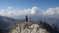
After a night at the Rabuons Mountain Hut, you’ll be ready to climb Mont Ténibre, the main highlight of this second stage. The route is challenging but you’ll be richly rewarded by the panoramic views that await you. To the south, you’ll recognise the Refuge de Rabuons and the lake; to the north and west, there are numerous lakes and the peaks on the border with Italy. After a more leisurely walk along the Chemin de l’Énergie, the scenery will become more pastoral as you approach the Lacs de Vens.
You are now in the Mercantour National Park; there are regulations to be observed, and failure to do so may result in a fine of up to €1,500 – please see the practical information.
Auron – Longon dairy farm
 16.41 mi
+5,928 ft
-4,970 ft
10 hrs
Very difficult
Departure from Saint-Étienne-de-Tinée (Alpes-Maritimes)
16.41 mi
+5,928 ft
-4,970 ft
10 hrs
Very difficult
Departure from Saint-Étienne-de-Tinée (Alpes-Maritimes)
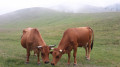
A long but beautiful stage combining the austere landscape of Mont Mounier with the green mountain pastures of Longon.Look up to watch the vultures.A gentle finish at the Vacherie de Longon, surrounded by animals.
Saint-Étienne-de-Tinée - Rabuons Refuge
 4.55 mi
+4,951 ft
-423 ft
6h 25
4.55 mi
+4,951 ft
-423 ft
6h 25
 Difficult
Departure from Saint-Étienne-de-Tinée (Alpes-Maritimes)
Difficult
Departure from Saint-Étienne-de-Tinée (Alpes-Maritimes)
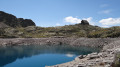
This first stage will take you to the Rabuons mountain hut, on the shores of the largest lake in the Alpes-Maritimes.The landscape is very rocky. You’ll come across plenty of Italians, as just across the border there are several mountain huts offering lovely routes via the nearby Pas de l’Ischiator.
⚠️ Allow around 4 hours for an average hiker in good physical condition to complete this walk.
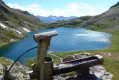
Saint-Etienne-de-Tinée - Lacs de Vens - Small Pass of Tortisse
 7.52 mi
+5,942 ft
-1,342 ft
7 hrs
Very difficult
Departure from Saint-Étienne-de-Tinée (Alpes-Maritimes)
7.52 mi
+5,942 ft
-1,342 ft
7 hrs
Very difficult
Departure from Saint-Étienne-de-Tinée (Alpes-Maritimes)
First stage of a two-day hike in the Haute-Tinée.
Ascent to the magnificent Lacs de Vens and the small pass of Tortisse via the Claï valley and Lac des Babarottes.
Plenty of marmots and chamois around the Lacs de Vens and below the small pass of Tortisse.
Roya - Roure
17.57 mi
+4,469 ft
-5,830 ft
12h 00
Difficult
Departure from Saint-Étienne-de-Tinée (Alpes-Maritimes)
Étape de la traversée des Alpes de Roya jusqu'à Roure. Randonnée allant de la Haute Tinée en passant par le Mercantour où l'on peut apercevoir des vautours. À l'approche du Col de Croussette un univers minéral nous attend puis un plateau quasi désertique pour finir par la douceur des pâturages de Roure.
From Roya to the Longon Refuge
 12.21 mi
+4,321 ft
-3,081 ft
9h 25
Difficult
Departure from Saint-Étienne-de-Tinée (Alpes-Maritimes)
12.21 mi
+4,321 ft
-3,081 ft
9h 25
Difficult
Departure from Saint-Étienne-de-Tinée (Alpes-Maritimes)
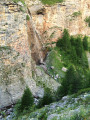
This eighteenth stage continues the traverse of the Mercantour Massif. From Roya, the GR®5 crosses the Vallon de Roya torrent, follows the Vallon de la Maïris upstream and then the Vallon de Sallevieille, before winding its way up to the Plan des Laces and then the Col de Crousette. From the pass, the path winds its way up the left-hand slope of the Vallon de la Culasse towards the Stèle Vallette, follows the ridge on the Vallon du Démant side, crosses the Baisse du Démant and descends to the Col du Refuge and then to the Col des Moulinés. It drops down to the bottom of the Vallon du Démant, crosses its torrent and, on the slope of the opposite side, meets the Vallon de la Gourgette. Above the hamlet of Vignols, it climbs beneath the ruin-like rocks of Les Chambrettes, where a colony of bearded vultures nests, and passes the small pass of Portes de Longon, then winds its way along a stream to reach the Refuge du Longon or Vacherie de Roure.
Vens Mountain Hut – Saint-Etienne-de-Tinée
 7.56 mi
+1,302 ft
-5,341 ft
4h 35
Difficult
Departure from Saint-Étienne-de-Tinée (Alpes-Maritimes)
7.56 mi
+1,302 ft
-5,341 ft
4h 35
Difficult
Departure from Saint-Étienne-de-Tinée (Alpes-Maritimes)
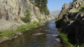
The aim of this third stage is, of course, to return to Saint-Etienne-de-Tinée. You’ll enjoy one last glimpse of the majestic scenery of the Vens Lakes, the Torrent de Vens, the waterfalls and also the Lac des Babarottes, which is a little more secluded. You’ll take the Chemin de l’Energie one last time – a very peaceful route overlooking the valley.
Refuge de Vens - Camp des Fourches
 7.34 mi
+2,090 ft
-2,441 ft
5h 10
Moderate
Departure from Saint-Étienne-de-Tinée (Alpes-Maritimes)
7.34 mi
+2,090 ft
-2,441 ft
5h 10
Moderate
Departure from Saint-Étienne-de-Tinée (Alpes-Maritimes)
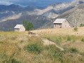
Thisthird and final stage of the Tour du Mont Aiga starts from the Refuge de Vens and crosses a balcony below the slopes of the Aiguilles de Tortisse to the north-east of the Lacs de Vens. After passing the Crête de la Côte and descending to the Maisons Forestières de Tortisse, you will walk along a balcony path beneath the slopes of the Tête des Mourres to reach the Morgon plateau and climb back up to Laussets and finally to the Lacs de Morgon. At the large Morgon lake, you will descend eastwards into Salso Moréno to rejoin the path of thefirst stage and Camp des Fourches. It is possible to see chamois early in the morning and, of course, marmots throughout the day.
Vens Mountain Hut – Rabuons Mountain Hut
8.38 mi
+2,677 ft
-2,188 ft
6h 10
Difficult
Departure from Saint-Étienne-de-Tinée (Alpes-Maritimes)
A more challenging second day to explore the ‘Chemin de l’Énergie’ and its panoramic views of the Haute Tinée.
Important: check with the refuge warden to see if the diversion via Lac Fer is still in place. This diversion requires a good level of fitness and/or a head for heights.