The Pointe d’Isatier via the Pas de Barbacane

A little-known and rarely visited summit, but one offering a stunning panorama of both the Tinée valley and Italy.

Details

3260357
Creation:
Last update:
Last review:
  • Walking
    Activity: Walking
  • ↔
    Distance: 7.09 mi
  • ◔
    Average duration: 7h 05 
  • ▲
    Difficulty: Difficult

  • ⚐
    Back to start: Yes
  • ↗
    Ascent: + 4,429 ft
  • ↘
    Descent: - 4,429 ft

  • ▲
    Highest point: 8,707 ft
  • ▼
    Lowest point: 4,278 ft

Photos

Description of the walk

The route starts in the small hamlet of Douans. Once you’ve passed the village of Isola and then the hamlet of Le Bourguet, a small road on the right points towards Douans, which you’ll reach quickly. Park in the small car park at the end of the road before the track, at marker 98.

(S/E) The Pas de Barbacane is signposted from the car park. Cross the hamlet along the track to marker 94.

(1) The arrow pointing towards the pass has disappeared; turn right between the two houses and head uphill. The path is well signposted here; walk gently up the valley to reach Douans Supérieur (a few barns dotted here and there mark the route). Follow the path to marker 125.
This marker is accompanied by a wayside shrine dedicated to Saint Anne.

(2) Stay on the path towards the Pas de Barbacane.
You’ll soon pass a small concrete building; from here, the path becomes harder to follow. A few yellow markings here and there and some cairns will help a little.
Note: if you stray from the path, don’t panic – you’ll eventually come across a small stream; simply follow it upstream.
Reach marker 105c at the junction with the Chemin de l’Énergie.

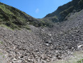
(3) Head down to the left for a few metres to head back towards the pass. The path becomes even less obvious here; look out for the cairns and climb gently between the two ridges. You’ll reach a large scree slope where there are more cairns and the path is finally quite easy to follow.

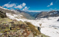
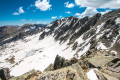
(4) Climb back up towards the pass. Be careful: there were still a few snowfields on 20 May, particularly on the last 100 metres before reaching the pass; crampons are strongly recommended. Reach the pass.

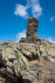
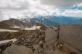
(5) Turn left onto the ridge leading to the Pointe d’Isatier. There is no visible path, but the ridge is wide and very easy to walk along. After a few metres, you’ll come across a small stone tower marking the summit of the Pointe. Take a moment here to enjoy the beautiful view.

(6) Head back along the same route, in the opposite direction, to return to the Douans car park (S/E).


Waypoints

  1. S/E : mi 0 - alt. 4,278 ft - Douans car park marker 98
  2. 1 : mi 0.18 - alt. 4,393 ft - Signpost 94 is damaged
  3. 2 : mi 1.63 - alt. 6,168 ft - Oratory of Sainte-Anne
  4. 3 : mi 2.39 - alt. 7,231 ft - Chemin de l’Énergie
  5. 4 : mi 2.69 - alt. 7,677 ft - Scree slope
  6. 5 : mi 3.3 - alt. 8,474 ft - Pas de Barbacane(2587m}
  7. 6 : mi 3.54 - alt. 8,707 ft - Pointe d'Isatier (2664m)
  8. S/E : mi 7.09 - alt. 4,278 ft - Douans car park, marker 98

Notes

A stream runs alongside you for part of the route if needed.
(From point 4) Please note that in May, there are still some patches of snow from the scree slope onwards. Appropriate equipment is strongly recommended.

Worth a visit

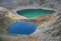
(3) The Chemin de l’Énergie leads to Lake Rabuons,
(5) Pas de Barbacane: opposite, Italy and the village of San Bernolfo at the bottom of the valley. To the right, a path leads to Tête Cimon.

Reviews and comments

4.5 / 5
Based on 2 reviews

Reliability of the description
4.5 / 5
Ease of following the route
4 / 5
Route interest
5 / 5
Jean-Marc Gambaudo
Jean-Marc Gambaudo

Overall rating : 4.7 / 5

Date of your route : Aug 16, 2021
Reliability of the description : ★★★★★ Very good
Ease of following the route : ★★★★☆ Good
Route interest : ★★★★★ Very good
Very busy route : No

A lovely walk in a very quiet area (no one else there that day). Be sure to head left after the junction with the ‘Chemin de l’Énergie’ so as not to end up at the bottom of the valley (lots of scree).
Magnificent views on both sides.

Machine-translated

Picson06230
Picson06230

Overall rating : 4.3 / 5

Date of your route : Jul 27, 2020
Reliability of the description : ★★★★☆ Good
Ease of following the route : ★★★★☆ Good
Route interest : ★★★★★ Very good
Very busy route : No

A lovely walk offering beautiful views towards Auron and Mt Mounier. This walk is very quiet (3
people)
You’ll need to set off very early, as the path is exposed to the sun from late morning onwards. The only trees are at the bottom of the route and are few and far between.
There is no drinking water; watch out for the herd upstream of the springs.
The route is mainly stony from marker 125 onwards; the markings disappear there and cairns are few and far between.
When crossing the rocky outcrops, don’t forget to note your bearings; otherwise, you may have to search around a bit.
On the final scree slope, look for the correct path, as some sections require you to use your hands.
When approaching the Pointe d’Isatier, watch out for the wind!!!
There’s a lovely view of Italy from here.
Enjoy the hike!!!!

Machine-translated

froment-e
froment-e

Planned walks in the area: do you have any idea how long it would take to walk from Douans to Rabuons, starting on this route and then taking the ‘Chemin de l’Énergie’ at marker 105c?
Thanks
Eric

Machine-translated

Other walks in the area

For more walks, use our search engine .

The GPS track and description are the property of this route's author. Please do not copy them without permission.