Pluzunet – Le Danot

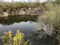
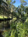
In the green Trégor region, a walk through wooded countryside with a brief visit to the Léguer before discovering the rolling landscape of the foothills of the ancient Montagnes Noires.

Details

196480
Creation:
Last update:
Last review:
  • Walking
    Activity: Walking
  • ↔
    Distance: 6.36 mi
  • ◔
    Average duration: 3h 20 
  • ▲
    Difficulty: Moderate

  • ⚐
    Back to start: Yes
  • ↗
    Ascent: + 482 ft
  • ↘
    Descent: - 479 ft

  • ▲
    Highest point: 377 ft
  • ▼
    Lowest point: 115 ft

Description of the walk

Park at a large junction with a central reservation, approximately 300 metres south of the D30. There is space to park several cars near a small picnic area.

(S/E) From the car park, head due south towards Mézo Danot.

(1) At the fork in the road, turn right onto a stony track which continues as a dirt track through the forest. At the junction at Ty Guen, carry on straight ahead to join a path running alongside the Léguer. Turn left and follow the river for 200 metres.

(2) Turn left onto a small forest path which winds its way uphill, then descends again, leading to a stopover lodge at Pont Coat Dunois.

(3) Follow the road to the left for 20 metres, then take a path on the left and follow it to the next junction.

(4) Take the path furthest to the right and cross the first road. Then turn right at a 90° angle, walking alongside a building, cross a second road (the D74) and continue straight ahead on the same path. This path takes a sharp left-hand bend and then joins a junction at Kerallain.

(5) Turn left towards the hamlet, which you pass through to reach a road.

(6) Follow the road to the right for about 350 metres until you reach a crossroads at a place called Poull Pry.

(7) Take the road on the left and, once at the end of it, turn onto the track on the right which leads to another road. Turn right for 50 metres.

(8) Turn onto the track on the right, pass Reyer and continue along the road that follows on from the track until you reach a fork (waymark on the right). At the waymark, turn right, following the route in the opposite direction to the outward journey.

(6) First turn right then left to continue due north.

(9) Just before the Crec’h ar Stang farm, take the path on the right and carry on straight ahead.

(10) At the crossroads, turn left. The path continues through the woods to join another track leading to Réquité; turn right here. Carry on along this track. At the first junction, turn right towards Mezo Danot and return to the junction you passed at the start of the walk.

(1). Carry on straight ahead to reach the car park (S/E).

Waypoints

  1. S/E : mi 0 - alt. 328 ft - No car park, but parking is available
  2. 1 : mi 0.2 - alt. 312 ft - Junction
  3. 2 : mi 1.2 - alt. 121 ft - Forest track on the left - Léguer (le)
  4. 3 : mi 1.72 - alt. 131 ft - Stopover lodge, first path on the left
  5. 4 : mi 2.07 - alt. 282 ft - Small forest track on the right
  6. 5 : mi 2.75 - alt. 325 ft - Path on the left towards Kerallain
  7. 6 : mi 2.89 - alt. 302 ft - Junction
  8. 7 : mi 3.13 - alt. 351 ft - Junction
  9. 8 : mi 3.62 - alt. 374 ft - Path on the right
  10. 9 : mi 4.76 - alt. 285 ft - Before the farm, take the path on the right
  11. 10 : mi 5.28 - alt. 338 ft - At the crossroads, turn left
  12. S/E : mi 6.36 - alt. 328 ft - Car park

Notes

This walk does not present any major difficulties. However, in wet weather (which, of course, is very rare in Brittany), some sections may be slippery and sometimes even flooded.

Reviews and comments

3.9 / 5
Based on 3 reviews

Reliability of the description
3 / 5
Ease of following the route
4.3 / 5
Route interest
4.3 / 5
le piaf
le piaf

Overall rating : 4.7 / 5

Date of your route : Jul 13, 2024
Reliability of the description : ★★★★☆ Good
Ease of following the route : ★★★★★ Very good
Route interest : ★★★★★ Very good
Very busy route : No

A walk in fine weather.
Even though I was familiar with some of the paths, we really enjoyed this lovely walk, which often took us along sunken paths.
I’d downloaded the route onto my smartphone. That makes it easier to stay on track using the GPS.
Please note that from point 4 onwards, the path is less well-trodden, less visible and, above all, blocked by uprooted trees. But you can make your way through this little valley without any trouble.
The paths were nice and dry that day.
So thank you for this route.

Machine-translated

gazok54
gazok54 ★

Thank you, marcheusedu 22
Visorando isn’t designed to send walkers along signposted trails, even though some walks do refer to them. We prefer walks off the beaten track. What’s more, we have no control over the signposting.
Of course, with the app you won’t have any problems at all. Nevertheless, you still need to know how to read an IGN map.

Machine-translated

marcheusedu 22
marcheusedu 22

Overall rating : 3 / 5

Date of your route : Aug 27, 2018
Reliability of the description : ★★☆☆☆ Disappointing
Ease of following the route : ★★★☆☆ Average
Route interest : ★★★★☆ Good

The route isn’t well signposted – I went the wrong way at number 4

I think I’ll do it again because the start really makes you want to carry on

I’ve downloaded the app onto my smartphone; I hope I’ll have better luck

Machine-translated

hermreeck
hermreeck

Overall rating : 4 / 5

Date of your route : Aug 08, 2016
Reliability of the description : ★★★☆☆ Average
Ease of following the route : ★★★★★ Very good
Route interest : ★★★★☆ Good

Luckily, I’d downloaded the route onto my GPS; at times, the paths weren’t very clear. It was very difficult to find the right path once the circular loops started to converge. In the end, we only managed 8 km instead of 11 km because I missed a circular loop. The walk isn’t too demanding and offers plenty of variety.

Machine-translated

Other walks in the area

For more walks, use our search engine .

The GPS track and description are the property of this route's author. Please do not copy them without permission.