Country:
 City:
City:


Park at the COSEC car park (sports complex).
(S/E) Cross Rue Blaise Pascal, follow Rue Duguesclin opposite and turn right onto Rue des Celtes until you reach the roundabout.
(1) Go round the roundabout and continue straight ahead along Rue Racine until you reach the junction with Rue Eugène Le Coupanec.
(2) Turn left onto this street, which continues as a footpath. Turn right at the fork to reach, at the next fork, theGR® de Pays (GRP®) walking trail marked in yellow and red. Turn left and follow these markings.
(3) Near the riding centre, turn right to cross the Voie Verte, then temporarily leave theGRP® route to take the path on the left which runs alongside the Le Poisson Volant tree-top adventure park. Further on, the path turns right and rejoins the GRP® route. Follow it to the left until you reach the junction, then take the road opposite – which is not signposted – leading onto another road.
(4) Cross the road and continue along the path, now markedGRP® again, towards the Stang er Brune stables and the village of Lannénec. Turn right and join a track.
(5) Turn left towards Stang er Brune. At the end of the track, on the edge of the forest, let theGRP® route continue straight ahead and take the path on the right leading to the village of Lannénec.
(6) Continue straight on along Rue du Prieuré for 200 metres until you reach two paths that extend from it.
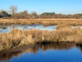
(7) Take the path on the left, which runs alongside the Étang de Lannénec, then turn onto the next path on the left, which runs alongside a marshy area before joining a tarmac road, the D162.
(8) Take this road to the left, towards Guidel, then turn right towards Saint-Mathieu via Rue de l’École.
(9) In the village, turn right to visit the Saint-Mathieu Chapel, then retrace your steps to continue the walk by following Rue de l’École to the right to rejoin the D162. Follow this road to the right again until you reach the next junction.
(10) Turn right towards Trézéléguen and Manécohal.
(11) At the Trézéléguen bend, leave the road and take the second path on the left. At the end of the path, take the small road on the left until you reach the next crossroads.
(12) Turn right, then right again at the next two junctions, to join the road leading to the village of Coat Coff.
(13) Take this road to the left and walk through the village of Coat Coff; then, walking alongside the Lann-Bihoué Naval Air Base, head towards Kervinio via Conatus.
(14) In Kervinio, cross the road to the opposite side and, further on, rejoin theGRP® path and the yellow and red markings.
(5) Turn left and follow a section of the route you took on the way there.
(4) Pass the junction and continue until you are near the riding centre.
(3). Then turn right, leaving theGRP® markings, to walk alongside the Lann er Roc’h stables and join the D162.
(15) Follow the D162 to the left, then turn right onto the path running parallel to the road to reach Ploemeur. Turn left, rejoin the D162 and follow it to the right.
(16) Further on, turn right onto a path to reach Rue Charles le Goffic; continue straight on to reach Rue Honoré de Balzac, then turn right. On Rue Jules Verne, turn left and, at the junction, continue straight ahead onto Rue Ronsard. At the junction with Rue Pascal, turn left to reach the COSEC car park (S/E).

 Visorando Member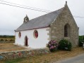
 Difficult
 Local authority
 Easy
Easy 
 Association / Club / Walk leader