Route du Parc océanique de Kerguélen in Larmor-Plage

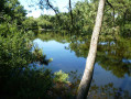
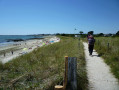
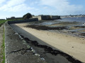
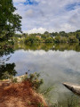
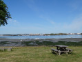
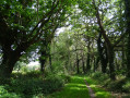
Between sea and land, the Anse de Kerguélen route takes you along sunken paths—veritable tunnels of vegetation—past meadows, ponds and marshes. Back on the shore, facing the Île de Groix, you’ll appreciate the contrast between the blue of the ocean and the white of the sandy coastline dotted with rocky outcrops.
This route is organised by Lorient Agglomération.

Details

57655609
Creation:
Last update:
Last review:
  • Walking
    Activity: Walking
  • ↔
    Distance: 3.37 mi
  • ◔
    Average duration: 1h 35 
  • ▲
    Difficulty: Easy

  • ⚐
    Back to start: Yes
  • ↗
    Ascent: + 20 ft
  • ↘
    Descent: - 20 ft

  • ▲
    Highest point: 43 ft
  • ▼
    Lowest point: 7 ft

Photos

Description of the walk

Parking available at the water sports centre car park. T4 bus route, ‘Parc Océanique’ stop nearby. Sign with a map at the starting point.

(S/E) At the far end of the car park, to the left of the building, look for the starting sign and follow the path straight ahead towards the beach. Turn left towards the pond.

(1) Continue straight on along the path running parallel to the seafront. At the car park, follow the gentle path to the left, cross over and head up to the left. At the pedestrian crossing, turn left and head straight ahead onto the Kerguélen Ocean Park path.

(2) At the junction of the three paths, take the middle one. Stay on this path (you can make a short detour to the right after 50 metres to see the Kerguélen Dolmen). Continue straight ahead twice through the meadows, then turn right to join the road at Le Moustoir.

(3) Head straight ahead and cross Le Moustoir (turning right, then left). Before the D152, turn right at the crash barrier and follow the path that passes near the Fontaine du Treuch. Follow this path and, at Kerguélen, follow the road to the left and turn onto the wide path on the right before the D152.

(4) Continue straight on to the Fontaine du Boulouc’h. Stay on the yellow-marked path and, at the next junction, turn left and follow the markings (twice to the right, then left and right). Continue along the main path, turning right, then left twice before turning right again.

(5) Then continue straight ahead and keep to the right until you reach a dead end. Cross over to the opposite side to walk alongside the Marais de Kerdreff.

(6) Turn right into Rue de Kerguélen and take the pedestrian crossing on the left. Take the path to the beach opposite and turn left at the crossroads. Turn right and walk straight across the car park on Rue des Courreaux. Cross the stone bridge on the right and continue straight on towards the beach.

(7) Turn right before the beach and stay on this path. At the junction, turn right, then immediately left onto the path along the dune ridge. Continue straight ahead, then follow (to the left and right) the path along the beach. Continue straight ahead before turning right back to your starting point (to the left and opposite). (S/E)


Waypoints

  1. S/E : mi 0 - alt. 23 ft - Kerguelen Water Sports Centre
  2. 1 : mi 0.09 - alt. 16 ft - Kerguélen Marshes
  3. 2 : mi 0.49 - alt. 10 ft - Kerguélen Ocean Park
  4. 3 : mi 0.82 - alt. 23 ft - Le Moustoir
  5. 4 : mi 1.3 - alt. 33 ft - The Boulouc'h fountain and wash house
  6. 5 : mi 2.03 - alt. 10 ft - Approach to the marsh
  7. 6 : mi 2.31 - alt. 10 ft - Kerdeff Marshes
  8. 7 : mi 2.6 - alt. 16 ft - Lorient Beach
  9. S/E : mi 3.37 - alt. 23 ft - Kerguelen Water Sports Centre

Notes

This route is included in the Morbihan Departmental Plan for Walking and Hiking Trails and is certified by the French Hiking Federation. You can follow the yellow markings. There is an information board with a map and details of heritage features at the start.

Worth a visit

- More information here.
- Kerguélen Beach.
- Kerguélen Marshes: restored in 2006.
- Ocean Park: 82 ha, of which 60 ha are within a Natural Area of Ecological, Faunistic and Floristic Interest. Site of Community Interest for the Lorient Urban Area, owned by the Conservatoire du Littoral since 1981.
- Kerguélen Dolmen: 4000–2000 BCE.
- Treuch Fountain: ancient fountain and cross, moved during the construction of the road.
- Boulouc'h fountain and wash house: domestic fountain refurbished in 2011.
- Kerdreff Marshes: former pond drained in 1905. Salt marshes, rushes and reeds, rich in insects and amphibians, providing a habitat for birds.
- Lorient beach: villas and fan-shaped streets, remnants of a property and tourism development project (1920).
- Kerguélen dune system: damaged between 1939 and 1945 by sand extraction (Organisation Todt). Replenished with sand and recolonised by dune vegetation (combating erosion and the risk of coastal flooding).

Reviews and comments

4.5 / 5
Based on 5 reviews

Reliability of the description
4.6 / 5
Ease of following the route
4.4 / 5
Route interest
4.4 / 5
User 26122997

Overall rating : 3.7 / 5

Date of your route : Jun 16, 2025
Reliability of the description : ★★★★☆ Good
Ease of following the route : ★★★☆☆ Average
Route interest : ★★★★☆ Good
Very busy route : No

Good hike, but the route is not always clear.

Machine-translated

Philippemarcel
Philippemarcel

Overall rating : 4.3 / 5

Date of your route : May 25, 2025
Reliability of the description : ★★★★☆ Good
Ease of following the route : ★★★★☆ Good
Route interest : ★★★★★ Very good
Very busy route : Yes

A lovely route, easy to follow with the help of a satnav.

Machine-translated

azzomarie
azzomarie

Overall rating : 5 / 5

Date of your route : Apr 28, 2025
Reliability of the description : ★★★★★ Very good
Ease of following the route : ★★★★★ Very good
Route interest : ★★★★★ Very good
Very busy route : No

A lovely, pleasant walk between land and sea

Machine-translated

Lorient Agglomération

Thank you for your positive feedback
Kind regards,

Machine-translated

Pascal C56
Pascal C56

Overall rating : 4.7 / 5

Date of your route : Nov 04, 2024
Reliability of the description : ★★★★★ Very good
Ease of following the route : ★★★★★ Very good
Route interest : ★★★★☆ Good
Very busy route : No

The signposting is very easy to follow and up to date.

Machine-translated

Olivierpx
Olivierpx

Overall rating : 4.7 / 5

Date of your route : Sep 02, 2024
Reliability of the description : ★★★★★ Very good
Ease of following the route : ★★★★★ Very good
Route interest : ★★★★☆ Good
Very busy route : No

Very, very good; easy to follow; a perfectly maintained path; and some absolutely lovely discoveries

Machine-translated

Other walks in the area

For more walks, use our search engine .

The GPS track and description are the property of this route's author. Please do not copy them without permission.