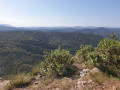
Ascent to the Lacamp Plateau

First section starting from Mayronnes, towards Clermont-sur-Lauquet and the climb up to the Lacamp plateau.
Places of interest: beautiful views, old bridges.

This walk is part of a multi-day hike: The Lacamp Plateau

Details

2606
Creation:
Last update:
Last review:
  • Walking
    Activity: Walking
  • ↔
    Distance: 16.02 mi
  • ◔
    Average duration: 9h 15 
  • ▲
    Difficulty: Difficult

  • ⚐
    Back to start: No
  • ↗
    Ascent: + 2,175 ft
  • ↘
    Descent: - 1,683 ft

  • ▲
    Highest point: 1,975 ft
  • ▼
    Lowest point: 728 ft

Photos

Description of the walk

Start from Mayronnes. Park in the car park just before the village (on the left).
Please note: it is not possible to leave cars in the village.

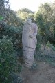
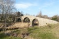
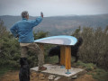
(S/E) Set off towards the village and follow theGR®36route. After the bridge, take the sculpture trail, which uses theGR®36as a backdrop for sculptures – a veritable natural exhibition space.
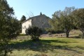
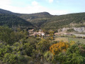
You’ll climb up to the heights of Pech de Terri and leave the sculpture trail to continue along theGR®. There’s very little elevation gain on this track. Beautiful views. You’ll pass by the old Saint Clément church.

(1) Carry on and you’ll reach the Maison Orestière in Combe de Vigne, which offers shelter or even a lodge.

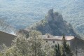
(2) Take the path down towards Durfor, where there is a viewpoint overlooking the castle, though it is not open to visitors (private property).

(3) Retrace your steps to return to the previous crossroads.

(2) Turn left, going round the back of the house and heading west. You’ll soon come to a wider path – this is the firebreak track.

(4) Take this straight ahead and then cross the Lacamp State Forest. Head for the Col de la Louviero.

(5) Turn right onto the D40. Pass the farm, then at thesecond hairpin bend you’ll find the start of a path.

(6) Take it to the right; it is blocked by a gate and an electric fence. Go through them, making sure to close them behind you. Follow the path due north until you reach another junction on the descent.

(7) Be careful here: there are two paths leading down to Clermont-sur-Lauquet:
- thefirst veers off to the left, but is a bit hard to follow at the start; it then leads to the tower (castle) at Clermont-sur-Lauquet,
- thesecond, which follows the route shown on the map, joins the Ruisseau des Illes.

(8) Go through the gate just after the ford, then take the track on the left to reach Clermont-sur-Lauquet.

(9) Retrace your steps along the previous route to return to the crossroads by the stream.

(8) Follow the stream upstream to look for camping spots. The last meadow is flatter and offers more space (E).
Note: if you continue climbing towards the plateau, there is another spot where you can set up camp on the way up, but it is small and may not be suitable for a group.

Waypoints

  1. S : mi 0 - alt. 909 ft - Car park before Mayronnes
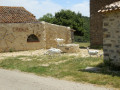
  2. 1 : mi 2.42 - alt. 935 ft - Saint Clément Church
  3. 2 : mi 3.91 - alt. 1,115 ft - Combe de Vigne forest lodge
  4. 3 : mi 5.11 - alt. 728 ft - Durfort Castle
  5. 4 : mi 6.99 - alt. 1,430 ft - Firebreak track
  6. 5 : mi 12.08 - alt. 1,955 ft - Col de la Louviéro
  7. 6 : mi 13.05 - alt. 1,824 ft - Hairpin bend on the D40
  8. 7 : mi 13.75 - alt. 1,430 ft - Junction for alternative route
  9. 8 : mi 14.13 - alt. 1,332 ft - Crossroads at the Ruisseau des Illes
  10. 9 : mi 14.83 - alt. 1,237 ft - Clermont-sur-Lauquet
  11. E : mi 16.02 - alt. 1,411 ft - Camping area

Notes

There are few water sources between Mayronnes and Clermont-sur-Lauquet.
Avoid lighting campfires, especially if the vegetation is dry. Use camping stoves instead.

Always be cautious and plan ahead when you're outdoors. Visorando and the author of this route cannot be held responsible for any accidents occurring on this route.

The GR® and PR® markings are the intellectual property of the Fédération Française de Randonnée Pédestre.

Reviews and comments

4.7 / 5
Based on 2 reviews

Reliability of the description
5 / 5
Ease of following the route
5 / 5
Route interest
4 / 5
chrisangus
chrisangus
• Edited:

Overall rating : 5 / 5

Date of your route : Aug 14, 2014
Reliability of the description : ★★★★★ Very good
Ease of following the route : ★★★★★ Very good
Route interest : ★★★★★ Very good

A very well-described walk that’s easy to follow, except for the final stretch before reaching the village (several paths aren’t clearly signposted).
Brilliant for anyone who loves the Corbières.
It captures your interest right from the start of the trail.
Be aware that water supplies are very scarce (make sure you bring plenty, especially in hot weather). The village at the end of the walk is rather deserted, so don’t expect to find any supplies, particularly if you’re camping there to continue the descent.
Otherwise, it’s pure bliss...!

Machine-translated

SIW111
SIW111

Overall rating : 4.3 / 5

Date of your route : Feb 06, 2014
Reliability of the description : ★★★★★ Very good
Ease of following the route : ★★★★★ Very good
Route interest : ★★★☆☆ Average

A lovely walk, best done in dry weather. Lots of sections through the woods.

Machine-translated

Other walks in the area

For more walks, use our search engine .

The GPS track and description are the property of this route's author. Please do not copy them without permission.