Country:

 City:
City:


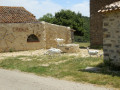
Car park at the entrance to the village with space for over 30 vehicles.
(S/E) Join the path at the far end of the car park, cross the stream and follow the path to the right for 400 m until you reach the junction with another small path on the left which climbs steeply (double signposting for the sculptural trail and the GR®36).
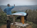
(1) Climb until you reach another, wider path. Be sure to take a look at the sculptures. Follow the path south-east.
(2) The sculpture trail branches off to the left from theGR®36. Stay on the GR® by continuing straight ahead and cross the Col de la Croix.
(3) Ignore the path on the left – which will be the return route – and carry on straight ahead.
(4) At the junction, turn right, pass through the hamlet of Les Hautes Jonquières, then take the path directly ahead of you at the end of the tarmac road. Join a track, then cross the Ruisseau des Jonquières.
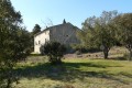
In a field on your left, you can see the old Saint-Clément Chapel, which is currently being restored. Continue along the track until you reach a junction shaped like an inverted Y.
(5) Leave theGR® 36 by taking a path at a 120° angle to your left. This path leads down to the dairy farm de Carrus or Basses Jonquières.
(6) Two shaded picnic tables await you at Carrus. Admire the architecture of this beautiful dairy farm. Leave Carrus by following the tarmac road down towards the Ruisseau des Jonquières.
(7) Just after the stream, take a small path on your right which bypasses the road. You’ll emerge a little further up onto the road, which you’ll cross to take another path opposite that cuts across the bend. Back on the road, follow it to the left for 100 m.
(8) At the junction with the Caunettes-en-Val road, look out for a path opposite, slightly to the right, which climbs steeply westwards and joins the track you took on the way there.
(3) Cross over and, opposite, rejoin the small path that cuts across the bend. You are now back on theGR® 36, which you took earlier. Follow it to the right and head back to the Col de la Croix.
(2) Leave the route you’ve already taken (GR® 36) and take the sculptural path on your right.
(9) At the fork, follow the scenic path to the left, heading north, to rejoin the GR® 36. Take the GR® 36 to the left.
(10) At this point, the path follows a stream bed which is difficult, or even very difficult, if it has rained recently. The map shows a less strenuous path, but we couldn’t find it at the start. Once past this difficult section, you’ll come to a more pleasant path.
(11) Turn right onto this path, which will take you back to the car park where you started (S/E).




 ))
)) Visorando Member

 Difficult