


Water points in the villages (please note that during winter, the municipal water routes are shut off to prevent freezing).
Be aware of the Cers wind, which can be fierce and persistent for several days (and nights).
Avoid lighting campfires. Use portable stoves instead.
Equipment: bring shelter (tent, tarpaulin) and warm clothing (cool nights).
The Lacamp Plateau


Starting from Mayronnes.
A circular spring loop to get you started: a two-day trek with one night’s bivouac at the end of the stage.
Details
Creation:
Last update:
Last review:
-
 Activity: Walking
 -
 Distance: 32.07 mi
 -
 Average duration: 2 days
 -
 Difficulty: Moderate
 -
-
 Back to start: Yes
 -
 Ascent: + 3,970 ft
 -
 Descent: - 3,986 ft
 -
-
 Highest point: 2,385 ft
 -
 Lowest point: 594 ft
-
 Country:
France
Country:
France
-
 Area: Massif des Corbières
 -
 City:
Mayronnes (11220)
City:
Mayronnes (11220) -
 Start/End: N 43.057364° / E 2.527228°
 -


 Hour-by-hour weather
Photos
Stages of the route
This route needs several days, find the details below:
Notes
Worth a visit
View of Durfor Castle (not open to visitors).
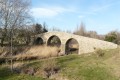
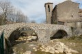
Visit the ancient bridges.
Option to pop over to Servies-en-Val (shops, castle).
Reviews and comments
4 / 5
Based on 3 reviews
Reliability of the description
4.7 / 5
4.7 / 5
Ease of following the route
4.3 / 5
4.3 / 5
Route interest
3 / 5
3 / 5

harlem49
Overall rating : 3.7 / 5
Date of your route : May 22, 2020
Reliability of the description : ★★★★☆ Good
Ease of following the route : ★★★★☆ Good
Route interest : ★★★☆☆ Average
Very busy route : No
We went on this hike in the middle of May; it was very sunny on the first day, so be careful as there’s very little shade – make sure you stay well hydrated and protect yourself. As a way to get back into the swing of things, it’s still quite a challenge, with both stages covering over 25 km. Even though the elevation gain isn’t huge, it’s still quite a long walk…
The campsite isn’t anything special (no views, an unkempt meadow and lots of mosquitoes) but it does the job. However, we woke up to rain – the weather forecast wasn’t accurate… So we decided to shorten the second stage by heading straight back down to Mayronnes. You can do this by continuing past Waypoint 3 and descending via the paths shown on OSM Trails. The descent is quite pleasant. The day’s walk is reduced from 25 km to 12.
Machine-translated
petipoucet
Overall rating : 3.7 / 5
Date of your route : Jun 19, 2019
Reliability of the description : ★★★★★ Very good
Ease of following the route : ★★★★☆ Good
Route interest : ★★☆☆☆ Disappointing
A hike in very hot weather. Please note that most of the trails are in full sun with no shade.
A good physical challenge to get you in shape before summer.
On the other hand, the landscape is monotonous and offers little of visual interest.
Furthermore, some sections of the path have been left to fall into disrepair, making progress difficult. Elsewhere, logging is in full swing; the tracks are generally used by machinery and are therefore very wide.
Finally, the campsite isn’t exactly idyllic; the stream had run dry and the meadow was unkempt (with grass 1 m high).
The GPX track and the locations of the water points are accurate.
Thank you for sharing
Machine-translated
LaRev
Overall rating : 4.7 / 5
Date of your route : Apr 27, 2019
Reliability of the description : ★★★★★ Very good
Ease of following the route : ★★★★★ Very good
Route interest : ★★★★☆ Good
A lovely long two-day walk. It’s perfect for spring as it’s not too high up and there’s no snow. And so it’s great for getting ready for the summer.
Machine-translated
Other walks in the area
Ascent to the Lacamp Plateau
 Visorando Member
 16.02 mi
+2,175 ft
-1,683 ft
9h 15
16.02 mi
+2,175 ft
-1,683 ft
9h 15
 Difficult
 Departure from Mayronnes (Aude)
First section starting from Mayronnes, towards Clermont-sur-Lauquet and the climb up to the Lacamp plateau.
Places of interest: beautiful views, old bridges.
Mayronnes circular loop
 6.54 mi
+1,089 ft
-1,083 ft
3h 55
Moderate
Departure from Mayronnes (Aude)
6.54 mi
+1,089 ft
-1,083 ft
3h 55
Moderate
Departure from Mayronnes (Aude)
Walk starting from Mayronnes, at the end of the road. The route follows the sculpture trail for part of the way.
Panoramic circular of Mayronnes
 7.84 mi
+2,057 ft
-2,057 ft
5h 25
Moderate
Departure from Mayronnes (Aude)
7.84 mi
+2,057 ft
-2,057 ft
5h 25
Moderate
Departure from Mayronnes (Aude)
Hike around Maryonnes with beautiful views of the Corbières. The trail climbs steeply in the first part through the undergrowth.
Circular starting from Taurize en Val de Dagne
6.58 mi
+1,316 ft
-1,325 ft
4h 10
Moderate
Departure from Taurize (Aude)
In Taurize, you may see the "bull" on the church wall and perhaps also the ancient pagan altar dedicated to the cult of Mithra on the hill overlooking the village. Some say there are mitounes fairies!
The Leaf Trail in Serviès-en-Val
 6.99 mi
+699 ft
-659 ft
3h 50
Moderate
Departure from Serviès-en-Val (Aude)
6.99 mi
+699 ft
-659 ft
3h 50
Moderate
Departure from Serviès-en-Val (Aude)
The route is shaped like a leaf, in reference to the vineyard it crosses. It leads from Serviès-en-Val to Rieux-en-Val and then to Villemagne. Follow the well-marked "Chemin des Six Sens" (Path of the Six Senses) and return to Serviès-en-Val by following the yellow markings.
The panoramic trail in Labastide-en-Val
 7.00 mi
+1,339 ft
-1,352 ft
4h 25
Moderate
Departure from Labastide-en-Val (Aude)
7.00 mi
+1,339 ft
-1,352 ft
4h 25
Moderate
Departure from Labastide-en-Val (Aude)
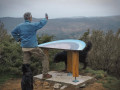
The Lacamp plateau overlooking the Val de Dagne offers numerous viewpoints. Heath, communal forest (beech and oak) and state-owned forest (fir and cedar). This trail passes two orientation tables that provide information about the Montagne Noire and the Pyrenees. It led to Bouisse, a day's walk across the Lacamp plateau.
On the village square, next to the fountain and at the corner of the old town hall, a sign describing the trail was installed in 2010.
Since 2020, the old public toilets have become the smallest museum in the world!
Mont Major
 8.68 mi
+1,398 ft
-1,394 ft
5h 10
Moderate
Departure from Saint-Pierre-des-Champs (Aude)
8.68 mi
+1,398 ft
-1,394 ft
5h 10
Moderate
Departure from Saint-Pierre-des-Champs (Aude)
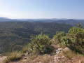
Despite its modest altitude, Mont Major (542 m), the highest point of the Serre de Blanes, offers a magnificent, almost 360° panorama encompassing the Montagne d’Alaric, the Carcassonne plain and, on a clear day, the peaks of the Ariège Pyrenees and the Canigou. The ascent, starting from the village of Saint-Pierre-des-Champs, takes place amidst a landscape typical of the Corbières, with small, isolated vineyards, pine trees and heath where holm oaks reign supreme. A breath of fresh air in a setting where peace and quiet are guaranteed.
For more walks, use our search engine .
The GPS track and description are the property of this route's author. Please do not copy them without permission.

