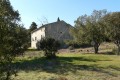
Descent from the Lacamp Plateau

Part Two: from Clermont-sur-Lauquet, climb up to the Lacamp plateau, then descend to Labastide-en-Val, Villetritouls, Taurize, Rieux-en-Val and return to Mayronnes.

This walk is part of a multi-day hike: The Lacamp Plateau

Details

2889
Creation:
Last update:
Last review:
  • Walking
    Activity: Walking
  • ↔
    Distance: 16.05 mi
  • ◔
    Average duration: 8h 55 
  • ▲
    Difficulty: Difficult

  • ⚐
    Back to start: No
  • ↗
    Ascent: + 1,781 ft
  • ↘
    Descent: - 2,303 ft

  • ▲
    Highest point: 2,385 ft
  • ▼
    Lowest point: 594 ft

Photos

Description of the walk

(S) Start from the valley of the Ruisseau des Illes (Clermont-sur-Lauquet). Follow the main path, which gradually becomes a track as you climb. You’ll reach Pech Agut.

(1) Cross a boxwood undergrowth to reach a Scots pine plantation. Heading east, you’ll easily reach the forest track. Take it south-southeast and follow the main track to reach the Pla de Vidalbe crossroads.

(2) Continue due east to reach the Lacamp Plateau. This is a vast forested area planted with Scots pine. The grassland areas are used for cattle grazing and are enclosed by electric fences.

(3) Return in the opposite direction to the previous crossroads.

(2) Take the track on the right which leads through the forest. Pass the fence and continue along the track. Pass by a karstic cave that plunges into the plateau (approach with caution) and carry on. Join a main track to reach the little house at Matto de Naout.

(4) Turn right and begin a gentle descent. Cross the Ruisseau de Richard. Carry on to reach the end of this track.

(5) Carry on to the right along the path that follows on from it. Reach the Serre d’al Py ridge. Go round it on the right, then on the left, and, at a sharp left-hand bend, join the Plo d’al Bruyé ridge.

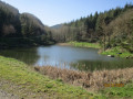
(6) Turn left to cross the Bois du Bosc. Reach the foot of Roc Taillau. Turn almost 180° to the right. Reach the Labastide Stream reservoir.

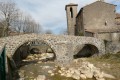
(7) Cross the dam and you’ll soon reach the D114; there’s a designated rest area where you can take a break. Continue on to the village of Labastide-en-Val, visit the old bridge, then cross the river via the small footbridge and head to the cemetery.

(8) Turn left onto the footpath and follow it until you reach the village of Villetritouls.

(9) As you leave the village, take the D603 opposite to reach the next village, Taurize.

(10) Keep to the left on the D603 and you’ll soon come to a multi-way junction. Leave the D603 and turn right, walking alongside the vineyards to reach the houses at Belotte.

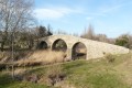
(11) Turn right and walk along the edge of the vineyards. Cross the Ruisseau de Taurize, then turn left and, still walking amongst the vineyards, head for the Roman Bridge below the village of Rieux-en-Val.

(12) Walk back a short way, then turn left to climb up through the heath. Reach the high point between Pech de la Fage and Redonel.

(13) From here, begin the descent along a tarmac road, then join the D41, turn right onto it and you’ll easily find the Mayronnes car park (E).

Waypoints

  1. S : mi 0 - alt. 1,414 ft - Camping
  2. 1 : mi 1.63 - alt. 2,201 ft - Pech Agut
  3. 2 : mi 3.05 - alt. 2,254 ft - Trail junction
  4. 3 : mi 3.39 - alt. 2,244 ft - Pla de Vidalble
  5. 4 : mi 5.05 - alt. 2,018 ft - Matto de Naout’s House
  6. 5 : mi 6.58 - alt. 2,031 ft - End of the trail
  7. 6 : mi 7.78 - alt. 1,575 ft - Plo d’al Bruyé
  8. 7 : mi 9.12 - alt. 883 ft - Water supply
  9. 8 : mi 9.9 - alt. 797 ft - Cemetery
  10. 9 : mi 10.93 - alt. 784 ft - D603
  11. 10 : mi 11.78 - alt. 781 ft - Villetritouls
  12. 11 : mi 12.57 - alt. 679 ft - Taurize
  13. 12 : mi 13.95 - alt. 600 ft - Roman Bridge
  14. 13 : mi 15.26 - alt. 988 ft - Below Pech de la Fage
  15. E : mi 16.05 - alt. 909 ft - Mayronnes car park

Notes

There is no water outside the villages. Avoid taking water from streams (there are livestock farms on the plateau, and the water is bacteriologically contaminated).
You can fill up with water in Mayronnes, Clermont-sur-Lauquet, Labastide-en-Val and at the cemetery in Taurize.
In winter, local authorities shut off the water routes due to freezing. It is therefore not easy to obtain water.
The wind is a major factor in the region: the Cers. Every village has its own Rue du Cers or Place du Cers. It can be strong, but above all, it is constant and can blow for several days on end. Bear this in mind when setting up camp.
Remember to bring windproof clothing, and perhaps even thin gloves.
Avoid lighting fires. The vegetation is Mediterranean in nature and a fire can get out of control very quickly. Instead, bring camping stoves.

Worth a visit

The old bridges at Labastide-en-Val and Rieux-en-Val are well worth a visit.
The villages are of little interest, apart from their Romanesque churches and chapels.
You won’t find any shops in the villages, nor indeed anyone living there on weekdays.

Reviews and comments

1.8 / 5
Based on 2 reviews

Reliability of the description
2 / 5
Ease of following the route
1 / 5
Route interest
2.5 / 5
Caruda
Caruda

Overall rating : 2.3 / 5

Date of your route : Jul 24, 2024
Reliability of the description : ★★☆☆☆ Disappointing
Ease of following the route : ★☆☆☆☆ Very disappointing
Route interest : ★★★★☆ Good
Very busy route : No

I got completely lost – lots of back and forth, off the beaten track
I think the person who gave us directions led us astray
It might be my fault...

Machine-translated

henri57
henri57 ★
• Edited:

Hello,

@patric11

This section is specifically dedicated to the Plateau de Lacamp hike : descent

As for your issue, please post it in the Support Forum: Visorando website (see link below)

Support Forum: Visorando website

Kind regards

Machine-translated

patric11
patric11

Hello, this message appears when I try to confirm my route and I don’t know what else to do?? §§§§ !!!

Please could you correct the following points before you can submit your route for selection:

Some waypoints on your route are missing from your description: no. 1, no. 2, no. 3, no. 4, no. 5, no. 6, no. 7. Please add them to the description (using the WPT symbol in the description’s formatting bar) or remove them from the map (by clicking on the waypoint again).

To correct these points, edit your route description (click here).

If you need help, please feel free to send a private message to an administrator or moderator.

Machine-translated

henri57
henri57 ★

Hello,

Thank you for taking the time to give your opinion.

Since when did I give you permission to address me informally?

Questions:

Who addressed you informally, as you seem to be the first to reply?

And why are you using the informal ‘you’ with someone who hasn’t addressed you informally?

Kind regards

Machine-translated

patric11
patric11

Overall rating : 1 / 5

Date of your route : Nov 12, 2019
Reliability of the description : Not used / Not applicable
Ease of following the route : Not used / Not applicable
Route interest : ★☆☆☆☆ Very disappointing

Since when did I give you permission to address me informally?

Machine-translated

Other walks in the area

For more walks, use our search engine .

The GPS track and description are the property of this route's author. Please do not copy them without permission.