Molière Plateau

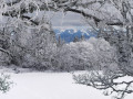
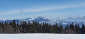
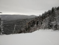
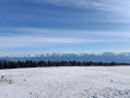
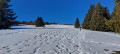
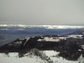
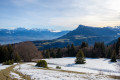
A lovely hike that partly follows the cross-country ski trails at Autrans. Magnificent views of Belledone and the Chartreuse, and even Mont Blanc from La Molière

Details

5079197
Creation:
Last update:
Last review:
  • Snowshoeing
    Activity: Snowshoeing
  • ↔
    Distance: 6.50 mi
  • ◔
    Duration according to the author: 4 hrs 
  • ▲
    Difficulty: Moderate

  • ⚐
    Back to start: Yes
  • ↗
    Ascent: + 1,335 ft
  • ↘
    Descent: - 1,319 ft

  • ▲
    Highest point: 5,358 ft
  • ▼
    Lowest point: 4,124 ft

Photos

Description of the walk

Park in the car park below the La Quoi ski lift, to the right of the road.

(S/E) Start the hike by following the cross-country ski trail which begins opposite the car park. Pass the Sure ski lift, continue on and make a hairpin bend to the left, then reach a junction of tracks at the next hairpin bend.

(1) Take this almost 180° bend and carry on to reach the junction with the Sentier Forestier de Plénouze.

(2) Take the steep slope branching off to the left, following the yellow and green markings. The climb is very steep at first but becomes less steep further on. A little further on, you’ll reach the junction with the Route Forestière des Feneys.

(3) Follow the ‘Raquette’ mark no. 8, then turn left up the slope to avoid walking on the track. At the top, you’ll find a signpost for Les Génisses.

(4) Turn right to follow the ‘Sentier des Génisses’ alongside the trail, so as not to walk on the cross-country ski track.

(5) Here on the Molière plateau, make your own track before reaching the magnificent Molière viewpoint. Take a moment to look at the orientation table here.

(6) Turn slightly right and follow the yellow and green marked trail downhill through the pine trees until you reach a cross-country ski trail marked out on the Route Forestière des Feneys.

(7) Turn right onto this track, continue straight on and you’ll come back to the junction you passed on the way there.

(3) Turn left back onto the route you took on the way out to reach the original junction further up.

(1) Head straight down towards the Sure ski lift, then follow the original route back to the car park at the Quoi ski lift (S/E).

Waypoints

  1. S/E : mi 0 - alt. 4,124 ft - Car park below the La Quoi ski lift
  2. 1 : mi 1.12 - alt. 4,347 ft - Initial junction
  3. 2 : mi 1.82 - alt. 4,606 ft - RF Plénouze junction
  4. 3 : mi 2.17 - alt. 5,059 ft - RF des Feneys
  5. 4 : mi 2.49 - alt. 5,325 ft - Signpost: Les Génisses
  6. 5 : mi 2.99 - alt. 5,308 ft - Les Génisses Trail
  7. 6 : mi 3.5 - alt. 5,358 ft - Table d'orientation de La Molière
  8. 7 : mi 3.8 - alt. 5,085 ft - Route Forestière des Feneys
  9. S/E : mi 6.5 - alt. 4,127 ft - Car park below the La Quoi ski lift

Notes

Make sure you have the usual safety equipment for a snowshoe hike.

This route passes through a protected area, which may be subject to special regulations:

Reviews and comments

4.5 / 5
Based on 2 reviews

Reliability of the description
4.5 / 5
Ease of following the route
4.5 / 5
Route interest
4.5 / 5
flots69
flots69

Overall rating : 4 / 5

Date of your route : Jan 07, 2023
Reliability of the description : ★★★★☆ Good
Ease of following the route : ★★★★☆ Good
Route interest : ★★★★☆ Good
Very busy route : No

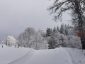
A lovely snowshoe hike in early January 2023, the day after one of the rare snowfalls.
Powder snow galore. I had to break trail as I was on my own for much of the route.
Beautiful scenery on the plateau. A few sections were a bit trickier with the snowshoes, but nothing impossible.
Make sure you wrap up warm, as you’re very exposed to the wind on the plateau. In my case, I was treated to some freezing cold.

Machine-translated

berbard k
berbard k

Overall rating : 5 / 5

Date of your route : Feb 23, 2021
Reliability of the description : ★★★★★ Very good
Ease of following the route : ★★★★★ Very good
Route interest : ★★★★★ Very good
Very busy route : Yes

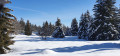
A lovely snowshoe hike. Snow and sunshine were on the cards.

Machine-translated

Other walks in the area

For more walks, use our search engine .

The GPS track and description are the property of this route's author. Please do not copy them without permission.