A stroll through the old village of Rochemaure

Suggested walk through the old village of Rochemaure, including a return trip to the footbridge.

Details

39781143
Creation:
Last update:
Last review:
  • Walking
    Activity: Walking
  • ↔
    Distance: 1.81 mi
  • ◔
    Average duration: 1h 00 
  • ▲
    Difficulty: Easy

  • ⚐
    Back to start: Yes
  • ↗
    Ascent: + 187 ft
  • ↘
    Descent: - 187 ft

  • ▲
    Highest point: 427 ft
  • ▼
    Lowest point: 210 ft

Photos

Description of the walk

Park in the car park behind Rochemaure Church.

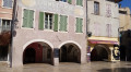
(S/E) Head towards the church and go out onto the church square. Continue to the town hall, turn left to walk past it, then take the first street on the right (Chemin de Gaudissart) which climbs towards the château, continues as a narrow path, and leads to the Chemin du Château.

(1) Turn left and follow a short stretch of road southwards to the small cluster of houses.

(2) Head back down to the left towards the village via Chemin de Malbouron (steps). You’ll come out onto Rue de la Violle; turn right, then immediately left at number 33 to reach Rue Sous-Ville.

(3) Turn left, head to La Placette – a charming little square with a fountain – and carry on straight ahead. Then turn right onto Rue du Rhône to head down towards the main road (Avenue du Teil); cross the road and continue opposite along Rue des Écoliers, passing the school.

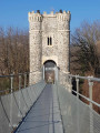
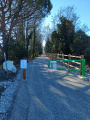
(4) Carry on to the right, go under the railway line and head for the footbridge.

(5) Turn back.

(4) Head straight on, passing behind Le Médiéval (hotel). Cross the departmental road again and head back up the small Ruelle du Pêcheur on the opposite side. Once at the top, turn right, pass the town hall again, then turn right towards the church forecourt and return to the car park (S/E).


Waypoints

  1. S/E : mi 0 - alt. 243 ft - Car park behind the church
  2. 1 : mi 0.21 - alt. 374 ft - Chemin du Château
  3. 2 : mi 0.36 - alt. 427 ft - Malbouron Path
  4. 3 : mi 0.48 - alt. 266 ft - Rue Sous-Ville
  5. 4 : mi 0.72 - alt. 240 ft - Junction: A/ right – R/ straight ahead
  6. 5 : mi 1.13 - alt. 210 ft - Footbridge
  7. S/E : mi 1.8 - alt. 243 ft - Car park behind the church

Notes

Reviews and comments

4.8 / 5
Based on 2 reviews

Reliability of the description
5 / 5
Ease of following the route
4.5 / 5
Route interest
5 / 5
Ma.com
Ma.com

Overall rating : 4.7 / 5

Date of your route : Apr 13, 2024
Reliability of the description : ★★★★★ Very good
Ease of following the route : ★★★★☆ Good
Route interest : ★★★★★ Very good
Very busy route : No

A lovely little walk to explore the village.
I walked up to the castle and the little village surrounding it: a must-do. It’s not really much higher up, and the hilltop village and the view are definitely worth it.
Be careful on the way down, though, as it’s a bit slippery.
I carried on to the Himalayan footbridge before heading back.
Thanks for the route!

Machine-translated

désapointé26
désapointé26

Overall rating : 5 / 5

Date of your route : Sep 23, 2023
Reliability of the description : ★★★★★ Very good
Ease of following the route : ★★★★★ Very good
Route interest : ★★★★★ Very good
Very busy route : No

The route wasn’t very busy in the old part of the village, but crossing the footbridge was much more of a hassle. There were plenty of people out for a stroll, cyclists and so on. An interesting little walk, though.

Machine-translated

Other walks in the area

For more walks, use our search engine .

The GPS track and description are the property of this route's author. Please do not copy them without permission.